Difference between revisions of "2020-05-29 -43 172"
Quaternary (talk | contribs) (Created page with "{{subst:Expedition}}") |
m (Location) |
||
| (One intermediate revision by one other user not shown) | |||
| Line 1: | Line 1: | ||
| − | + | [[Image:{{{image|2020_05_29_-43_172_01.JPG}}}|thumb|left]] | |
| − | + | <!-- | |
| + | And DON'T FORGET to add your expedition and the best photo you took to the gallery on the Main Page! We'd love to read your report, but that means | ||
| − | + | we first have to discover it! :) | |
| − | + | --> | |
| + | |||
| + | {{meetup graticule | ||
| + | | lat=-43 | ||
| + | | lon=172 | ||
| + | | date=2020-05-29 | ||
| + | | graticule_name=Christchurch | ||
| + | | graticule_link=Christchurch,_New_Zealand | ||
| + | }} | ||
| − | |||
| − | |||
| − | |||
| − | |||
| − | |||
| − | |||
__NOTOC__ | __NOTOC__ | ||
| + | |||
== Location == | == Location == | ||
| − | + | ||
| + | Hutchinson Reserve, Akaroa, New Zealand | ||
== Participants == | == Participants == | ||
| − | + | ||
| − | + | The [[User:Quaternary|Quaternary]] ([[User talk:Quaternary|talk]]) family geohashers | |
== Plans == | == Plans == | ||
| − | + | ||
| + | I awoke this morning near the small town of Akaroa, and upon checking the daily geohash, found that there was a very close geohash to be hashed in a public reserve called Hutchinson Reserve - perfect! The first Geohash for me since the Dark Ages. | ||
| + | |||
| + | '''Firstly, I must say, a big thanks to all those involved with porting the Geohashing website to the new site.''' | ||
== Expedition == | == Expedition == | ||
| − | + | ||
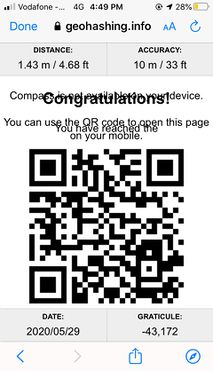
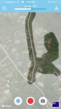
| + | We'd left it to end of the day to do the geohash. This was a bit unfortunate, as the light was pretty dim in the bush at this stage. Hutchinson Reserve is a pretty small pocket of native bush, with no formal walking tracks, so we had to tread carefully (so as not to step on any baby plants) in order to find the geohash. We found a few odd things en route, including a long forgotten wheelbarrow. GPS wasn't so great under the trees, but we circled around for a while, to make sure we covered the general area pretty thoroughly! | ||
| + | |||
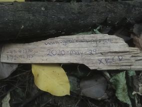
| + | We left a small hashmarker behind to mark what we took as the hashpoint. | ||
| + | |||
| + | There was a geocache also hidden in this reserve, namely, https://www.geocaching.com/geocache/GC7GRYN_hutchinson-reserve-akaroa, so we did that too for good measure. | ||
| + | |||
| + | It's good to have finally knocked off a hash after the Dark Ages - it's so good to be back! | ||
| + | |||
== Tracklog == | == Tracklog == | ||
| − | < | + | |
| + | <gallery widths="213px" heights="379px" perrow="4"> | ||
| + | Image:2020_05_29_-43_172_Geolocation1.JPG | | ||
| + | Image:2020_05_29_-43_172_Geolocation2.JPG | | ||
| + | Image:2020_05_29_-43_172_Geolocation3.JPG | | ||
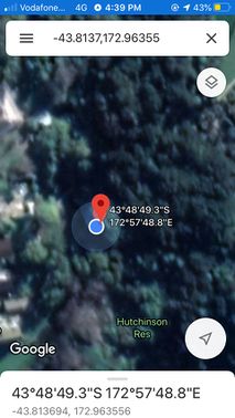
| + | Image:2020_05_29_-43_172_Geolocation4.JPG | Made it! | ||
| + | Image:2020_05_29_-43_172_Geolocation5.JPG | Defogging in the "Fog of World" app around the hashpoint | ||
| + | </gallery> | ||
| + | |||
| + | |||
== Photos == | == Photos == | ||
| − | < | + | |
| − | Image: | + | <gallery widths="320px" heights="213px" perrow="4"> |
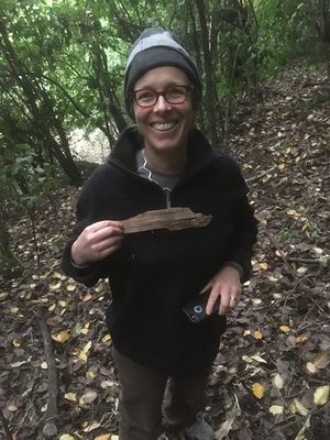
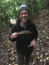
| − | - | + | Image:2020_05_29_-43_172_01.JPG | My trusty and long-suffering geohashing companion at the hashpoint |
| − | + | Image:2020_05_29_-43_172_02.JPG | The hashmarker at the hashpoint | |
| + | Image:2020_05_29_-43_172_04.JPG | Looking in one direction from the hashpoint ... | ||
| + | Image:2020_05_29_-43_172_03.JPG | ... and looking in the other direction from the hashpoint | ||
</gallery> | </gallery> | ||
== Achievements == | == Achievements == | ||
| − | |||
| − | |||
| − | + | {{gratuitous ribbon | |
| − | |||
| − | |||
| − | + | | color = red | |
| + | | icon = Electric_car.png | ||
| + | | latitude = -43 | ||
| + | | longitude = 172 | ||
| + | | date = 2020-05-29 | ||
| + | | achievement = Electric Vehicle Achievement | ||
| + | | description = travelling to and from the Geohash in an electric vehicle | ||
| + | | name = Quaternary | ||
| + | | image = 2014_08_14_-43_172_5_Eco_power.JPG | ||
| − | + | }} | |
| − | |||
| − | |||
| − | |||
| − | |||
| − | |||
| − | |||
[[Category:Expeditions]] | [[Category:Expeditions]] | ||
| − | |||
[[Category:Expeditions with photos]] | [[Category:Expeditions with photos]] | ||
| − | |||
| − | |||
| − | |||
| − | |||
| − | |||
[[Category:Coordinates reached]] | [[Category:Coordinates reached]] | ||
| − | + | [[Category:Meetup on 2020-05-29]] | |
| − | + | {{location|NZ|CAN}} | |
| − | |||
| − | [[Category: | ||
| − | -- | ||
| − | |||
| − | |||
| − | |||
| − | |||
| − | |||
| − | |||
| − | |||
| − | |||
| − | |||
| − | |||
| − | |||
| − | |||
| − | |||
Latest revision as of 09:42, 1 June 2020
| Fri 29 May 2020 in Christchurch: -43.8137039, 172.9635534 geohashing.info google osm bing/os kml crox |
Location
Hutchinson Reserve, Akaroa, New Zealand
Participants
The Quaternary (talk) family geohashers
Plans
I awoke this morning near the small town of Akaroa, and upon checking the daily geohash, found that there was a very close geohash to be hashed in a public reserve called Hutchinson Reserve - perfect! The first Geohash for me since the Dark Ages.
Firstly, I must say, a big thanks to all those involved with porting the Geohashing website to the new site.
Expedition
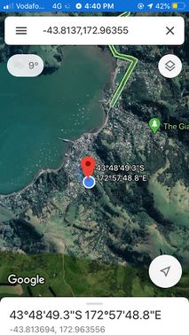
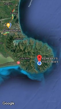
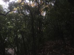
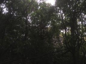
We'd left it to end of the day to do the geohash. This was a bit unfortunate, as the light was pretty dim in the bush at this stage. Hutchinson Reserve is a pretty small pocket of native bush, with no formal walking tracks, so we had to tread carefully (so as not to step on any baby plants) in order to find the geohash. We found a few odd things en route, including a long forgotten wheelbarrow. GPS wasn't so great under the trees, but we circled around for a while, to make sure we covered the general area pretty thoroughly!
We left a small hashmarker behind to mark what we took as the hashpoint.
There was a geocache also hidden in this reserve, namely, https://www.geocaching.com/geocache/GC7GRYN_hutchinson-reserve-akaroa, so we did that too for good measure.
It's good to have finally knocked off a hash after the Dark Ages - it's so good to be back!
Tracklog
Photos
Achievements
Quaternary earned the Electric Vehicle Achievement
|
