Difference between revisions of "2016-03-26 -37 144"
From Geohashing
imported>Razetoei |
m (More specific location) |
||
| (17 intermediate revisions by 3 users not shown) | |||
| Line 1: | Line 1: | ||
| + | [[Image:{{{image|2016-03-26 -37 144 selfie.jpg}}}|thumb|left]] | ||
| + | |||
{{meetup graticule | {{meetup graticule | ||
| lat=-37 | | lat=-37 | ||
| lon=144 | | lon=144 | ||
| − | | date=2016-03-26 | + | | date=2016-03-26}} |
| − | | | + | |
| − | | | + | <!-- If you did not specify these parameters in the template, please substitute appropriate values for IMAGE, LAT, LON, and DATE (YYYY-MM-DD format) |
| + | |||
| + | [[Image:{{{image|IMAGE}}}|thumb|left]] | ||
| + | |||
| + | Remove this section if you don't want an image at the top (left) of your report. You should remove the "Image:" or "File:" | ||
| + | tag from your image file name, and replace the all upper-case word IMAGE in the above line. | ||
| + | |||
| + | And DON'T FORGET to add your expedition and the best photo you took to the gallery on the Main Page! We'd love to read your report, but that means we first have to discover it! :) | ||
| + | --> | ||
| + | |||
| + | __NOTOC__ | ||
| + | |||
| + | == Location == | ||
| + | Farm in Cocoroc, near Little River, which is halfway between Geelong and Melbourne | ||
| + | |||
| + | == Participants == | ||
| + | [[User:Razetoei|Razetoei]] | ||
| + | |||
| + | == Plans == | ||
| + | Be there at 16:00 for Saturday meetup | ||
| + | |||
| + | == Expedition == | ||
| + | Running late because kid #3 needed to wee and I needed coffee. Avoided the coppers on the highway trying to do people for speeding on the Eggster weekend. Arrived at the geohash at 16:36. Climbed two fences with only one row of barbed wire between them. Must have been our lucky day. Stepped nimbly over many volcanic rocks. Startled a rabbit. Geohashed successfully. Went off to find the nearest geocache which was a little way down the highway on the other side. | ||
| + | |||
| + | == Photos == | ||
| + | <gallery perrow="5"> | ||
| + | Image:2016-03-26 -37 144 selfie.jpg | Me and kid #3 | ||
| + | Image:2016-03-26 -37 144 flora.jpg | A dead thistle? | ||
| + | Image:2016-03-26 -37 144 feet.jpg | Right this very here | ||
| + | Image:2016-03-26 -37 144 screencap.png | Ta da! | ||
| + | </gallery> | ||
| + | |||
| + | == Achievements == | ||
| + | {{#vardefine:ribbonwidth|800px}} | ||
| + | {{Two to the N achievement| count = 1| latitude = -37| longitude = 144 | date = 2016-03-26 | name = Razetoei}} | ||
| + | {{consecutive geohash 2| count = 2| latitude = -37| longitude = 144| date = 2016-03-26| name = Razetoei}} | ||
| + | |||
| + | |||
| + | [[Category:Expeditions]] | ||
| + | [[Category:Expeditions with photos]] | ||
| + | [[Category:Coordinates reached]] | ||
| + | {{location|AU|VIC|WY}} | ||
Latest revision as of 12:47, 1 August 2020
| Sat 26 Mar 2016 in -37,144: -37.9628467, 144.5633580 geohashing.info google osm bing/os kml crox |
Location
Farm in Cocoroc, near Little River, which is halfway between Geelong and Melbourne
Participants
Plans
Be there at 16:00 for Saturday meetup
Expedition
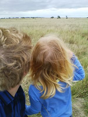
Running late because kid #3 needed to wee and I needed coffee. Avoided the coppers on the highway trying to do people for speeding on the Eggster weekend. Arrived at the geohash at 16:36. Climbed two fences with only one row of barbed wire between them. Must have been our lucky day. Stepped nimbly over many volcanic rocks. Startled a rabbit. Geohashed successfully. Went off to find the nearest geocache which was a little way down the highway on the other side.
Photos
Achievements
Razetoei earned the Two to the N achievement
|
Razetoei earned the Consecutive geohash achievement
|


