Difference between revisions of "2013-05-30 50 8"
imported>QuarterCacher (An expedition message sent via Geohash Droid for Android.) |
m (fix, sorry) |
||
| (9 intermediate revisions by 5 users not shown) | |||
| Line 1: | Line 1: | ||
| − | |||
| − | |||
| − | |||
| − | |||
| − | |||
| − | |||
| − | |||
| − | |||
| − | |||
| − | |||
{{meetup graticule | {{meetup graticule | ||
| lat=50 | | lat=50 | ||
| Line 15: | Line 5: | ||
}} | }} | ||
| − | |||
__NOTOC__ | __NOTOC__ | ||
== Location == | == Location == | ||
| − | + | A field not far from Königstein im Taunus. | |
== Participants == | == Participants == | ||
| − | + | * [[User:M|M]] | |
| − | + | * [[User:QuarterCacher|QuarterCacher]] | |
| + | * [[User:LadyBB|LadyBB]] | ||
| + | * [[User:EmmJay|EmmJay]] | ||
| + | * [[User:Draradech|Draradech]] | ||
| + | |||
| + | (and Mampfred doing the dirty documentation work again ...) | ||
== Plans == | == Plans == | ||
| − | + | ==== Draradech ==== | |
| + | Do a bike-juggernaut-tron expedition. | ||
== Expedition == | == Expedition == | ||
| − | <!-- | + | ==== M, QuarterCacher, LadyBB, EmmJay ==== |
| + | They got there, I was told.<br> | ||
| + | And they were quite adamant on the fact that there must have been somebody else going for the hash as there was quite a lot of grass trampling that couldn't have had any other reason to be there. Mampfred is thinking: aliens? | ||
| + | ==== Draradech ==== | ||
| + | As I already had something planned this afternoon, I did go hashing early. Sorry Mampfred, no aliens.<br> | ||
| + | I had planned to go juggernaut on the way to the hash, and take a curve back, to get the tron achievement as well. That didn't last long, 2 minutes in, I already had botched the tron requirements:<br> | ||
| + | [[File:2013-05-30_50_8_fail.jpg|300px]]<br> | ||
| + | Oh well, so concentrate on the juggernaut, then. I already knew it would be kind of a close call to cross the B40:<br> | ||
| + | [[File:2013-05-30_50_8_crossing_b40.jpg|300px]]<br> | ||
| + | Directly after the bridge, the way leads on, but is off limits, if I want to get the juggernaut (red line is 5% deviation from straight line):<br> | ||
| + | [[File:2013-05-30_50_8_detour.jpg|300px]]<br> | ||
| + | So I'll have to climb down the more direct route (green arrow).<br> | ||
| + | [[File:2013-05-30_50_8_wait_what.jpg|300px]]<br> | ||
| + | Wait. What?! Why did I climb down the left side again???<br> | ||
| + | From there on it was just zig-zagging my way up to the hash:<br> | ||
| + | [[File:2013-05-30_50_8_juggernaut.jpg|300px]]<br> | ||
| + | [http://www.mappingsupport.com/p/gmap4.php?q=http://draradech.de/2013-05-30_50_8.kml&t=s Juggernaut path]<br> | ||
| − | == | + | == Additional Photos == |
| − | |||
| − | |||
| − | |||
| − | |||
| − | |||
| − | |||
<gallery perrow="5"> | <gallery perrow="5"> | ||
| + | Image:2013-05-30_50_8_16-54-50-290.jpg | Coordinates reached | ||
| + | Image:2013-05-30_50_8_proof.jpg | Coordinates reached | ||
| + | Image:2013-05-30_50_8_grin.jpg | Stupid grin | ||
</gallery> | </gallery> | ||
== Achievements == | == Achievements == | ||
{{#vardefine:ribbonwidth|800px}} | {{#vardefine:ribbonwidth|800px}} | ||
| − | + | {{bicycle geohash | latitude = 50 | longitude = 8 | date = 2013-05-30 | name = Draradech | distance = 30.6 km | bothways = true}} | |
| − | + | {{Earliest geohasher | latitude = 50 | longitude = 8 | date = 2013-05-30 | name = Draradech}} | |
| − | + | {{Ribbon | icon = Juggernaut968.png | color = darkviolet | user = Draradech | achievement = [[Juggernaut achievement]] | | |
| − | + | action = reaching the {{egl|2013-05-30|50|8|text=(50, 8) geohash}} in a straight line (with a deviation of 4.6%) on [[2013-05-30 50 8 | 2013-05-30]] | category = Juggernaut achievement}} | |
| − | |||
| − | [[ | ||
| − | |||
| − | |||
| − | |||
| − | [[ | ||
| − | -- | ||
| − | |||
| − | |||
[[Category:Expeditions]] | [[Category:Expeditions]] | ||
| − | |||
[[Category:Expeditions with photos]] | [[Category:Expeditions with photos]] | ||
| − | |||
| − | |||
| − | |||
| − | |||
| − | |||
[[Category:Coordinates reached]] | [[Category:Coordinates reached]] | ||
| − | + | {{location|DE|HE|MTK}} | |
| − | |||
| − | |||
| − | |||
| − | |||
| − | |||
| − | |||
| − | |||
| − | |||
| − | |||
| − | |||
| − | |||
| − | |||
| − | |||
| − | |||
| − | |||
| − | |||
| − | |||
Latest revision as of 19:03, 18 January 2022
| Thu 30 May 2013 in 50,8: 50.1638727, 8.4625104 geohashing.info google osm bing/os kml crox |
Location
A field not far from Königstein im Taunus.
Participants
(and Mampfred doing the dirty documentation work again ...)
Plans
Draradech
Do a bike-juggernaut-tron expedition.
Expedition
M, QuarterCacher, LadyBB, EmmJay
They got there, I was told.
And they were quite adamant on the fact that there must have been somebody else going for the hash as there was quite a lot of grass trampling that couldn't have had any other reason to be there. Mampfred is thinking: aliens?
Draradech
As I already had something planned this afternoon, I did go hashing early. Sorry Mampfred, no aliens.
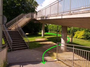
I had planned to go juggernaut on the way to the hash, and take a curve back, to get the tron achievement as well. That didn't last long, 2 minutes in, I already had botched the tron requirements:
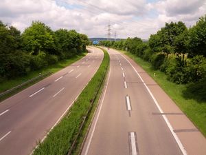
Oh well, so concentrate on the juggernaut, then. I already knew it would be kind of a close call to cross the B40:
Directly after the bridge, the way leads on, but is off limits, if I want to get the juggernaut (red line is 5% deviation from straight line):
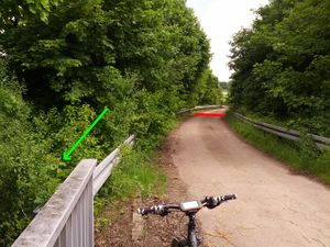
So I'll have to climb down the more direct route (green arrow).
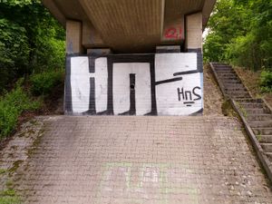
Wait. What?! Why did I climb down the left side again???
From there on it was just zig-zagging my way up to the hash:
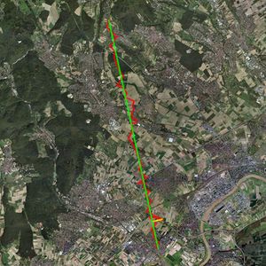
Juggernaut path
Additional Photos
Achievements
Draradech earned the Bicycle geohash achievement
|
Draradech earned the Earliest geohasher achievement
|
Draradech earned the Juggernaut achievement
|


