Difference between revisions of "2021-07-16 41 2"
(New Expedition) |
m (User categories) |
||
| (2 intermediate revisions by the same user not shown) | |||
| Line 17: | Line 17: | ||
== Anti-Retro Expedition == | == Anti-Retro Expedition == | ||
| − | 5 days ago I went with some friends on a bicycle route, and they showed me some new paths where I still hadn't been before. Nice -I though- so when I need to go in this area again, I will already know which paths I could take. Little I knew, that | + | 5 days ago I went with some friends on a bicycle route, and they showed me some new paths where I still hadn't been before. Nice -I though- so when I need to go in this area again, I will already know which paths I could take. Little I knew, that 4 days later, the hash would fall no more than 10m from the path that went along the shore of the river. It caught me kind of on surprise (well, when doesn't it, right?) and I wasn't sure if I would be in the mood to go again in this area. Keep in mind, I would be going in the afternoon, there is no shade no where near here and it's 30ºC (86F)... |
== Expedition == | == Expedition == | ||
| Line 25: | Line 25: | ||
But that was it. Took off 20 minutes later than expected but the rest went as planned. Found the way with no problems, managed the heat correctly, had enough water and I found a few geocaches on the way. | But that was it. Took off 20 minutes later than expected but the rest went as planned. Found the way with no problems, managed the heat correctly, had enough water and I found a few geocaches on the way. | ||
| − | Pictures of the hash where also taken, in the very same path only | + | Pictures of the hash where also taken, in the very same path only 4 days later, and then I went on discovering Ripollet, to see how the bike-roads are there in case I need to plan a future expedition on that direction. |
3 hours later I arrived back home. And that was that. | 3 hours later I arrived back home. And that was that. | ||
| Line 33: | Line 33: | ||
== Photos == | == Photos == | ||
| − | |||
{{#vardefine:gaWidth|300}} | {{#vardefine:gaWidth|300}} | ||
{{#vardefine:gaHeight|200}} | {{#vardefine:gaHeight|200}} | ||
| − | {{#vardefine:gaLines| | + | {{#vardefine:gaLines|3}} |
{{Gallery2| | {{Gallery2| | ||
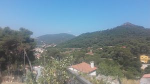
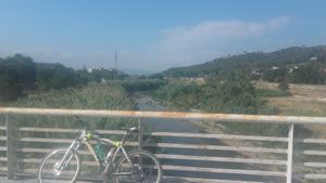
| − | {{GalleryItem | Image: . | + | {{GalleryItem | Image: 2021-07-16 41 2 autopista.jpg | Reaching Montcada after crossing the highway.}} |
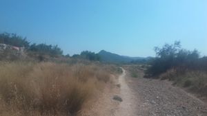
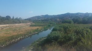
| + | {{GalleryItem | Image: 2021-07-16 41 2 sud.jpg | Already on the river shore looking south. You can see the same mountain as on the previous picture.}} | ||
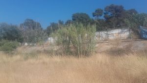
| + | {{GalleryItem | Image: 2021-07-16 41 2 hash.jpg | Reeds where the hash fell.}} | ||
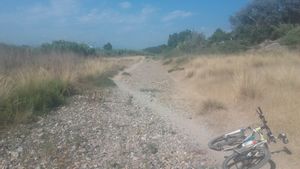
| + | {{GalleryItem | Image: 2021-07-16 41 2 nord.jpg | Parking ''Frühlingskiefer'' looking north.}} | ||
| + | {{GalleryItem | Image: 2021-07-16 41 2 GPSr.jpg | Proof with GPSr.}} | ||
| + | {{GalleryItem | Image: 2021-07-16 41 2 cross.jpg | Crossing the river, looking north.}} | ||
| + | {{GalleryItem | Image: 2021-07-16 41 2 sud2.jpg | Same spot as before, but looking south. That hill belongs already to Barcelona.}} | ||
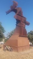
| + | {{GalleryItem | Image: 2021-07-16 41 2 llevantada.jpg | Sculpture in Ripollet called [[osmnode:3533778401|''Llevantada'']] (strong wind from east).}} | ||
}} | }} | ||
| − | |||
| − | |||
== Achievements == | == Achievements == | ||
{{#vardefine:ribbonwidth|800px}} | {{#vardefine:ribbonwidth|800px}} | ||
| − | '' | + | {{bicycle geohash | latitude = 41 | longitude = 2 | date = 2021-07-16 | name = SastRe.O with ''Frühlingskiefer'' | distance = 38.9km | bothways = true | image = 2021-07-16 41 2 cross.jpg}} |
| + | {{Déjà vu geohash | latitude = 41 | longitude = 2 | date = 2021-07-16 | olddate = 4 days ago | name = SastRe.O}} | ||
| + | <small>As proof, there is the [[osmuser:SastReO/traces/3736449|tracklog]] from monday which was already duly uploaded on osm already ;) </small> | ||
== Other Geohashing Expeditions and Plans on This Day == | == Other Geohashing Expeditions and Plans on This Day == | ||
| Line 51: | Line 57: | ||
{{Location|ES|CT|B}} | {{Location|ES|CT|B}} | ||
| + | {{user categories|user=SastRe.O|bike=38.9}} | ||
[[Category:Expeditions]] | [[Category:Expeditions]] | ||
[[Category:Expeditions with photos]] | [[Category:Expeditions with photos]] | ||
[[Category:Coordinates reached]] | [[Category:Coordinates reached]] | ||
| − | |||
| − | |||
| − | |||
| − | |||
| − | |||
| − | |||
| − | |||
| − | |||
| − | |||
| − | |||
| − | |||
| − | |||
| − | |||
| − | |||
| − | |||
| − | |||
| − | |||
| − | |||
| − | |||
Latest revision as of 15:04, 14 February 2022
| Fri 16 Jul 2021 in Barcelona, Catalonia: 41.4989362, 2.1982577 geohashing.info google osm bing/os kml crox |
Location
On the shore of the Besòs river, in Montcada i Reixac.
Participants
Anti-Retro Expedition
5 days ago I went with some friends on a bicycle route, and they showed me some new paths where I still hadn't been before. Nice -I though- so when I need to go in this area again, I will already know which paths I could take. Little I knew, that 4 days later, the hash would fall no more than 10m from the path that went along the shore of the river. It caught me kind of on surprise (well, when doesn't it, right?) and I wasn't sure if I would be in the mood to go again in this area. Keep in mind, I would be going in the afternoon, there is no shade no where near here and it's 30ºC (86F)...
Expedition
But I was in the mood :) Packed sufficient water, helmet, backpack, everything ready and... what? The tire is flat? Ah, that was a real bummer. I almost called it off, but, ok, I will change it. The thing is I will have to go there with no spare one. I never need it on the road anyway, do I? I though I had checked the bike the night before. Apparently I did not (?).
But that was it. Took off 20 minutes later than expected but the rest went as planned. Found the way with no problems, managed the heat correctly, had enough water and I found a few geocaches on the way.
Pictures of the hash where also taken, in the very same path only 4 days later, and then I went on discovering Ripollet, to see how the bike-roads are there in case I need to plan a future expedition on that direction.
3 hours later I arrived back home. And that was that.
Tracklog
Photos
|
Achievements
SastRe.O with Frühlingskiefer earned the Bicycle geohash achievement
|
SastRe.O earned the Déjà Vu Geohash Achievement
|
As proof, there is the tracklog from monday which was already duly uploaded on osm already ;)
Other Geohashing Expeditions and Plans on This Day
Expeditions and Plans
| 2021-07-16 | ||
|---|---|---|
| Segovia, Spain | Wingman | In the wilds, near the road between Fresnedillas de la Oliva and Robledo de... |
| Barcelona, Spain | SastRe.O | On the shore of the Besòs river, in Montcada i Reixac. |
