Difference between revisions of "2009-12-30 49 -123"
imported>Elbie |
m |
||
| (12 intermediate revisions by 6 users not shown) | |||
| Line 9: | Line 9: | ||
==Participants== | ==Participants== | ||
| − | * Elbie | + | * [[User:Elbie|Elbie]] |
| + | * [[User:Robyn|Robyn]] (& T-Rex) | ||
| + | * [[User:Wade|Wade]] | ||
==Planning== | ==Planning== | ||
| Line 15: | Line 17: | ||
* 12:30 - leave UBC | * 12:30 - leave UBC | ||
* 14:00 - arrive hashpoint | * 14:00 - arrive hashpoint | ||
| + | |||
| + | Wade and Robyn's plan: | ||
| + | * somewhere around 1:30 ish - leave home | ||
| + | * whenever, probably close to 2:00 - arrive hashpoint | ||
| + | * later - return home, change into respectable clothes | ||
| + | * 14:40 - Wade leave home to meet people downtown | ||
| + | * 15:00 - Wade meets people downtown | ||
==Expeditions== | ==Expeditions== | ||
===Elbie=== | ===Elbie=== | ||
| + | Looking at the coordinates that morning, I decided this would be a good opportunity for a Tron achievement for me. I decided on a route -- taking SW Marine down to Richmond, then going across Sea Island, then taking the Dyke path to the point; then going through Richmond proper to the SkyTrain, taking that to Broadway, taking a detour to MEC, and then riding back to UBC from there. | ||
| + | |||
| + | The plan worked nicely up until I was crossing the No. 2 bridge from Sea Island to Lulu Island. There was a snag in my plan that I had realized as I'd gotten into Richmond -- the bike signage there is ''terrible''. Thus far I'd been able to correctly interpret the signs, and to connect the dots where signs should be -- however, I was not prepared for there just being no signs to figure out, as was the case getting off the bridge. Missing my turnoff, I had to eventually loop back, woefully failing at the Tronhash. | ||
| + | |||
| + | The dyke path, once I was on it, was full of its own share of confusing signage around construction areas, but I nevertheless managed to get to about 30 metres from the hashpoint by around 13:40. Scrambling through thick blackberry bushes and small trees (alders?) and fighting against the tree-cover to get a GPS signal, I eventually managed to get to the hashpoint. | ||
| + | |||
| + | After stumbling out from the bushes and finding my bike again, I got out some lunch and waited to see if anybody else would show up. I saw a man walk quite confidently into the bushes about 15 metres away from me, so I decided to go over and greet what I assumed was a fellow geohasher. Turns out he'd wanted to take a leak. | ||
| + | |||
| + | Returning to my bike, I started putting together a sign for the hashpoint. Just as I was heading back into the bushes, I head from the distance, the sound of people running and an excited cry -- "''GEOHASHERS!!!''". | ||
| + | |||
===Robyn & Wade === | ===Robyn & Wade === | ||
We got up this morning and puttered about doing the things that you do when it's the second last day of the year, and the first day in a week that you've had no houseguests. Around 12:30 that puttering included checking the geohash. "Hey!" said Robyn, "It's accessible!" Robyn clicked on the Meetup link that should have taken her to this page, to see if it existed yet, but the Internet told her it couldn't do that right now. | We got up this morning and puttered about doing the things that you do when it's the second last day of the year, and the first day in a week that you've had no houseguests. Around 12:30 that puttering included checking the geohash. "Hey!" said Robyn, "It's accessible!" Robyn clicked on the Meetup link that should have taken her to this page, to see if it existed yet, but the Internet told her it couldn't do that right now. | ||
| − | Wade had a meeting downtown at three, so -- | + | Wade had a meeting downtown at three, so there was no time to bike. We put on boots and swamp-appropriate trousers, wrote out some quick directions, gathered GPS, compass, and dinosaur and jumped in the car. The directions led us past the airport, right on Westminster Highway, right on Barnard Avenue, then left on Westminster Highway again. That sounds weird, but it worked out in the end. It brought us to a park, an actual recreational area with a parking lot next to a dyke. The geohash was only 300 metres from the parked car. We walked along the dyke and when the geohash was about 80 metres away, Robyn drew breath to say "I think it's going to be off to the right there." Instead, what she said was "Geohashers!!" and burst into a run, because someone with a bicycle was emerging from the approximate location of the geohash. It turned out to be Elbie, and not some stranger going for a whizz in the bushes. Elbie reported the geohash to be about 20 minutes away into the copse. |
| + | |||
| + | People not accustomed to geohashing might think this strange. Or people not accustomed to metric might think they had misremembered what a metre was. But geohashers will understand. In this case it was only about fifteen metres of brambles. Wade used some heavy sticks to help batter the brambles into submission, but while he was doing that and despite T-Rex's vigilant presence, a velociraptor darted by and savaged his hand. Nevertheless, we both persevered and reached the point. | ||
| + | |||
| + | We're pleased to have reached what will probably be Vancouver's last geohash of the year, and delighted to have coincidenatally arrived while Elbie was there. On the way back to the car we saw a Great Blue Heron looking for fish in a ditch. At least we think it was looking for fish. Maybe it was geohashing. | ||
| + | |||
| + | Wade has decided that his geohashing kit should include work gloves, canvas pants, and gardening shears. He'd prefer a machete but thought it easier to not get arrested when walking around with garden shears. | ||
| + | |||
| + | After all that, Wade was only 15 minutes late for his meeting. | ||
| + | |||
| + | Update: The velociraptor got Wade's leg pretty badly, too, but we think he'll live. | ||
==Photos== | ==Photos== | ||
[http://www.flickr.com/photos/patitsas/sets/72157622980193761/detail/ Elbie's are here.] | [http://www.flickr.com/photos/patitsas/sets/72157622980193761/detail/ Elbie's are here.] | ||
| − | + | ||
| + | <gallery caption="Wade & Robyn's Photos" widths="200px" heights="200px" perrow="3"> | ||
| + | Image:2009-12-30 49 -123.car.jpg|Ready for the expedition. | ||
| + | Image:2009-12-30 49 -123.brambles.jpg|Wade demonstrates his bramble-fighting technique | ||
| + | Image:2009-12-30 49 -123.2GPSes.jpg|Two GPSes mark the spot | ||
| + | Image:2009-12-30 49 -123.robynandwade.jpg|As do two grinning geohashers and a hashscot | ||
| + | Image:2009-12-30 49 -123.halfwade.jpg|Vancouver geohash meetups average 2.3 participants | ||
| + | Image:2009-12-30 49 -123.wounds.jpg|Wade's raptor wounds | ||
| + | </gallery> | ||
[[Category:Expeditions]] | [[Category:Expeditions]] | ||
| + | [[Category:Coordinates reached]] | ||
| + | {{location|CA|BC|MV}} | ||
Latest revision as of 18:58, 18 March 2022
| Wed 30 Dec 2009 in 49,-123: 49.1689328, -123.1974537 geohashing.info google osm bing/os kml crox |
Location
Northwestern coast of Richmond.
Participants
Planning
Elbie's plan:
- 12:30 - leave UBC
- 14:00 - arrive hashpoint
Wade and Robyn's plan:
- somewhere around 1:30 ish - leave home
- whenever, probably close to 2:00 - arrive hashpoint
- later - return home, change into respectable clothes
- 14:40 - Wade leave home to meet people downtown
- 15:00 - Wade meets people downtown
Expeditions
Elbie
Looking at the coordinates that morning, I decided this would be a good opportunity for a Tron achievement for me. I decided on a route -- taking SW Marine down to Richmond, then going across Sea Island, then taking the Dyke path to the point; then going through Richmond proper to the SkyTrain, taking that to Broadway, taking a detour to MEC, and then riding back to UBC from there.
The plan worked nicely up until I was crossing the No. 2 bridge from Sea Island to Lulu Island. There was a snag in my plan that I had realized as I'd gotten into Richmond -- the bike signage there is terrible. Thus far I'd been able to correctly interpret the signs, and to connect the dots where signs should be -- however, I was not prepared for there just being no signs to figure out, as was the case getting off the bridge. Missing my turnoff, I had to eventually loop back, woefully failing at the Tronhash.
The dyke path, once I was on it, was full of its own share of confusing signage around construction areas, but I nevertheless managed to get to about 30 metres from the hashpoint by around 13:40. Scrambling through thick blackberry bushes and small trees (alders?) and fighting against the tree-cover to get a GPS signal, I eventually managed to get to the hashpoint.
After stumbling out from the bushes and finding my bike again, I got out some lunch and waited to see if anybody else would show up. I saw a man walk quite confidently into the bushes about 15 metres away from me, so I decided to go over and greet what I assumed was a fellow geohasher. Turns out he'd wanted to take a leak.
Returning to my bike, I started putting together a sign for the hashpoint. Just as I was heading back into the bushes, I head from the distance, the sound of people running and an excited cry -- "GEOHASHERS!!!".
Robyn & Wade
We got up this morning and puttered about doing the things that you do when it's the second last day of the year, and the first day in a week that you've had no houseguests. Around 12:30 that puttering included checking the geohash. "Hey!" said Robyn, "It's accessible!" Robyn clicked on the Meetup link that should have taken her to this page, to see if it existed yet, but the Internet told her it couldn't do that right now.
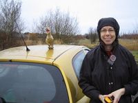
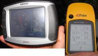
Wade had a meeting downtown at three, so there was no time to bike. We put on boots and swamp-appropriate trousers, wrote out some quick directions, gathered GPS, compass, and dinosaur and jumped in the car. The directions led us past the airport, right on Westminster Highway, right on Barnard Avenue, then left on Westminster Highway again. That sounds weird, but it worked out in the end. It brought us to a park, an actual recreational area with a parking lot next to a dyke. The geohash was only 300 metres from the parked car. We walked along the dyke and when the geohash was about 80 metres away, Robyn drew breath to say "I think it's going to be off to the right there." Instead, what she said was "Geohashers!!" and burst into a run, because someone with a bicycle was emerging from the approximate location of the geohash. It turned out to be Elbie, and not some stranger going for a whizz in the bushes. Elbie reported the geohash to be about 20 minutes away into the copse.
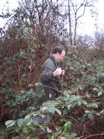
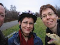
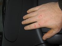
People not accustomed to geohashing might think this strange. Or people not accustomed to metric might think they had misremembered what a metre was. But geohashers will understand. In this case it was only about fifteen metres of brambles. Wade used some heavy sticks to help batter the brambles into submission, but while he was doing that and despite T-Rex's vigilant presence, a velociraptor darted by and savaged his hand. Nevertheless, we both persevered and reached the point.
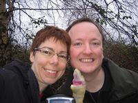
We're pleased to have reached what will probably be Vancouver's last geohash of the year, and delighted to have coincidenatally arrived while Elbie was there. On the way back to the car we saw a Great Blue Heron looking for fish in a ditch. At least we think it was looking for fish. Maybe it was geohashing.
Wade has decided that his geohashing kit should include work gloves, canvas pants, and gardening shears. He'd prefer a machete but thought it easier to not get arrested when walking around with garden shears.
After all that, Wade was only 15 minutes late for his meeting.
Update: The velociraptor got Wade's leg pretty badly, too, but we think he'll live.
Photos
- Wade & Robyn's Photos
