Difference between revisions of "2016-08-16 41 -119"
From Geohashing
m |
m (Adding hours) |
||
| Line 37: | Line 37: | ||
[[Category:Coordinates reached - Did not attempt]] | [[Category:Coordinates reached - Did not attempt]] | ||
{{location|US|NV|WA}} | {{location|US|NV|WA}} | ||
| − | {{user categories|user=Fippe}} | + | {{user categories|user=Fippe|hours=11}} |
Revision as of 19:06, 11 December 2022
| Tue 16 Aug 2016 in 41,-119: 41.0942757, -119.4144188 geohashing.info google osm bing/os kml crox |
Location
This Geohash is located near the peak of Leadsville Mountain in the Hog Ranch Mountains.
Participants
- Fippe
- his father
Expedition
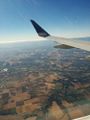
My father and I were flying from FRA via SFO to PDX on this day. At 11:39 local time (18:39 UTC) we flew over this Geohash. If only we had been aware, it would have been the first expedition in this graticule. I took a few pictures, but not at the right time.
Photos
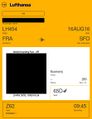
My boarding pass
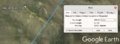
Air Geohash Proof
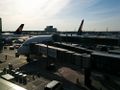
Planes in Frankfurt. The plane in the foreground may have been the one we were in.
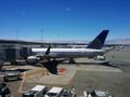
Planes in San Francisco
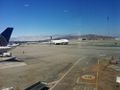
Planes in San Francisco
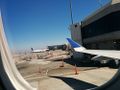
Planes in San Francisco
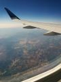
Over California
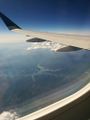
This might be Shasta Lake
Over Oregon


Tracklog
Ribbons
Fippe and his father earned the Curse of Unawareness Consolation Prize
|
Is it true that Fippe and his father earned the Air geohash achievement?
|