Difference between revisions of "2023-09-07 -34 138"
(hash planning) |
m (Location) |
||
| (One intermediate revision by one other user not shown) | |||
| Line 1: | Line 1: | ||
<!-- If you did not specify these parameters in the template, please substitute appropriate values for IMAGE, LAT, LON, and DATE (YYYY-MM-DD format) | <!-- If you did not specify these parameters in the template, please substitute appropriate values for IMAGE, LAT, LON, and DATE (YYYY-MM-DD format) | ||
| − | [[Image: | + | [[Image:2023-09-07 -34 138 thumbs up.png|thumb|left]] |
Remove this section if you don't want an image at the top (left) of your report. You should remove the "Image:" or "File:" | Remove this section if you don't want an image at the top (left) of your report. You should remove the "Image:" or "File:" | ||
| Line 25: | Line 25: | ||
Given that I'm at university today and have a two hour gap of no classes from 12pm-2pm, I'll probably take a bus to the hash during that time. | Given that I'm at university today and have a two hour gap of no classes from 12pm-2pm, I'll probably take a bus to the hash during that time. | ||
| − | |||
== Expedition == | == Expedition == | ||
| − | <!-- how it all turned out. your narrative goes here. -- | + | <!-- how it all turned out. your narrative goes here. --> |
| + | After leaving the lecture at 12pm, I walked to the bus stop on Frome Rd and took a bus to the geohash. (Conveniently there was one, and I didn't need to do any transfers.) | ||
| + | |||
| + | Attempting to get to the actual geohash location was tricky, as it was further into the house than I was expecting. It ''was'' possible for me to access the side of the house, and I hoped that I might be able to get the GPS error radius to ''just'' contain the geohash, but it wasn't possible. | ||
| + | |||
| + | Not wanting to give up, I knocked on the door of the house containing the hash and for the first time... had to explain what geohashing is and ask for permission to enter. That was definitely the most awkward I have felt in a long time. Thankfully, the person living there allowed me to enter his backyard, which was enough to get the screenshot and leave (after thanking him probably too many times). | ||
== Tracklog == | == Tracklog == | ||
| − | <!-- if your GPS device keeps a log, you may use Template:Tracklog, post a link here, or both -- | + | <!-- if your GPS device keeps a log, you may use Template:Tracklog, post a link here, or both --> |
| + | {{tracklog|2023-09-07 -34 138.gpx}} | ||
== Photos == | == Photos == | ||
<!-- Insert pictures between the gallery tags using the following format: | <!-- Insert pictures between the gallery tags using the following format: | ||
Image:2020-##-## ## ## Alpha.jpg | Witty Comment | Image:2020-##-## ## ## Alpha.jpg | Witty Comment | ||
| − | -- | + | --> |
<gallery perrow="5"> | <gallery perrow="5"> | ||
| + | Image:2023-09-07 -34 138 google maps.png | Obligatory Google Maps screenshot | ||
| + | Image:2023-09-07 -34 138 thumbs up.png | [[Stupid grin]]? you're going to have to trust me on that one :) | ||
</gallery> | </gallery> | ||
== Achievements == | == Achievements == | ||
{{#vardefine:ribbonwidth|100%}} | {{#vardefine:ribbonwidth|100%}} | ||
| − | + | {{Ambassador geohash | |
| − | - | + | | latitude = -34 |
| + | | longitude = 138 | ||
| + | | date = 2023-09-07 | ||
| + | | name = [[User:XXOs|XXOs]] | ||
| + | }} | ||
| + | {{Two to the N achievement | ||
| + | | count = 2 | ||
| + | | date = 2023-09-07 | ||
| + | | latitude = -34 | ||
| + | | longitude = 138 | ||
| + | | name = [[User:XXOs|XXOs]] | ||
| + | }} | ||
__NOTOC__ | __NOTOC__ | ||
| − | <!-- =============== USEFUL CATEGORIES FOLLOW ================ | + | <!-- =============== USEFUL CATEGORIES FOLLOW ================ --> |
| − | |||
| − | |||
<!-- ==REQUEST FOR TWITTER BOT== Please leave either the New report or the Expedition planning category in as long as you work on it. This helps the twitter bot a lot with announcing the right outcome at the right moment. --> | <!-- ==REQUEST FOR TWITTER BOT== Please leave either the New report or the Expedition planning category in as long as you work on it. This helps the twitter bot a lot with announcing the right outcome at the right moment. --> | ||
| − | |||
| − | |||
| − | |||
| − | |||
| − | |||
| − | |||
| − | |||
[[Category:Expeditions]] | [[Category:Expeditions]] | ||
| − | |||
[[Category:Expeditions with photos]] | [[Category:Expeditions with photos]] | ||
| − | |||
| − | |||
| − | |||
| − | |||
| − | |||
[[Category:Coordinates reached]] | [[Category:Coordinates reached]] | ||
| − | + | {{location|AU|SA|PE}} | |
| − | |||
| − | |||
| − | |||
| − | |||
| − | |||
| − | |||
| − | |||
| − | |||
| − | |||
| − | |||
| − | |||
| − | |||
| − | |||
| − | |||
| − | |||
| − | |||
| − | |||
Latest revision as of 04:42, 7 September 2023
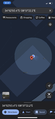
| Thu 7 Sep 2023 in -34,138: -34.8806695, 138.6228419 geohashing.info google osm bing/os kml crox |
Location
179-181 North East Road, Manningham SA 5086
Participants
Plans
Given that I'm at university today and have a two hour gap of no classes from 12pm-2pm, I'll probably take a bus to the hash during that time.
Expedition
After leaving the lecture at 12pm, I walked to the bus stop on Frome Rd and took a bus to the geohash. (Conveniently there was one, and I didn't need to do any transfers.)
Attempting to get to the actual geohash location was tricky, as it was further into the house than I was expecting. It was possible for me to access the side of the house, and I hoped that I might be able to get the GPS error radius to just contain the geohash, but it wasn't possible.
Not wanting to give up, I knocked on the door of the house containing the hash and for the first time... had to explain what geohashing is and ask for permission to enter. That was definitely the most awkward I have felt in a long time. Thankfully, the person living there allowed me to enter his backyard, which was enough to get the screenshot and leave (after thanking him probably too many times).
Tracklog
Photos
Obligatory Google Maps screenshot

Stupid grin? you're going to have to trust me on that one :)


Achievements
XXOs earned the Ambassador achievement
|
