Difference between revisions of "2023-12-03 -41 173"
Quaternary (talk | contribs) (Created page with "{{subst:Expedition}}") |
m (Location) |
||
| (8 intermediate revisions by one other user not shown) | |||
| Line 1: | Line 1: | ||
| − | + | [[Image:{{{image|2023_12_03_-41_173_01.jpg}}}|thumb|left]] | |
| − | + | <!-- | |
| + | And DON'T FORGET to add your expedition and the best photo you took to the gallery on the Main Page! We'd love to read your report, but that means we first have to discover it! :) | ||
| + | --> | ||
| + | |||
| + | {{meetup graticule | ||
| + | | lat=-41 | ||
| + | | lon=173 | ||
| + | | date=2023-12-03 | ||
| + | | graticule_name=Nelson | ||
| + | | graticule_link=Nelson,_New_Zealand}} | ||
| − | + | __NOTOC__ | |
| − | |||
| − | |||
| − | |||
| − | |||
| − | |||
| − | |||
| − | |||
== Location == | == Location == | ||
| − | + | ||
| + | Down a bank from a walking track, near Mapua, Nelson | ||
== Participants == | == Participants == | ||
| − | + | ||
| − | + | The [[User:Quaternary|Quaternary]] ([[User talk:Quaternary|talk]]) family geohashers | |
== Plans == | == Plans == | ||
| − | + | ||
| + | A family commemoration event had brought all the family together for this weekend, and right on queue, an achievable geohash appeared, halfway between where we were staying at our Airbnb and the in-laws place that we were on our way to visit. Couldn’t ask for much better luck than this. Thus, our party of six set off. | ||
== Expedition == | == Expedition == | ||
| − | + | ||
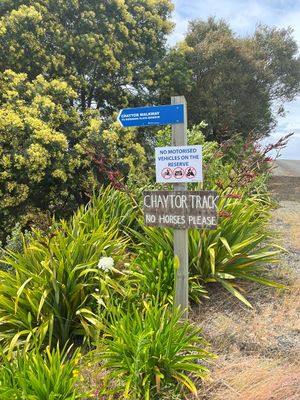
| + | It appeared that the geohash was close to what appeared to be a walking track. And when we arrived, that did eventuate to be the case - Chayton Track, a shared walking/biking track going through a reserve. We would need to walk about 500 metres down this track and then we'd be about 20 metres from the hash. Brilliant! Oh, and the sign said to leave horses in the car. | ||
| + | |||
| + | As we walked down the track my companions didn't necessarily share my enthusiasm, as they could see large patches of prickly gorse and blackberry, which I admitted didn't look inviting, but I had experienced far worse (raptors, etc). | ||
| + | |||
| + | A few minutes later we reached the point that we had to plunge down the pretty steep bank and get to the other side of a dead pine tree that we had seen on google maps satellite view. At this point, two of the party refused to continue on the expedition, despite the fact that happily in the vicinity of the hash, it was devoid of prickly vegetation (or worse). Plus, don't they know you should never split the party?! (They all need to play more DnD). | ||
| + | |||
| + | So scramble down the bank the remaining Fab Four did, and while the GPS went a bit crazy under the trees and in the small gorge, we found a spot which we felt confident was the ordained hashpoint. Success! | ||
| + | |||
| + | PS: Check out this geohash report here [[2015-04-06 -41 173|2015-04-06]] in the same graticule 8 years ago - the youngest family geohasher has grown somewhat | ||
== Tracklog == | == Tracklog == | ||
| − | < | + | |
| + | <gallery widths="213px" heights="379px" perrow="4"> | ||
| + | Image:2023_12_03_-41_173_Geolocation1.jpg | | ||
| + | Image:2023_12_03_-41_173_Geolocation2.jpg | | ||
| + | Image:2023_12_03_-41_173_Geolocation3.jpg | | ||
| + | Image:2023_12_03_-41_173_Geolocation4.jpg | | ||
| + | </gallery> | ||
| + | |||
| + | |||
== Photos == | == Photos == | ||
| − | < | + | |
| − | Image: | + | <gallery widths="320px" heights="213px" perrow="3"> |
| − | -- | + | Image:2023_12_03_-41_173_01.jpg | A conveniently located walking track got us to within 20 metres of the hash |
| − | + | Image:2023_12_03_-41_173_02.jpg | My enthusiastic geohashing companions | |
| + | Image:2023_12_03_-41_173_03.jpg | At the hash! | ||
| + | Image:2023_12_03_-41_173_04.jpg | Looking west (what is that rope?) | ||
| + | Image:2023_12_03_-41_173_05.jpg | Looking north | ||
| + | Image:2023_12_03_-41_173_06.jpg | Looking east | ||
| + | Image:2023_12_03_-41_173_07.jpg | Looking south | ||
| + | Image:2023_12_03_-41_173_08.jpg | Looking up | ||
| + | Image:2023_12_03_-41_173_09.jpg | Getting back up to the walking track proper was pretty easy, as we discovered a rope someone had put in to help us clamber up | ||
| + | Image:2023_12_03_-41_173_10.jpg | Reunited with the group after our successful hash! | ||
</gallery> | </gallery> | ||
== Achievements == | == Achievements == | ||
| − | |||
| − | |||
| − | + | {{gratuitous ribbon | |
| − | |||
| − | |||
| − | |||
| − | + | | color = red | |
| + | | icon = Electric_car.png | ||
| + | | latitude = -41 | ||
| + | | longitude = 173 | ||
| + | | date = 2023-12-03 | ||
| + | | achievement = Electric Vehicle Achievement | ||
| + | | description = travelling to and from the Geohash in an electric vehicle | ||
| + | | name = Quaternary | ||
| + | | image = 2014_08_14_-43_172_5_Eco_power.JPG | ||
| − | + | }} | |
| − | |||
| − | |||
| − | |||
| − | |||
| − | |||
[[Category:Expeditions]] | [[Category:Expeditions]] | ||
| − | |||
[[Category:Expeditions with photos]] | [[Category:Expeditions with photos]] | ||
| − | |||
| − | |||
| − | |||
| − | |||
| − | |||
[[Category:Coordinates reached]] | [[Category:Coordinates reached]] | ||
| − | + | [[Category:Meetup on 2023-12-03]] | |
| − | + | {{location|NZ|TAS}} | |
| − | |||
| − | [[Category: | ||
| − | -- | ||
| − | |||
| − | |||
| − | |||
| − | |||
| − | |||
| − | |||
| − | |||
| − | |||
| − | |||
| − | |||
| − | |||
| − | |||
| − | |||
Latest revision as of 02:42, 9 December 2023
| Sun 3 Dec 2023 in Nelson: -41.2455867, 173.0601441 geohashing.info google osm bing/os kml crox |
Location
Down a bank from a walking track, near Mapua, Nelson
Participants
The Quaternary (talk) family geohashers
Plans
A family commemoration event had brought all the family together for this weekend, and right on queue, an achievable geohash appeared, halfway between where we were staying at our Airbnb and the in-laws place that we were on our way to visit. Couldn’t ask for much better luck than this. Thus, our party of six set off.
Expedition
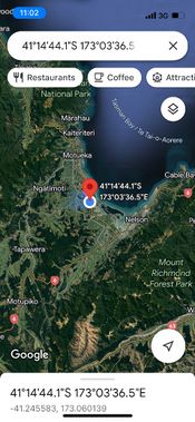
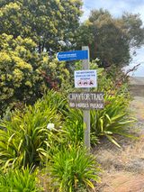
It appeared that the geohash was close to what appeared to be a walking track. And when we arrived, that did eventuate to be the case - Chayton Track, a shared walking/biking track going through a reserve. We would need to walk about 500 metres down this track and then we'd be about 20 metres from the hash. Brilliant! Oh, and the sign said to leave horses in the car.
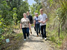
As we walked down the track my companions didn't necessarily share my enthusiasm, as they could see large patches of prickly gorse and blackberry, which I admitted didn't look inviting, but I had experienced far worse (raptors, etc).
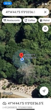
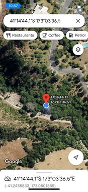
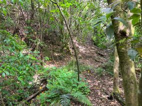
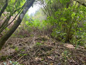
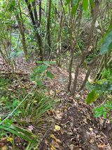
A few minutes later we reached the point that we had to plunge down the pretty steep bank and get to the other side of a dead pine tree that we had seen on google maps satellite view. At this point, two of the party refused to continue on the expedition, despite the fact that happily in the vicinity of the hash, it was devoid of prickly vegetation (or worse). Plus, don't they know you should never split the party?! (They all need to play more DnD).
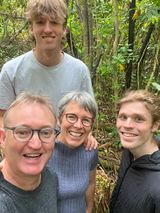
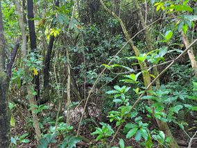
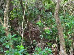
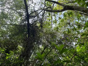
So scramble down the bank the remaining Fab Four did, and while the GPS went a bit crazy under the trees and in the small gorge, we found a spot which we felt confident was the ordained hashpoint. Success!
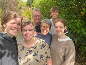
PS: Check out this geohash report here 2015-04-06 in the same graticule 8 years ago - the youngest family geohasher has grown somewhat
Tracklog
Photos
Achievements
Quaternary earned the Electric Vehicle Achievement
|
