Difference between revisions of "Greensboro, North Carolina"
From Geohashing
imported>Ncbears (Upcoming Easy as 3.14 159 hash) |
m (per Renaming Proposal) |
||
| (28 intermediate revisions by 11 users not shown) | |||
| Line 1: | Line 1: | ||
{{graticule | {{graticule | ||
| − | | | + | | lat= 36 |
| − | |nw = [[Blacksburg, Virginia | + | | lon= -79 |
| − | |n = [[Roanoke, Virginia | + | | nw = [[Blacksburg, Virginia]] |
| − | |ne = [[Appomattox, Virginia | + | | n = [[Roanoke, Virginia]] |
| − | |w = [[Winston-Salem, North Carolina|Winston-Salem, | + | | ne = [[Appomattox, Virginia]] |
| − | |e = [[Henderson, North Carolina|Henderson | + | | w = [[Winston-Salem, North Carolina|Winston-Salem]] |
| − | |sw = [[Charlotte, North Carolina|Charlotte | + | | name = [[Greensboro, North Carolina|Greensboro]] |
| − | |s = [[Chapel Hill, North Carolina|Chapel Hill | + | | e = [[Henderson, North Carolina|Henderson]] |
| − | |se = [[Raleigh, North Carolina|Raleigh | + | | sw = [[Charlotte, North Carolina|Charlotte]] |
| + | | s = [[Chapel Hill, North Carolina|Chapel Hill]] | ||
| + | | se = [[Raleigh, North Carolina|Raleigh]] | ||
}} | }} | ||
| − | + | == The N36, W79 Graticule == | |
| + | This [[graticule]] ({{Today's location|lat=36|lon=-79|text=36 -79}}) contains major cities along the I40/I85 and Hwy 58 corridors, with rolling hills in the southern section and mountains to the north. | ||
| − | |||
| − | |||
| − | + | ==Hashers== | |
| + | *[[User:Ncbears|NCBears]] | ||
| + | *[[User:Oracle989|Oracle989]] | ||
| + | *[[User:Sebejias|Sebejias]] | ||
| + | *[[User:LevinSerra|LevinSerra]] | ||
| + | *[[User:Dave Drowsy|Dave Drowsy]] | ||
| − | [[Category: North Carolina]] | + | ==Expeditions== |
| + | [[2013-09-01 36 -79|2013-09-01]] - [[User:Davedrowsy|Dave]] and his wife undertook their very first geohashing expedition today in this graticule! It was unsuccessful, but they had fun anyways. | ||
| + | |||
| + | [[2013-03-02 36 -79|2013-03-02]] - [[User:Birdray|Birdray]] - Just off a pathway in Oak Ridge Town Park. | ||
| + | |||
| + | {{egl|2010-11-15|global|text=2010-11-15}} - The Global Geohash point is in this graticule North West of Cascade Virgina. | ||
| + | |||
| + | [[2010-07-30 36 -79|2010-07-30]] - [[User:LevinSerra|LevinSerra]] and [[User:Sebejias|Sebejias]] - Birthday Hash attempt in Reidsville | ||
| + | |||
| + | [[2009-10-11 36 -79|2009-10-11]] - [[User:Oracle989|Oracle989]] - In a railroad right-of-way next to a low-traffic road. | ||
| + | |||
| + | Staturday meet up - [[Template:Pi|Pi Geohash]] [[2009-03-14 36 -79|2009 03 14]]. | ||
| + | |||
| + | ==Achievements== | ||
| + | {{Graticule unlocked|date=2009-03-14|latitude=36|longitude=-79|name=[[User:Ncbears|NCBears]]}} | ||
| + | |||
| + | <gallery widths="160px" align=center> | ||
| + | Image:3_14_Pi_Day_Pie_001.jpg|Who wants pie? | ||
| + | </gallery> | ||
| + | |||
| + | [[Category:North Carolina]] | ||
[[Category:Virginia]] | [[Category:Virginia]] | ||
| − | [[Category:Inactive | + | [[Category:Inactive graticules]] |
Latest revision as of 07:25, 20 March 2024
| Blacksburg, Virginia | Roanoke, Virginia | Appomattox, Virginia |
| Winston-Salem | Greensboro | Henderson |
| Charlotte | Chapel Hill | Raleigh |
|
Today's location: not yet announced | ||
The N36, W79 Graticule
This graticule (36 -79) contains major cities along the I40/I85 and Hwy 58 corridors, with rolling hills in the southern section and mountains to the north.
Hashers
Expeditions
2013-09-01 - Dave and his wife undertook their very first geohashing expedition today in this graticule! It was unsuccessful, but they had fun anyways.
2013-03-02 - Birdray - Just off a pathway in Oak Ridge Town Park.
2010-11-15 - The Global Geohash point is in this graticule North West of Cascade Virgina.
2010-07-30 - LevinSerra and Sebejias - Birthday Hash attempt in Reidsville
2009-10-11 - Oracle989 - In a railroad right-of-way next to a low-traffic road.
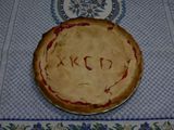
Staturday meet up - Pi Geohash 2009 03 14.
Achievements
NCBears earned the Graticule Unlocked Achievement
|
