Difference between revisions of "2008-06-01 37 -121"
From Geohashing
imported>Tapin (→Logistics) |
m (per Renaming Proposal) |
||
| (24 intermediate revisions by 12 users not shown) | |||
| Line 4: | Line 4: | ||
|lon=-121 | |lon=-121 | ||
|date=2008-06-1 | |date=2008-06-1 | ||
| + | |graticule_name=San Jose, California | ||
}} | }} | ||
== Planning details == | == Planning details == | ||
| − | '''Note:''' This was originally posted in the | + | '''Note:''' This was originally posted in the {{egl|2008-06-01|37|-122|text=SF graticule}} |
== Logistics == | == Logistics == | ||
| Line 17: | Line 18: | ||
*** The entire length of Spring Street is marked "No Stopping Any Time". I suggest parking in the dirt lot at Hedding and Walnut (about 100 feet down Hedding from the intersection of Hedding and Coleman) --[[User:Tapin|Tapin]] 18:04, 1 June 2008 (UTC) | *** The entire length of Spring Street is marked "No Stopping Any Time". I suggest parking in the dirt lot at Hedding and Walnut (about 100 feet down Hedding from the intersection of Hedding and Coleman) --[[User:Tapin|Tapin]] 18:04, 1 June 2008 (UTC) | ||
****Umm, I'm confused by these instructions. It doesn't look like Walnut intersects with Hedding at all, and it seems a bit out of the way. Maybe someone could provide a link to the spot you mean? --[[User:Mystitat|Mystitat]] | ****Umm, I'm confused by these instructions. It doesn't look like Walnut intersects with Hedding at all, and it seems a bit out of the way. Maybe someone could provide a link to the spot you mean? --[[User:Mystitat|Mystitat]] | ||
| − | *****Sorry, yes, Google Maps doesn't seem to list the road, but it's definitely there and marked. Walnut continues to the southeast of [http://maps.google.com/?ie=UTF8&ll=37.347119,-121.913969&spn=0.00229,0.004367&t=h&z=18 this] picture; the dirt lot I referenced is to the northwest of Hedding at that spot. --[[User:Tapin|Tapin]] 19: | + | *****Sorry, yes, Google Maps doesn't seem to list the road, but it's definitely there and marked. Walnut continues to the southeast of the very center of [http://maps.google.com/?ie=UTF8&ll=37.347119,-121.913969&spn=0.00229,0.004367&t=h&z=18 this] picture; the dirt lot I referenced is to the northwest of Hedding at that spot. You can see the points where the road is ''supposed'' to go in that map, but it's an old picture. --[[User:Tapin|Tapin]] 19:27, 1 June 2008 (UTC) |
* Now taking suggestions for local establishments at which to meet -- Google Earth suggests there's a Quizno's just past Hedding on the southwest side of Coleman? | * Now taking suggestions for local establishments at which to meet -- Google Earth suggests there's a Quizno's just past Hedding on the southwest side of Coleman? | ||
* [[User:Ted|I]] suggest that we meet at the actual spot as best we can (NOTE: do not cross the freeway illegally!) at 4:00pm, get a few pictures, discuss actual "sit down meet-up" locations and leave by 4:15. In addition, I will bring the makings of a small, make-shift marker for this most infamous of meetups, hopefully to be buried under layers of concrete and discovered eons hence by future archeologists... :) | * [[User:Ted|I]] suggest that we meet at the actual spot as best we can (NOTE: do not cross the freeway illegally!) at 4:00pm, get a few pictures, discuss actual "sit down meet-up" locations and leave by 4:15. In addition, I will bring the makings of a small, make-shift marker for this most infamous of meetups, hopefully to be buried under layers of concrete and discovered eons hence by future archeologists... :) | ||
| Line 29: | Line 30: | ||
*I'll be there... not sure how many kids I'll bring. Mmmmm. Pizza. [[User:FunkyTuba|FunkyTuba]] 06:54, 1 June 2008 (UTC) | *I'll be there... not sure how many kids I'll bring. Mmmmm. Pizza. [[User:FunkyTuba|FunkyTuba]] 06:54, 1 June 2008 (UTC) | ||
* [[User:Ted|Ted]] and Vicki will try to be there. | * [[User:Ted|Ted]] and Vicki will try to be there. | ||
| + | * I'll try to be there --[[User:Tapin|Tapin]] 19:47, 1 June 2008 (UTC) | ||
== Execution/aftermath == | == Execution/aftermath == | ||
| + | |||
| + | * [[User:Tapin|Joe]] scouted the spot at about 10am | ||
| + | * [[User:foobert|foobert]]: I had prior commitments at the designated time. But, on my way there, I drove the northbound on-ramp at 2:50PM. There were 2 hashers sitting against the barrier under the sign. I honked repeatedly, they jumped up and waived energetically. Even at 30 mph, I felt the bond. Blue Jetta wagon ring a bell for anyone? | ||
| + | * [[User:Ted|Ted]] Made it to the spot @4pm[-ish] with others. Vicki hung out on the other side of the "Absolutely no pedestrians, for any reason, ever; this means you" sign. | ||
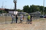
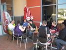
| + | * [[User:Mystitat|Mystitat]] Arrived to base camp at 4:00ish. Hung out on the safe side of the fence while contact was made, then enjoyed Quiznos deliciousness. | ||
| + | |||
| + | |||
| + | {{Graticule unlocked | name = [[User:Tapin|Tapin]], [[User:Ted|Ted]], [[User:FunkyTuba|FunkyTuba]], [[User:Zigdon|Zigdon]], and [[User:Relsqui|Relsqui]] | date = 2008-06-01 | latitude = 37 | longitude = -121}} | ||
| + | {{land geohash | name = [[User:Tapin|Tapin]], [[User:Ted|Ted]], [[User:FunkyTuba|FunkyTuba]], [[User:Zigdon|Zigdon]], and [[User:Relsqui|Relsqui]] | date = 2008-06-01 | latitude = 37 | longitude = -121 | image = 2008-06-01-a.JPG }} | ||
| + | {{Template:Geotrash | latitude=37 | longitude= -121 | date=2008-06-01 | name=Ted |image=Geotrashing.jpg }} | ||
| + | |||
| + | == Photographic Evidence == | ||
| + | <gallery widths="150px" heights="100px" perrow="3"> | ||
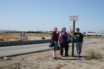
| + | Image:2008-06-01 37 -121-Tapin-1.JPG|[[User:Tapin|Joe]] made it at 10am | ||
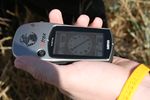
| + | Image:2008-06-01 37 -121-Tapin-2.JPG|...and here's the GPS proof | ||
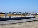
| + | Image:BaseCamp.jpg|A dirt field in the vicinity served as base of operations for the 4pm group. | ||
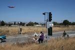
| + | Image:2008-06-01 37 -121-ClaireandPete.JPG|Claire and Pete got pretty close, but weren't allowed to risk life and limb to get to the exact point. | ||
| + | Image:Admonished.jpg|Nanny state warnings... | ||
| + | Image:Violated.jpg|...could not deter some of us. | ||
| + | Image:2008-06-01_37_-121-The_Island_From_Afar.JPG|The view of the site from an area outside of the "no pedestrian" zone, while geohashers braver than I mark out the exact spot. | ||
| + | Image:2008-06-01_37_-121-Bicycles.JPG|Bicyclists showed up in full force (for values of force == 2). | ||
| + | Image:2008-06-01-a.JPG|Gang of 4 that made it at 4pm[-ish]. Someone's got a GPS-shot... | ||
| + | Image:IMG_4579.JPG|Another angle of the four intrepid geohashers on the spot. | ||
| + | Image:TheProof.jpg|The proof on Zigdon's GPS. Well, that we reached '''a''' spot, anyway. | ||
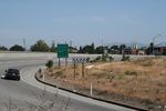
| + | Image:Theview.jpg|The view from the geohash itself back along the access route. | ||
| + | Image:Crowd.jpg|The cheering crowd. | ||
| + | Image:Geotrashing.jpg|Paying our debt to society. | ||
| + | Image:Retreat.jpg|Dodging traffic: land and air. | ||
| + | Image:2008-06-01 37 -121-Quiznohashing.JPG|Quiznohashing | ||
| + | Image:Relsquicaption.jpg|... | ||
| + | Image:TheWholeCrew.jpg|All of us at the closest eating place to the geohash... a Quizno's. | ||
| + | |||
| + | </gallery> | ||
| + | |||
| + | [[Category:Expeditions]] | ||
| + | [[Category:Expeditions with photos]] | ||
| + | [[Category:Coordinates reached]] | ||
| + | {{location|US|CA|SL}} | ||
Latest revision as of 07:42, 20 March 2024
| Sun 1 Jun 2008 in San Jose, California: 37.3491079, -121.9162389 geohashing.info google osm bing/os kml crox |
Contents
Planning details
Note: This was originally posted in the SF graticule
Logistics
- Google Maps link
- Nice, convenient location that just happens to be completely impractical: Highway 880 exit to Coleman Ave, in the dirt next to the off-ramp.
- Easy access by foot, suggest parking on nearby Spring Street.
- The entire length of Spring Street is marked "No Stopping Any Time". I suggest parking in the dirt lot at Hedding and Walnut (about 100 feet down Hedding from the intersection of Hedding and Coleman) --Tapin 18:04, 1 June 2008 (UTC)
- Umm, I'm confused by these instructions. It doesn't look like Walnut intersects with Hedding at all, and it seems a bit out of the way. Maybe someone could provide a link to the spot you mean? --Mystitat
- Sorry, yes, Google Maps doesn't seem to list the road, but it's definitely there and marked. Walnut continues to the southeast of the very center of this picture; the dirt lot I referenced is to the northwest of Hedding at that spot. You can see the points where the road is supposed to go in that map, but it's an old picture. --Tapin 19:27, 1 June 2008 (UTC)
- Umm, I'm confused by these instructions. It doesn't look like Walnut intersects with Hedding at all, and it seems a bit out of the way. Maybe someone could provide a link to the spot you mean? --Mystitat
- The entire length of Spring Street is marked "No Stopping Any Time". I suggest parking in the dirt lot at Hedding and Walnut (about 100 feet down Hedding from the intersection of Hedding and Coleman) --Tapin 18:04, 1 June 2008 (UTC)
- Easy access by foot, suggest parking on nearby Spring Street.
- Now taking suggestions for local establishments at which to meet -- Google Earth suggests there's a Quizno's just past Hedding on the southwest side of Coleman?
- I suggest that we meet at the actual spot as best we can (NOTE: do not cross the freeway illegally!) at 4:00pm, get a few pictures, discuss actual "sit down meet-up" locations and leave by 4:15. In addition, I will bring the makings of a small, make-shift marker for this most infamous of meetups, hopefully to be buried under layers of concrete and discovered eons hence by future archeologists... :)
- The actual spot is mildly difficult, not to mention marked "No pedestrians" (which I, uh, noticed on the way back). However, there's a huge empty dirt field directly east of the spot that's extremely easily accessible. --Tapin 18:04, 1 June 2008 (UTC)
Intended attendees
- I'll certainly be there. Zigdon 20:02, 30 May 2008 (UTC)
- I'll be there, possibly with one or two others. Closest places I can think of are a cheap sandwich shop and a Mexican restaurant at the corner of Elm and Emory, just a few blocks away, but I've never eaten there. There are also several good restaurants (Pasta Pomodoro, Roxie's New York Pizza, Tee Nee Thai), all located a short distance away on the Alameda at Race Street. Archchancellor 21:25, 31 May 2008 (UTC)
- I'll try my darndest to be there. Mystitat
- I'll be there... not sure how many kids I'll bring. Mmmmm. Pizza. FunkyTuba 06:54, 1 June 2008 (UTC)
- Ted and Vicki will try to be there.
- I'll try to be there --Tapin 19:47, 1 June 2008 (UTC)
Execution/aftermath
- Joe scouted the spot at about 10am
- foobert: I had prior commitments at the designated time. But, on my way there, I drove the northbound on-ramp at 2:50PM. There were 2 hashers sitting against the barrier under the sign. I honked repeatedly, they jumped up and waived energetically. Even at 30 mph, I felt the bond. Blue Jetta wagon ring a bell for anyone?
- Ted Made it to the spot @4pm[-ish] with others. Vicki hung out on the other side of the "Absolutely no pedestrians, for any reason, ever; this means you" sign.
- Mystitat Arrived to base camp at 4:00ish. Hung out on the safe side of the fence while contact was made, then enjoyed Quiznos deliciousness.
Tapin, Ted, FunkyTuba, Zigdon, and Relsqui earned the Graticule Unlocked Achievement
|
Tapin, Ted, FunkyTuba, Zigdon, and Relsqui earned the Land geohash achievement
|
Ted earned the GeoTrash Geohash Achievement
|
Photographic Evidence
Joe made it at 10am


