Difference between revisions of "2023-10-31 51 15"
m |
(11-in-a-row) |
||
| Line 50: | Line 50: | ||
{{minesweeper geohash|graticule=Cottbus, Germany|ranknumber=6|nw=true|n=true|w=true|e=true|sw=true|s=true|image=Cottbus.png|name=[[User:Fippe|Fippe]]}} | {{minesweeper geohash|graticule=Cottbus, Germany|ranknumber=6|nw=true|n=true|w=true|e=true|sw=true|s=true|image=Cottbus.png|name=[[User:Fippe|Fippe]]}} | ||
{{minesweeper geohash|graticule=Frankfurt (Oder), Germany|ranknumber=6|nw=true|n=true|w=true|sw=true|s=true|se=true|image=Frankfurt (Oder).png|name=[[User:Fippe|Fippe]]}} | {{minesweeper geohash|graticule=Frankfurt (Oder), Germany|ranknumber=6|nw=true|n=true|w=true|sw=true|s=true|se=true|image=Frankfurt (Oder).png|name=[[User:Fippe|Fippe]]}} | ||
| + | {{inarow|date=2023-10-31|latitude=51|longitude=15|level=11|name=[[User:Fippe|Fippe]]}} | ||
{{consecutive geohash 3|date=2023-08-31|latitude=52|longitude=7|daycount=62|hashcount=81|name=[[User:Fippe|Fippe]]}} | {{consecutive geohash 3|date=2023-08-31|latitude=52|longitude=7|daycount=62|hashcount=81|name=[[User:Fippe|Fippe]]}} | ||
Latest revision as of 20:27, 4 May 2024
| Tue 31 Oct 2023 in 51,15: 51.2182837, 15.0160547 geohashing.info google osm bing/os kml crox |
Location
This Geohash is located on a meadow in Görlitz.
Participants
Expedition
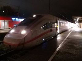
The first message that I saw on my phone on this day was the message "Zug fällt aus", which is not a great way to wake up. Luckily, while the train being cancelled, there was a replacement train for the same route. After getting ready for the day, I cycled to Osnabrück Central and took an IC train heading eastwards to Berlin. I was supposed to change onto a faster ICE train in Hannover which was heading in the same direction, but that train was over an hour late.
Instead, I stayed on the IC and continued my way towards Berlin. At the time, I thought that this meant I would miss my connection in Berlin and thus lose almost a whole hour waiting for the next one. But then I noticed something: At three stations in Berlin - Spandau, Central and East - my current train is scheduled to arrive just a minute or two after the connecting train is scheduled to leave. Should the connecting train be a minute or two late, I should be able to make the connection. I checked the layout of the platforms for the three stations and figured that my best chances would be at Spandau and Central since my trains would be on platforms directly next to each other, I wouldn't even have to carry my bike down the stairs and up again.
The connecting train was not late, though. However, to everybody's surprise, the IC arrived in Spandau two minutes earlier than scheduled. Hurrying accross the platform, I managed to make the connection and boarded the new train. A few minutes later, I noticed that Spandau had indeed been my only chance, as I did not see the IC arriving at Berlin's Central and East stations before my train left.
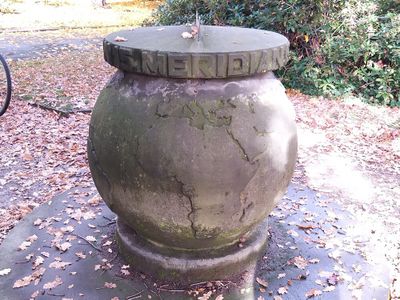
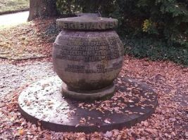
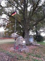
After making another connection in Cottbus, I finally arrived in Görlitz shortly after noon, and started cycling. I first saw a stone globe marking the 15th meridian. It makes note of the fact the Central European Time is based on this meridian, and lists countries using the CET: The states of central Europe, Hungary, Yugoslavia, Italy, Tunisia and Cameroon. A bit to the east, I crossed a bridge over the river Neiße marking the border between Görlitz, Germany and Zgorzelec, Poland. I crossed a different bridge bringing me back to Görlitz and continued cycling north towards the Geohash along a paths more or less parallel to the Neiße.
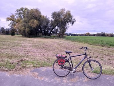
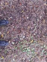
The coordinates were located on a recently mowed meadow in Ober-Neundorf, the northernmost borough of Görlitz. Both the coordinates and the Neiße were just a stone's throw away from the path, to the west and to the east respectively. I could easily reach the coordinates on the edge of the meadow near a group of trees.
After recording proof, I reflected on this expedition: It is the fourth expedition to this graticule, which contains the easternmost parts of Germany. It is overwhelmingly Polish by area, with tiny Czech and German slices on its edges. Despite that, this is already the second expedition to the German part, after Danatar's expedition last year. Since today's coordinates are slightly more east, this is Germany's easternmost expedition, for now.
The easternmost point of Germany is not far from the Geohash, so I cycled there next. A stone marks a position that is clearly not the easternmost spot, since there is a short path leading to the shore of the Neiße, in which the true easternmost point is located. I signed the guestbook, and now cycled westwards.
On a path in a forest running parallel to train tracks, I approached Horka, and reached the station there in time for my train via Cottbus to Berlin Central. Jan and I had dinner there, before I boarded a train that took me to Osnabrück Central. There, I decided to attempt another expedition, and boarded a train to Sutthausen on my way to 2023-10-31 52 8.
Photos
Tracklog
Ribbons
Fippe earned the Land geohash achievement
|
Fippe earned the XKCD-100 Honorable Mention Achievement
|
Fippe earned the Border geohash achievement
|
Fippe achieved level 3 of the Minesweeper Geohash achievement
|
Fippe achieved level 4 of the Minesweeper Geohash achievement
|
Fippe achieved level 6 of the Minesweeper Geohash achievement
|
Fippe achieved level 6 of the Minesweeper Geohash achievement
|
Fippe earned the 11-in-a-row achievement
|
Fippe earned the Consecutive geohash achievement
|
- Meetup on 2023-10-31
- Meetup in 51 15
- Expeditions with tracklogs
- Land geohash achievement
- Xkcd-100 geohash achievement
- Border geohash achievement
- Minesweeper geohash achievement
- N-in-a-row achievement
- Consecutive geohash achievement
- Expeditions
- Coordinates reached
- Expeditions with photos
- Meetup in Landkreis Görlitz
- Expeditions by Fippe
- Fippe's expeditions by bike
- Fippe's expeditions by train
