Difference between revisions of "2016-09-10 -37 146"
From Geohashing
imported>Benjw (no longer a new report) |
m (subst-ing) |
||
| (9 intermediate revisions by 4 users not shown) | |||
| Line 1: | Line 1: | ||
| − | |||
| − | |||
| − | |||
| − | |||
| − | |||
| − | |||
| − | |||
| − | |||
| − | |||
| − | |||
{{meetup graticule | {{meetup graticule | ||
| lat=-37 | | lat=-37 | ||
| Line 21: | Line 11: | ||
In bushland 5km north of Heyfield. | In bushland 5km north of Heyfield. | ||
== Participants == | == Participants == | ||
| − | Steve | + | *[[User:Stevage|Steve]] |
| + | *EB | ||
| + | *[[User:Thomasha|Tom]] | ||
| + | *Miriam | ||
| + | *[[User:Lachie|Lachie]] | ||
== Expedition == | == Expedition == | ||
| − | We | + | We were on a two-day softcore cycle tour along the Gippsland Plains Rail Trail. We'd vaguely intended to camp in the bush somewhere near Heyfield but didn't have a plan. When it came to that part of the day, I checked the geohash, and amazingly discovered that it was in a gettable location. I suggested to the others that we get the hash, and if it looked campable, we could even camp there. |
| − | + | ||
| + | Amazingly it all came together. It was pretty much the perfect spot: just far enough off the road to not be visible, but easy to access through the not very dense bush. I was even able to set up my tent basically right on the geohash itself. | ||
== Photos == | == Photos == | ||
| − | < | + | <gallery mode="packed" heights="300px"> |
| − | + | File:IMG_20160910_204017215.jpg | |
| − | + | File:IMG_20160911_090108203.jpg | |
| − | + | File:IMG_20160911_090100651.jpg | |
</gallery> | </gallery> | ||
== Achievements == | == Achievements == | ||
{{#vardefine:ribbonwidth|800px}} | {{#vardefine:ribbonwidth|800px}} | ||
| + | |||
| + | {{Camping geohash | ||
| + | |||
| + | | latitude = -37 | ||
| + | | longitude = 146 | ||
| + | | date = 2016-09-10 | ||
| + | | name = [[User:Stevage|Stevage]], [[User:Lachie|Lachie]], Tom, Miriam, Ellen | ||
| + | | arrival = a time late in the day | ||
| + | | departure = | ||
| + | | residence = tents | ||
| + | | distance = | ||
| + | | image = | ||
| + | |||
| + | }} | ||
| + | |||
| + | {{bicycle geohash | ||
| + | | latitude=-37 | ||
| + | | longitude=146 | ||
| + | | date=2016-09-10 | ||
| + | | name=Steve, Lachie, Tom, Miriam, Ellen | ||
| + | }} | ||
| + | |||
[[Category:Expeditions]] | [[Category:Expeditions]] | ||
[[Category:Coordinates reached]] | [[Category:Coordinates reached]] | ||
| + | {{location|AU|VIC|WE}} | ||
Latest revision as of 20:11, 24 May 2024
| Sat 10 Sep 2016 in -37,146: -37.9475927, 146.7841626 geohashing.info google osm bing/os kml crox |
Location
In bushland 5km north of Heyfield.
Participants
Expedition
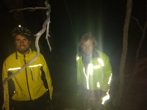
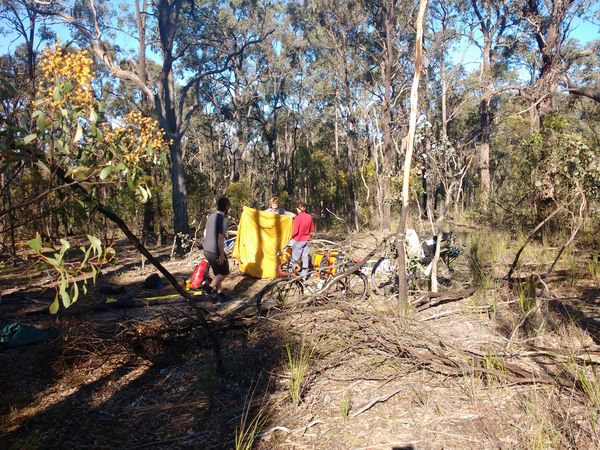
We were on a two-day softcore cycle tour along the Gippsland Plains Rail Trail. We'd vaguely intended to camp in the bush somewhere near Heyfield but didn't have a plan. When it came to that part of the day, I checked the geohash, and amazingly discovered that it was in a gettable location. I suggested to the others that we get the hash, and if it looked campable, we could even camp there.
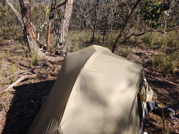
Amazingly it all came together. It was pretty much the perfect spot: just far enough off the road to not be visible, but easy to access through the not very dense bush. I was even able to set up my tent basically right on the geohash itself.
Photos
Achievements
Stevage, Lachie, Tom, Miriam, Ellen earned the Camping geohash achievement
|
Steve, Lachie, Tom, Miriam, Ellen earned the Bicycle geohash achievement
|


