Difference between revisions of "2023-02-06 41 -111"
From Geohashing
(substing template) |
m (Location) |
||
| (One intermediate revision by one other user not shown) | |||
| Line 1: | Line 1: | ||
| − | + | [[Image:2023-02-06 41 -111 Grin.jpg|thumb|left]] | |
| − | + | {{meetup graticule|date=2023-02-06|lat=41|lon=-111}} | |
| − | [[Image: | ||
| − | |||
| − | |||
| − | |||
| − | |||
| − | |||
| − | |||
== Location == | == Location == | ||
| − | + | Just off a road on the outskirts of Evanston, Wyoming | |
| − | |||
== Participants == | == Participants == | ||
| − | + | * [[User:Mckaysalisbury|McKay]] ([[User talk:Mckaysalisbury|talk]]) | |
| − | |||
== Plans == | == Plans == | ||
| − | + | Drive out there after work. Get some pictures. Have dinner with a friend. | |
== Expedition == | == Expedition == | ||
| − | + | The snow made things a little difficult, but it wasn't too far off the road, so I didn't have to trudge through too much snow. | |
| − | |||
| − | |||
| − | |||
== Photos == | == Photos == | ||
| − | |||
| − | |||
| − | |||
<gallery perrow="5"> | <gallery perrow="5"> | ||
| + | Image:2023-02-06 41 -111 Grin.jpg | Grin | ||
</gallery> | </gallery> | ||
== Achievements == | == Achievements == | ||
{{#vardefine:ribbonwidth|100%}} | {{#vardefine:ribbonwidth|100%}} | ||
| − | + | {{Reverse Regional | |
| + | | latitude = latitude 41 | ||
| + | | longitude = longitude -111 | ||
| + | | name = name of achiever [[User:Mckaysalisbury|McKay]] ([[User talk:Mckaysalisbury|talk]]) | ||
| + | | count = 2 | ||
| + | | graticule = Ogden, Utah | ||
| + | | level = state | ||
| + | | reached = 2 | ||
| + | }} | ||
__NOTOC__ | __NOTOC__ | ||
| − | |||
| − | |||
| − | |||
| − | |||
| − | |||
| − | |||
| − | |||
| − | |||
| − | |||
[[Category:Expeditions]] | [[Category:Expeditions]] | ||
| − | |||
[[Category:Expeditions with photos]] | [[Category:Expeditions with photos]] | ||
| − | |||
| − | |||
| − | |||
| − | |||
[[Category:Coordinates reached]] | [[Category:Coordinates reached]] | ||
| − | + | {{location|US|WY|UI}} | |
| − | |||
| − | |||
| − | |||
| − | |||
| − | |||
| − | |||
| − | |||
| − | |||
| − | |||
| − | |||
| − | |||
| − | |||
| − | |||
Revision as of 23:42, 18 August 2024

| Mon 6 Feb 2023 in 41,-111: 41.2133636, -111.0099733 geohashing.info google osm bing/os kml crox |
Location
Just off a road on the outskirts of Evanston, Wyoming
Participants
Plans
Drive out there after work. Get some pictures. Have dinner with a friend.
Expedition
The snow made things a little difficult, but it wasn't too far off the road, so I didn't have to trudge through too much snow.
Photos
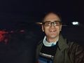
Grin
Achievements
name of achiever McKay (talk) earned the Reverse regional achievement
|