Difference between revisions of "My kingdom for a boat consolation prize"
imported>Frogman |
|||
| (15 intermediate revisions by 11 users not shown) | |||
| Line 1: | Line 1: | ||
| + | [[File:Boatless.PNG|right]] | ||
| + | [[:Template:My kingdom for a boat]] | ||
| + | {{My kingdom for a boat}} | ||
| + | |||
Take this ribbon because your quest for the hashpoint was ended on the shore of a body of water that you somehow failed to account for when planning the expedition. | Take this ribbon because your quest for the hashpoint was ended on the shore of a body of water that you somehow failed to account for when planning the expedition. | ||
| Line 8: | Line 12: | ||
*[[2008-06-24 53 9]] was not exactly reached by [[User:Hermann|Hermann]] and [[User:Felix|Felix]] because the geohash was in the middle of a swamp | *[[2008-06-24 53 9]] was not exactly reached by [[User:Hermann|Hermann]] and [[User:Felix|Felix]] because the geohash was in the middle of a swamp | ||
| − | *[[2008-07-16 47 -122]] While the Google | + | *[[2008-07-16 47 -122]] While the Google satellite photo showed ample beach, there was none. We must assume that the photo was taken at a very low tide and our visit was at high tide. The exact point was under about 15 feet of water and about 150 yards offshore - so [[User:Harlequin|Harlequin]] and [[User:HarlequinsDad|HarlquinsDad]] got as close as we could. |
*[[2008-07-24 47 -122]] Seattle again, where the map showed no major bodies of water between [[User:Thomcat|Thomcat]] and the hash point. Sloughs don't follow normal maps, apparently, and satellites can be blocked by trees. | *[[2008-07-24 47 -122]] Seattle again, where the map showed no major bodies of water between [[User:Thomcat|Thomcat]] and the hash point. Sloughs don't follow normal maps, apparently, and satellites can be blocked by trees. | ||
| + | *[[2009-08-25 47 -65]] In Bathurst, New Brunswick, [[User:wmcduff|wmcduff]] was thwarted by beavers. No, seriously. He was. | ||
| + | |||
| + | * [[2009-10-24 50 -1]] Hythe, Hampshire, UK. [[User:Sermoa|Sermoa]] might have reached the geohash point if the tide of Southampton Water was out. But it wasn't. And she had no boat. | ||
| + | |||
| + | *[[2013-03-13 52 21]] [[User:Ziemek|Ziemek]], [[User:Ziemba|Ziemba]] and [[User:Norill|Norill]] discovered that river islets MOVE. | ||
| − | + | *[[2014-04-19 45 -122]] [[User:Michael5000|Michael5000]] and [[User:Jiml|Jim]] each find that a lake has been swollen by spring rains. | |
| − | [[ | ||
| − | [[ | + | *[[2019-07-04 43 -79]] [[User:Frogman|Frogman]] had expected to get a little wet on this expedition, but not to swim across a flooding body of water. |
Latest revision as of 13:11, 4 July 2019
Template:My kingdom for a boat
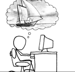
This user earned the My kingdom for a boat consolation prize
|
Take this ribbon because your quest for the hashpoint was ended on the shore of a body of water that you somehow failed to account for when planning the expedition.
This is not to console you for the fact that a given day's point falls in inaccessible water. If you can see it's in water, or unreachable because of water before you start, then that's just the way geohashing works, even if you went to the shore to look longingly at it. Take this ribbon if the point appeared to be on land, yet turned out to be in a seasonal lake, or in terrain that was flooded by a dam built since Google's survey was done. Also take it if the point itself was on land, but the road was flooded, or your path met an unfordable river, an uncircumnavigable ditch or other body of water that wasn't in the satellite view, or looked like a field or road. If the progress-impeding body of water is an unexpected swamp, then the There Might be Alligators! ribbon is in order.
Before you give up and take this ribbon, consider the MacGyver Achievement. Can you build a bridge, raft or nuclear submarine out of garbage lying around the shore? Even if you fail in that endeavour, you can pack out the collected garbage and take the Geotrash Geohash achievement.
Winners
- 2008-06-24 53 9 was not exactly reached by Hermann and Felix because the geohash was in the middle of a swamp
- 2008-07-16 47 -122 While the Google satellite photo showed ample beach, there was none. We must assume that the photo was taken at a very low tide and our visit was at high tide. The exact point was under about 15 feet of water and about 150 yards offshore - so Harlequin and HarlquinsDad got as close as we could.
- 2008-07-24 47 -122 Seattle again, where the map showed no major bodies of water between Thomcat and the hash point. Sloughs don't follow normal maps, apparently, and satellites can be blocked by trees.
- 2009-08-25 47 -65 In Bathurst, New Brunswick, wmcduff was thwarted by beavers. No, seriously. He was.
- 2009-10-24 50 -1 Hythe, Hampshire, UK. Sermoa might have reached the geohash point if the tide of Southampton Water was out. But it wasn't. And she had no boat.
- 2013-03-13 52 21 Ziemek, Ziemba and Norill discovered that river islets MOVE.
- 2014-04-19 45 -122 Michael5000 and Jim each find that a lake has been swollen by spring rains.
- 2019-07-04 43 -79 Frogman had expected to get a little wet on this expedition, but not to swim across a flooding body of water.
