Difference between revisions of "2008-07-26 52 13"
imported>Relet (+cache id) |
imported>ReletBot m (Automatically appending gallery for one of relet's expeditions.) |
||
| Line 27: | Line 27: | ||
[[Category:Expeditions with photos]] | [[Category:Expeditions with photos]] | ||
[[Category:Coordinates reached]] | [[Category:Coordinates reached]] | ||
| + | |||
| + | == Gallery == | ||
| + | <gallery widths="160px" align=center> | ||
| + | Image:200807265213-P1010749.JPG|Train station | ||
| + | Image:200807265213-P1010726.JPG|Train station exit. | ||
| + | Image:200807265213-P1010728.JPG|Memorial | ||
| + | Image:200807265213-P1010729.JPG.html?g2_imageViewsIndex=2|Close-up of the inscription | ||
| + | Image:200807265213-P1010730.JPG|Umweltforschung Großbeeren GmbH - the landowner | ||
| + | Image:200807265213-P1010735.JPG|lyx leading the way. | ||
| + | Image:200807265213-P1010736.JPG|next best place to be | ||
| + | Image:200807265213-P1010745.JPG|relet | ||
| + | Image:200807265213-P1010748.JPG|a totally unrelated no trespassing sign - just for the collection | ||
| + | </gallery> | ||
Revision as of 01:28, 1 July 2009

| Sat 26 Jul 2008 in 52,13: 52.3492491, 13.3190500 geohashing.info google osm bing/os kml crox |
Todays meetup was on an experimental farm near Großbeeren. Lyx and relet reached the spot quite late, as their train only arrived at 4pm at Großbeeren station. We saw no sign of other geohashing species.
We walked the distance from Großbeeren station to the hash, admiring the nearby wakeboarding facility and the village of Großbeeren. They've got a quite impressive (Sixth Coalition) war memorial in the center. We came within eyesight of the hash using a service path next to the actual lot. The lot is owned by an environment research company and features several small experimental fields with different crops and vegetables - and huge swarms of birds. All participants declared that to be close enough[tm] as we weren't planning to trample the fields anyway.
We placed the second geohashcache at the very location we've reached. GC1EJCT - Geohashflashcashe #2
- Train station
- Train station exit.
- Memorial
- Close-up of the inscription
- Umweltforschung Großbeeren GmbH - the landowner
- lyx leading the way.
- next best place to be
- relet
- a totally unrelated no trespassing sign - just for the collection
Gallery
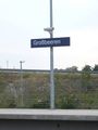
Train station

Train station exit.
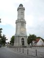
Memorial
- 200807265213-P1010729.JPG.html?g2 imageViewsIndex=2
Close-up of the inscription
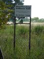
Umweltforschung Großbeeren GmbH - the landowner
lyx leading the way.
next best place to be

relet
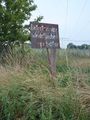
a totally unrelated no trespassing sign - just for the collection


