Difference between revisions of "2009-02-27"
From Geohashing
imported>Ncbears (New page: <noinclude>{{date navigation}}</noinclude> {{auto coordinates|2009-02-27}} {{auto gallery|2009-02-27}}) |
imported>ReletBot m (moving from Template:auto gallery to Template:auto gallery2) |
||
| (One intermediate revision by one other user not shown) | |||
| Line 1: | Line 1: | ||
<noinclude>{{date navigation}}</noinclude> | <noinclude>{{date navigation}}</noinclude> | ||
{{auto coordinates|2009-02-27}} | {{auto coordinates|2009-02-27}} | ||
| − | {{auto | + | {{auto gallery2|2009-02-27}} |
| + | <noinclude>{{expedition summaries|2009-02-27}}</noinclude> | ||
Latest revision as of 22:26, 23 August 2010
Expedition Archives from February 2009
Thursday 26 February 2009 | Friday 27 February 2009 | Saturday 28 February 2009
See also: Category:Meetup on 2009-02-27
Coordinates
West of -30°: .9365708, .9058680
East of -30°: .9907551, .2606795
Globalhash:
88.335916688504,-86.155363377810
Photo Gallery
Expeditions and Plans
| 2009-02-27 | ||
|---|---|---|
| Lake Charles, Louisiana | Robyn | I leave town walking, with a brief detour for a lunch stop. I'm walking alo... |
| Nogales, Arizona | KarMann | In a residential neighborhood just a bit off of Sahuarita Rd, and right on ... |
| Athens, Georgia | NWoodruff | Somewhere |
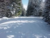
| Mt. Rainier, Washington | New User | It appeared to be just off the road, just inside the boundaries of Mount Ra... |
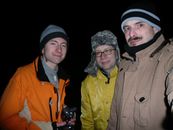
| Landshut, Germany | dawidi, Tomcat, Hans | In a meadow, about 5km east of Neutraubling. |

