Difference between revisions of "2009-03-11 52 7"
imported>Arvid (imagesincluded) |
imported>FippeBot m (Location) |
||
| (3 intermediate revisions by 3 users not shown) | |||
| Line 20: | Line 20: | ||
[http://maps.google.com/maps?f=q&hl=en&geocode=&q=http:%2F%2Farvid.org%2Ftracks%2Fgeohash20090311.kmz Arvid's tracklog] by bicycle. | [http://maps.google.com/maps?f=q&hl=en&geocode=&q=http:%2F%2Farvid.org%2Ftracks%2Fgeohash20090311.kmz Arvid's tracklog] by bicycle. | ||
| + | Arvid | ||
| − | + | I left home just after 13:00, and arrived near the hash nicely at 14:00. Tnx backwind! I walked into the field, and walked to the hashpoint. Germany loves me, or at least it was trying to stick to me. I saw quite some hares around the hash. The first picture has two of them in them! I couldn't really see that unless I looked at the original 10MP photo, where there are 2 stains that must be them. I'm not really good at photographing wildlife. | |
| + | |||
| + | I put XKCD on the unpaved road next to the hash where the field was, so relet could see I had been there. At 14:30 I took the interesting way home. | ||
| + | |||
| + | There was a road that didnt cross the highway, and the roads were not so good there. Later I was at a railwaycrossing that stated that the road was a dead end. I have found out that sometimes, this just means you end up at a private property, where there are more roads coming together. When at the farm there were some kids playing outside, and a woman asked if she could help me. I saw the track my GPS told me was the one, and pointed that I wanted to go that way. She told me that that track ended in a field. I didn't believe it, but since both roads were probably private property anyway, I returned. The railwaycrossing however, was now closed. It was only 1 track. After a couple of minutes there was a train. After some more minutes(total waiting time 8mins), my patience ended. It wasn't very easy to get past these closed barriers(took 3 minutes). I wondered how they were operated, and found cables that led to a house a bit further. | ||
| + | |||
| + | Well, I got past it, and continued my way. A couple of km longer way. In the end I got to the road where I should have gotten if the road from that farm. There was something of a track, but it was completely overgrown, and I could see some more barriers. Maybe the woman was right. Anyway, I continued my journey and arrived home at 16:30. | ||
{{quote|left|Oh German clay, why do you stick to me this way|Arvid}} | {{quote|left|Oh German clay, why do you stick to me this way|Arvid}} | ||
<gallery> | <gallery> | ||
| − | Image:2009-03-11 52 7-RES02619.JPG|Where I came from. | + | Image:2009-03-11 52 7-RES02619.JPG|Where I came from. Spot the hares! |
| − | Image:2009-03-11 52 7-RES02624.JPG| | + | Image:2009-03-11 52 7-RES03618.JPG|Time of arrival. |
| + | Image:2009-03-11 52 7-RES02624.JPG|Where I came from and bike. | ||
Image:2009-03-11 52 7-RES02625.JPG|Where the hash is. | Image:2009-03-11 52 7-RES02625.JPG|Where the hash is. | ||
Image:2009-03-11 52 7-RES02626.JPG|Success. | Image:2009-03-11 52 7-RES02626.JPG|Success. | ||
| + | Image:2009-03-11 52 7-RES03627.JPG|Happy hasher. | ||
Image:2009-03-11 52 7-RES02628.JPG|Clay. | Image:2009-03-11 52 7-RES02628.JPG|Clay. | ||
Image:2009-03-11 52 7-RES02629.JPG|There is a shoe underneath it. Really! | Image:2009-03-11 52 7-RES02629.JPG|There is a shoe underneath it. Really! | ||
| Line 38: | Line 47: | ||
Image:2009-03-11 52 7-RES02637.JPG|Tag for relet. | Image:2009-03-11 52 7-RES02637.JPG|Tag for relet. | ||
Image:2009-03-11 52 7-RES02638.JPG|Tag in overview. | Image:2009-03-11 52 7-RES02638.JPG|Tag in overview. | ||
| + | Image:2009-03-11 52 7-RES02640.JPG|Closed barrier. | ||
| + | Image:2009-03-11 52 7-RES02641.JPG|Operated by cables. | ||
| + | Image:2009-03-11 52 7-RES02642.JPG|Coming from a barn a bit further. | ||
</gallery> | </gallery> | ||
| + | |||
| + | == [[User:relet|relet]] == | ||
| + | |||
| + | relet failed. Well, failed to reach the hash in time to meet up. By the time he had crossed Belgium and the Netherlands, it was half past three in the afternoon. Sorry arvid! I missed his tag, too, because I took the road north of the hash, which was a dead-end but led closer to the hash on dry (non-clayful) feet. | ||
| + | |||
| + | *[http://relet.net/g2/d/14720-1/Screenshot-3.png Layout of the place] | ||
| + | *[http://relet.net/g2/d/14659-2/p1030516.jpg Wind turbines! - The view from the field in front of the hash] | ||
| + | *[http://relet.net/g2/d/14664-2/p1030517.jpg The hashfield from the north.] Would I be able to get any closer? | ||
| + | *[http://relet.net/g2/d/14669-3/p1030518.jpg Yes! The neigbouring field had an unplanted border]. I then jumped a ditch and crossed a hedge to stand on the field itself. | ||
| + | *[http://relet.net/g2/d/14722-1/Screenshot-4.png Hashpoint reached] by the common sense critierion (I do not trample on any planted fields). | ||
| + | *[http://relet.net/g2/d/14674-5/p1030520.jpg Stupid facepalm for being so late] | ||
| + | *[http://relet.net/g2/d/14679-2/p1030521.jpg Left a card] | ||
| + | *[http://relet.net/g2/d/14689-5/p1030523.jpg I believed these to have been arvids tracks.] They were not, apparently. | ||
| + | *[http://relet.net/g2/d/14694-5/p1030524.jpg The road north of the hash] | ||
| + | |||
| + | Still, thats a successful four country multihash for me. Now I had just to drive another five hours back home. :} | ||
| + | |||
| + | [[2009-03-11 52 6|The previous part of my expedition]] | ||
| + | [[2009-03-11 50 4|The first part of my expedition]] | ||
| + | |||
[[Category:Expeditions]] | [[Category:Expeditions]] | ||
[[Category:Expeditions with photos]] | [[Category:Expeditions with photos]] | ||
[[Category:Coordinates reached]] | [[Category:Coordinates reached]] | ||
| + | |||
| + | == Gallery == | ||
| + | <gallery widths="160px" align=center> | ||
| + | Image:20090311527Screenshot-3.png|Layout of the place | ||
| + | Image:20090311527p1030516.jpg|Wind turbines! - The view from the field in front of the hash | ||
| + | Image:20090311527p1030517.jpg|The hashfield from the north. | ||
| + | Image:20090311527p1030518.jpg|Yes! The neigbouring field had an unplanted border | ||
| + | Image:20090311527Screenshot-4.png|Hashpoint reached | ||
| + | Image:20090311527p1030520.jpg|Stupid facepalm for being so late | ||
| + | Image:20090311527p1030521.jpg|Left a card | ||
| + | Image:20090311527p1030523.jpg|I believed these to have been arvids tracks. | ||
| + | Image:20090311527p1030524.jpg|The road north of the hash | ||
| + | </gallery> | ||
| + | {{location|DE|NW|BOR}} | ||
Latest revision as of 02:16, 8 August 2019
| Wed 11 Mar 2009 in 52,7: 52.0756037, 7.1407393 geohashing.info google osm bing/os kml crox |
Contents
Plan
relet asked whether Arvid had any plans today. Relet would be driving back from Brussels to Berlin, and Enschede is sort-of on the way. Arvid had a day off, so he could go. Arvid suggested 52 7. Relet suggested 2pm.
For Arvid it would be about an hour of cycling to the hash, which meant he had to leave at 1pm.
Achievements
Expedition
Arvid's tracklog by bicycle. Arvid
I left home just after 13:00, and arrived near the hash nicely at 14:00. Tnx backwind! I walked into the field, and walked to the hashpoint. Germany loves me, or at least it was trying to stick to me. I saw quite some hares around the hash. The first picture has two of them in them! I couldn't really see that unless I looked at the original 10MP photo, where there are 2 stains that must be them. I'm not really good at photographing wildlife.
I put XKCD on the unpaved road next to the hash where the field was, so relet could see I had been there. At 14:30 I took the interesting way home.
There was a road that didnt cross the highway, and the roads were not so good there. Later I was at a railwaycrossing that stated that the road was a dead end. I have found out that sometimes, this just means you end up at a private property, where there are more roads coming together. When at the farm there were some kids playing outside, and a woman asked if she could help me. I saw the track my GPS told me was the one, and pointed that I wanted to go that way. She told me that that track ended in a field. I didn't believe it, but since both roads were probably private property anyway, I returned. The railwaycrossing however, was now closed. It was only 1 track. After a couple of minutes there was a train. After some more minutes(total waiting time 8mins), my patience ended. It wasn't very easy to get past these closed barriers(took 3 minutes). I wondered how they were operated, and found cables that led to a house a bit further.
Well, I got past it, and continued my way. A couple of km longer way. In the end I got to the road where I should have gotten if the road from that farm. There was something of a track, but it was completely overgrown, and I could see some more barriers. Maybe the woman was right. Anyway, I continued my journey and arrived home at 16:30.
| “ | Oh German clay, why do you stick to me this way
|
” |
—Arvid
| ||
relet
relet failed. Well, failed to reach the hash in time to meet up. By the time he had crossed Belgium and the Netherlands, it was half past three in the afternoon. Sorry arvid! I missed his tag, too, because I took the road north of the hash, which was a dead-end but led closer to the hash on dry (non-clayful) feet.
- Layout of the place
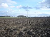
- Wind turbines! - The view from the field in front of the hash
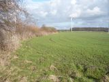
- The hashfield from the north. Would I be able to get any closer?
- Yes! The neigbouring field had an unplanted border. I then jumped a ditch and crossed a hedge to stand on the field itself.
- Hashpoint reached by the common sense critierion (I do not trample on any planted fields).
- Stupid facepalm for being so late
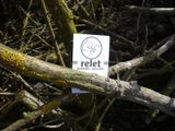
- Left a card
- I believed these to have been arvids tracks. They were not, apparently.
- The road north of the hash
Still, thats a successful four country multihash for me. Now I had just to drive another five hours back home. :}
The previous part of my expedition The first part of my expedition


