Difference between revisions of "2010-04-18 50 11"
imported>Reinhard (Created page with '{{subst:Expedition |lat = 50 |lon = 11 |date = 2010-04-18 }}') |
imported>FippeBot m (Location) |
||
| (9 intermediate revisions by 2 users not shown) | |||
| Line 1: | Line 1: | ||
| − | |||
<!-- If you did not specify these parameters in the template, please substitute appropriate things for IMAGE, LAT, LON, and DATE (YYYY-MM-DD format) | <!-- If you did not specify these parameters in the template, please substitute appropriate things for IMAGE, LAT, LON, and DATE (YYYY-MM-DD format) | ||
| Line 15: | Line 14: | ||
__NOTOC__ | __NOTOC__ | ||
== Location == | == Location == | ||
| − | + | On the road between Magdala and Niedersynderstedt, close to Autobahn A4 exit Magdala. | |
== Participants == | == Participants == | ||
| − | + | * [[User:Paintedhell|Juja]] | |
| + | * [[User:Manu|Manu]] | ||
| + | * [[User:Reinhard|Reinhard]] | ||
| − | == | + | == Expeditions: [[User:Paintedhell|Juja]] == |
| − | + | I was going to Weimar together with J., so I thought it would be nice to drop by at the hash on our way there, as it wasn't too much of a detour. We went there by car, but actually parked near the hash and walked the last few meters. I took the usual photos, and then I even marked the spot, but now my camera battery (which was ''almost'' flat since January) was really flat and I couldn't take the photo for proof. Since Manu and Reinhard only raced past the hash, they didn't see it either... well. Pity! | |
| − | == | + | == Expeditions: [[User:Manu|Manu]] and [[User:Reinhard|Reinhard]] == |
| − | + | ... were driving back to Jena after the weekend and could do a 4 km detour to reach this hashpoint. Instead of taking exit Mellingen they took the next exit Magdala and turned right towards Niedersynderstedt and drove over the hashpoint. In Niedersynderstedt they turned and drove back to Magdala, driving over the spot a 2nd time. While Manu was doing a perfect job driving at the speed limit of 100 km/h, Reinhard was failing completely (twice!) taking a photo of his GPS device while driving over the hashpoint. He at least recorded a track which proves that they reached the coordinates. It might also prove the speed racer, but since Manu and Reinhard already earned a [[speed_racer_achievement|speed racer achievement]] before, there's no need to care for it again. Besides Manu driving and Reinhard taking blurry pictures, there were also NanoLE (beneath the windscreen), Frucho, Fracho, Roosevelt, Schnauzi and the little Foxi aboard. | |
== Tracklog == | == Tracklog == | ||
| − | + | [http://www.everytrail.com/view_trip.php?trip_id=580562 The one of Manu and Reinhard can be found here.] | |
== Photos == | == Photos == | ||
| − | + | {{gallery|width=200|height=200|lines=3 | |
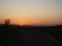
| − | Image: | + | |Image:100418_50_11_1.jpg|Sunset on J&J's way to the hash. |
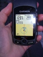
| − | -- | + | |Image:100418_50_11_2.jpg|Proof of coordinates. |
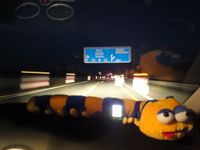
| − | + | |Image:20100418-50N11E-01.jpg|You may guess it says exit to Magdala and Blankenhain. NanoLE enjoys the drive. | |
| − | + | |Image:20100418-50N11E-02.jpg|Somewhere close to the hashpoint. | |
| − | + | }} | |
| − | |||
| − | |||
| − | |||
| − | |||
| − | |||
| − | |||
| − | |||
| − | |||
| − | |||
| − | |||
[[Category:Expeditions]] | [[Category:Expeditions]] | ||
| − | |||
[[Category:Expeditions with photos]] | [[Category:Expeditions with photos]] | ||
| − | |||
| − | |||
| − | |||
| − | |||
[[Category:Coordinates reached]] | [[Category:Coordinates reached]] | ||
| − | + | {{location|DE|TH|AP}} | |
| − | |||
| − | |||
| − | |||
| − | |||
| − | |||
| − | |||
| − | |||
| − | |||
| − | |||
Latest revision as of 01:39, 9 August 2019
| Sun 18 Apr 2010 in 50,11: 50.8919619, 11.4373027 geohashing.info google osm bing/os kml crox |
Location
On the road between Magdala and Niedersynderstedt, close to Autobahn A4 exit Magdala.
Participants
Expeditions: Juja
I was going to Weimar together with J., so I thought it would be nice to drop by at the hash on our way there, as it wasn't too much of a detour. We went there by car, but actually parked near the hash and walked the last few meters. I took the usual photos, and then I even marked the spot, but now my camera battery (which was almost flat since January) was really flat and I couldn't take the photo for proof. Since Manu and Reinhard only raced past the hash, they didn't see it either... well. Pity!
Expeditions: Manu and Reinhard
... were driving back to Jena after the weekend and could do a 4 km detour to reach this hashpoint. Instead of taking exit Mellingen they took the next exit Magdala and turned right towards Niedersynderstedt and drove over the hashpoint. In Niedersynderstedt they turned and drove back to Magdala, driving over the spot a 2nd time. While Manu was doing a perfect job driving at the speed limit of 100 km/h, Reinhard was failing completely (twice!) taking a photo of his GPS device while driving over the hashpoint. He at least recorded a track which proves that they reached the coordinates. It might also prove the speed racer, but since Manu and Reinhard already earned a speed racer achievement before, there's no need to care for it again. Besides Manu driving and Reinhard taking blurry pictures, there were also NanoLE (beneath the windscreen), Frucho, Fracho, Roosevelt, Schnauzi and the little Foxi aboard.
Tracklog
The one of Manu and Reinhard can be found here.
Photos
|


