Difference between revisions of "2008-05-24 40 -111"
From Geohashing
imported>Mckaysalisbury (approach) |
m (per Renaming Proposal) |
||
| (17 intermediate revisions by 7 users not shown) | |||
| Line 1: | Line 1: | ||
| − | + | {{meetup graticule | |
| + | | map=<map lat="40" lon="-111" date="2008-05-24" /> | ||
| + | | lat=40 | ||
| + | | lon=-111 | ||
| + | | date=2008-05-24 | ||
| + | }} | ||
| − | This days point of interest | + | == info == |
| − | + | This days point of interest for the [[Salt Lake City, Utah|SLC]] [[graticule]] is | |
| − | Interesting, there's a parking lot just north of the interest point, as well as some trails that head around the base of the mountain. | + | {{egl|2008-05-24|40|-112|text=40.126648°, -111.547534°}} |
| + | |||
| + | 1725 ft off the highway, and 900 feet up | ||
| + | |||
| + | Interesting, there's a parking lot just north of the interest point, as well as some trails that head around the base of the mountain. [http://maps.google.com/maps/mm?ie=UTF8&hl=en&ll=40.128819,-111.548717&spn=0.009811,0.0156&t=h&z=16] | ||
I'll be there. I'll probably parking at the little lot, and I'm not sure how I'll approach yet. [[User:Mckaysalisbury|McKay]] 17:12, 23 May 2008 (UTC) | I'll be there. I'll probably parking at the little lot, and I'm not sure how I'll approach yet. [[User:Mckaysalisbury|McKay]] 17:12, 23 May 2008 (UTC) | ||
| + | |||
| + | == backyard == | ||
| + | |||
| + | So, I can see the point from my backyard. Way cool! [[User:Mckaysalisbury|McKay]] 15:55, 24 May 2008 (UTC) | ||
| + | |||
| + | [[Image:2008-05-24 40 -111 Porch.jpg|left|300px]] | ||
| + | [[Image:2008-05-24 40 -111 Zoom.jpg|left|300px]] | ||
| + | |||
| + | == Attempts == | ||
| + | |||
| + | === Success === | ||
| + | I made it! [[User:Mckaysalisbury|McKay]] 15:28, 27 May 2008 (UTC) | ||
| + | |||
| + | |||
| + | {{Graticule unlocked | latitude = 40 | longitude = -111 | date = 2008-05-24 | name = [[User:Mckaysalisbury|McKay]] }} | ||
| + | {{one with nature | latitude = 40 | longitude = -111 | date = 2008-05-24 |name = [[User:Mckaysalisbury|McKay]] }} | ||
| + | {{Geohashing Day | latitude = 40 | longitude = -111 | year = 2008 | coorddate = 2008-05-24 | mouseover = true | name = [[User:mckaysalisbury|McKay]]}} | ||
| + | |||
| + | [[Image:2008-05-24 40 -111 Grin.JPG|right|300px]] | ||
| + | [[Image:2008-05-24 40 -111 Location.JPG|right|300px]] | ||
| + | [[Image:2008-05-24 40 -111 and time.JPG|right|300px]] | ||
| + | [[Image:2008-05-24 40 -111 Looking Home.JPG|right|300px]] | ||
| + | [[Image:2008-05-24 40 -111 Tolerance.JPG|right|300px]] | ||
| + | |||
| + | |||
| + | [[Category:Expeditions]] | ||
| + | [[Category:Expeditions with photos]] | ||
| + | [[Category:Coordinates reached]] | ||
| + | {{location|US|UT|UT}} | ||
Latest revision as of 14:48, 2 April 2024
| Sat 24 May 2008 in 40,-111: 40.1266480, -111.5475331 geohashing.info google osm bing/os kml crox |
Contents
info
This days point of interest for the SLC graticule is
1725 ft off the highway, and 900 feet up
Interesting, there's a parking lot just north of the interest point, as well as some trails that head around the base of the mountain. [1]
I'll be there. I'll probably parking at the little lot, and I'm not sure how I'll approach yet. McKay 17:12, 23 May 2008 (UTC)
backyard
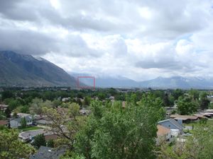
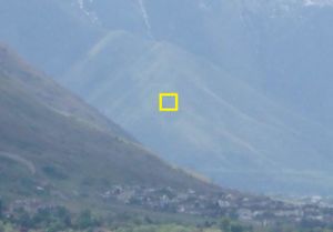
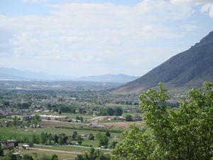
So, I can see the point from my backyard. Way cool! McKay 15:55, 24 May 2008 (UTC)
Attempts
Success
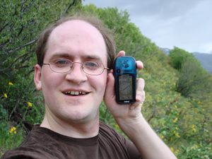
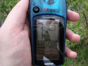
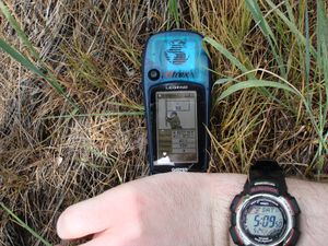
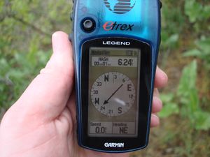
I made it! McKay 15:28, 27 May 2008 (UTC)
McKay earned the Graticule Unlocked Achievement
|
McKay earned the One with Nature Geohash Achievement
|
McKay earned the 2008 Mouse Over Day achievement
|
