Difference between revisions of "2010-09-09 60 22"
imported>Jusu |
imported>FippeBot m (Location) |
||
| (12 intermediate revisions by one other user not shown) | |||
| Line 12: | Line 12: | ||
| lon=22 | | lon=22 | ||
| date=2010-09-09 | | date=2010-09-09 | ||
| + | | graticule_name=Turku, Finland | ||
| + | | graticule_link=Turku, Finland | ||
}} | }} | ||
| Line 19: | Line 21: | ||
<strike>[http://kansalaisen.karttapaikka.fi/kartanhaku/koordinaattihaku.html?y=60.1941066&x=22.8828243&srsName=EPSG%3A4258&e=270356&n=6664781&scale=8000&tool=siirra&styles=normal&lang=en Map]. The location seems to be on a forest path near Strömma channel. Jusu thinks he's been there before. [http://www.salo.fi/attachements/2010-06-02T12-21-40136.pdf Salo-Teijo-Strömma cycling route] goes through the hashpoint.</strike> | <strike>[http://kansalaisen.karttapaikka.fi/kartanhaku/koordinaattihaku.html?y=60.1941066&x=22.8828243&srsName=EPSG%3A4258&e=270356&n=6664781&scale=8000&tool=siirra&styles=normal&lang=en Map]. The location seems to be on a forest path near Strömma channel. Jusu thinks he's been there before. [http://www.salo.fi/attachements/2010-06-02T12-21-40136.pdf Salo-Teijo-Strömma cycling route] goes through the hashpoint.</strike> | ||
| − | What the heck | + | What the heck. I looked Thursday's coordinates on Wednesday (2010-09-08). They were 60.1941066 22.8828243. By Thursday (2010-09-09) they had changed to 60.1353974, 22.9979195. I obviously have something to learn here. |
Nevertheless, now the hashpoint is even easier to reach. It is on a road called Särkisalontie. | Nevertheless, now the hashpoint is even easier to reach. It is on a road called Särkisalontie. | ||
[http://kansalaisen.karttapaikka.fi/kartanhaku/koordinaattihaku.html?y=60.1353974&x=22.9979195&srsName=EPSG%3A4258&e=277777&n=6673225&scale=8000&tool=siirra&styles=normal&lang=en See map]. | [http://kansalaisen.karttapaikka.fi/kartanhaku/koordinaattihaku.html?y=60.1353974&x=22.9979195&srsName=EPSG%3A4258&e=277777&n=6673225&scale=8000&tool=siirra&styles=normal&lang=en See map]. | ||
| + | |||
== Participants == | == Participants == | ||
| − | * [[User:Jusu|Jusu]] | + | * [[User:Jusu|Jusu]] |
| + | |||
== Plans == | == Plans == | ||
| − | <strike>Drive nearby by car on Thursday evening. Then there will be about 700 m - 1 km walking or cycling | + | <strike>Drive nearby by car on Thursday evening. Then there will be about 700 m - 1 km walking or cycling.</strike> |
Aiming for [[Speed_racer_achievement|Speed racer achievement]] on Thursday evening. Speed limit is 80 km/h. | Aiming for [[Speed_racer_achievement|Speed racer achievement]] on Thursday evening. Speed limit is 80 km/h. | ||
| + | |||
== Expedition == | == Expedition == | ||
| − | + | I drove through the hashpoint around 18:45 o'clock. Nothing special there. | |
| + | |||
| + | Believe or not, I might have driven the same route today even if the hashpoint hadn't been there. Namely, my destination was a public sauna on the sea shore. It is open on Tuesday, Thursday and Sunday evenings on September. (The sauna of my normal summer and winter swimming place by a lake is closed on September.) Well, I have some kind of flu, but some sauna and quick swim won't make it worse, I guess... Water temperature was 16°C. It was much warmer just few weeks ago. It's getting colder rather quickly when there's wind and coldish nights. | ||
| + | |||
| + | Surprisingly, I have some very bad quality pictures of the sauna location also in [[2010-08-12_60_22|2010-08-12 60 22]], and in [http://www.geocaching.com/seek/log.aspx?LUID=99287e5f-9dc5-4f27-b3bc-8a2b88f9588c&IID=300d7789-1b25-49be-9ac5-a3d72e5382e6 Where's in a name geocache log]. | ||
== Tracklog == | == Tracklog == | ||
<!-- if your GPS device keeps a log, you may post a link here --> | <!-- if your GPS device keeps a log, you may post a link here --> | ||
| + | I have a tracklog. Let's see whether I'll upload it somewhere some day. | ||
| + | |||
== Photos == | == Photos == | ||
| + | Series of bad photos continues. | ||
<!-- Insert pictures between the gallery tags using the following format: | <!-- Insert pictures between the gallery tags using the following format: | ||
Image:2010-##-## ## ## Alpha.jpg | Witty Comment | Image:2010-##-## ## ## Alpha.jpg | Witty Comment | ||
--> | --> | ||
| − | <gallery perrow=" | + | <gallery widths=300px heights=225px perrow="3"> |
| + | Image:09092010627 särkisalo info.jpg | Särkisalo info map. 2.0 km to hashpoint. | ||
| + | Image:09092010630 approaching hashpoint.jpg | Approaching hashpoint | ||
| + | Image:09092010631 speedometer.jpg | Speedometer, thermometer, chronometer, odometer, tachometer, fuelometer... | ||
| + | Image:09092010634 hashpoint.jpg | Da Hashpoint! | ||
| + | Image:09092010636 passed hashpoint.jpg | Passed the hashpoint | ||
| + | Image:09092010645 swimming place.jpg | Small pier on the right is our swimming place. Sauna isn't visible. Ulkoluoto bridge is on the left. | ||
| + | Image:09092010653 niksaari minigolf.jpg | Minigolf on the side of the bridge | ||
| + | Image:09092010656 sun has set.jpg | Sun has set | ||
</gallery> | </gallery> | ||
== Achievements == | == Achievements == | ||
{{#vardefine:ribbonwidth|800px}} | {{#vardefine:ribbonwidth|800px}} | ||
| − | + | {{Speed racer | |
| − | |||
| − | + | | latitude = 60 | |
| − | + | | longitude = 22 | |
| − | + | | date = 2010-09-09 | |
| + | | name = Jusu | ||
| + | | image = 09092010634 hashpoint.jpg | ||
| + | | speed = 80 km/h | ||
| − | + | }} | |
| − | |||
| − | |||
| − | |||
| − | |||
[[Category:Expeditions]] | [[Category:Expeditions]] | ||
| − | |||
[[Category:Expeditions with photos]] | [[Category:Expeditions with photos]] | ||
| − | + | [[Category:Coordinates reached]] | |
| − | + | {{location|FI|19}} | |
| − | |||
| − | |||
| − | |||
| − | |||
| − | |||
| − | |||
| − | |||
| − | [[Category:Coordinates | ||
| − | |||
| − | |||
| − | |||
| − | |||
| − | |||
| − | |||
Latest revision as of 03:39, 9 August 2019
| Thu 9 Sep 2010 in Turku, Finland: 60.1353974, 22.9979195 geohashing.info google osm bing/os kml crox |
Location
Map. The location seems to be on a forest path near Strömma channel. Jusu thinks he's been there before. Salo-Teijo-Strömma cycling route goes through the hashpoint.
What the heck. I looked Thursday's coordinates on Wednesday (2010-09-08). They were 60.1941066 22.8828243. By Thursday (2010-09-09) they had changed to 60.1353974, 22.9979195. I obviously have something to learn here.
Nevertheless, now the hashpoint is even easier to reach. It is on a road called Särkisalontie. See map.
Participants
Plans
Drive nearby by car on Thursday evening. Then there will be about 700 m - 1 km walking or cycling.
Aiming for Speed racer achievement on Thursday evening. Speed limit is 80 km/h.
Expedition
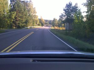
I drove through the hashpoint around 18:45 o'clock. Nothing special there.
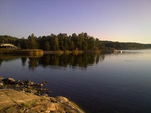
Believe or not, I might have driven the same route today even if the hashpoint hadn't been there. Namely, my destination was a public sauna on the sea shore. It is open on Tuesday, Thursday and Sunday evenings on September. (The sauna of my normal summer and winter swimming place by a lake is closed on September.) Well, I have some kind of flu, but some sauna and quick swim won't make it worse, I guess... Water temperature was 16°C. It was much warmer just few weeks ago. It's getting colder rather quickly when there's wind and coldish nights.
Surprisingly, I have some very bad quality pictures of the sauna location also in 2010-08-12 60 22, and in Where's in a name geocache log.
Tracklog
I have a tracklog. Let's see whether I'll upload it somewhere some day.
Photos
Series of bad photos continues.


