Difference between revisions of "2011-06-05 49 -123"
imported>Robyn (fixing) |
m (More specific location) |
||
| (3 intermediate revisions by 2 users not shown) | |||
| Line 1: | Line 1: | ||
[[Image:2011-06-05 49 -123.JPG|thumb]] | [[Image:2011-06-05 49 -123.JPG|thumb]] | ||
==Location== | ==Location== | ||
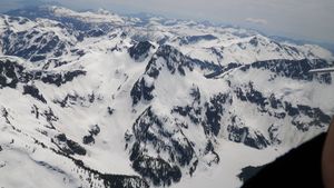
| − | Between the | + | Between the Alpha and Omega mountain peaks in the Tantalus range, right beside the thoroughly frozen and snow-covered Lovely Water Lake. |
==Participants== | ==Participants== | ||
* [[User:Robyn|Robyn]] | * [[User:Robyn|Robyn]] | ||
* Bill | * Bill | ||
==Expedition== | ==Expedition== | ||
| − | Robyn went geohashing here with her boss. It was awesome. We have a | + | Robyn went geohashing here with her boss. It was awesome. We have a high resolution photos, but there's so much snow that they're kind of overexposed. |
| + | |||
| + | Here are the two photos we took, along with their location coding. The camera was automatically triggered at the exact coordinates by the GPS-linked camera software, and we took an extra shot just to be sure. Yeah, I have the best geohashing equipment ever for my job, and my boss is awesome. No you can't come with me. The insurance doesn't allow non-crewmembers. | ||
| + | |||
| + | [[Image:00075-qvRGB.jpg]] | ||
| + | |||
| + | 6F8CFB78-7F9E-44DC-805D-6EAF922994D5-00074: 71 110605 212612 "110605-2102-C-GNZQ" "LR08-206" 11 1 2 N49.774900 W123.252857 2245.0 GPS 360.00 -0.00064 | ||
| + | |||
| + | |||
| + | [[File:00074-qvRGB.jpg]] | ||
| + | |||
| + | 6F8CFB78-7F9E-44DC-805D-6EAF922994D5-00075: 72 110605 212617 "110605-2102-C-GNZQ" "LR08-206" 11 1 1 N49.777922 W123.252747 2249.5 GPS 362.00 -0.00064 | ||
| + | |||
| + | Target: 49.778022°, -123.25285° | ||
| + | |||
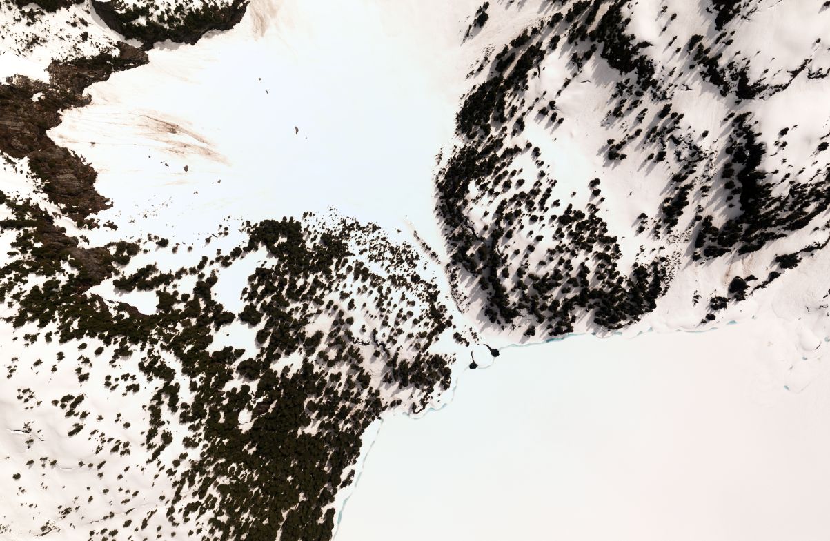
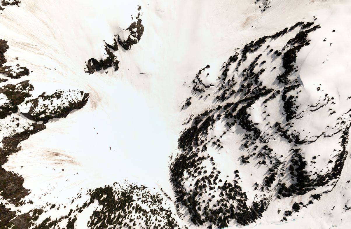
| + | If you zoom in on the Google Earth image you can see it matches quite nicely. | ||
| + | |||
| + | {{meetup graticule | ||
| + | | lat=49 | ||
| + | | lon=-123 | ||
| + | | date=2011-06-05 | ||
| + | }} | ||
[[Category:Expeditions]] | [[Category:Expeditions]] | ||
| Line 12: | Line 33: | ||
[[Category: Meetup in 49 -123]] | [[Category: Meetup in 49 -123]] | ||
[[Category: Meetup on 2011-06-05]] | [[Category: Meetup on 2011-06-05]] | ||
| − | [[Category:Expeditions with photos]] | + | [[Category: Expeditions with photos]] |
| + | [[Category: Air geohash achievement]] | ||
| + | {{location|CA|BC|SL}} | ||
Latest revision as of 23:43, 9 August 2020
Location
Between the Alpha and Omega mountain peaks in the Tantalus range, right beside the thoroughly frozen and snow-covered Lovely Water Lake.
Participants
- Robyn
- Bill
Expedition
Robyn went geohashing here with her boss. It was awesome. We have a high resolution photos, but there's so much snow that they're kind of overexposed.
Here are the two photos we took, along with their location coding. The camera was automatically triggered at the exact coordinates by the GPS-linked camera software, and we took an extra shot just to be sure. Yeah, I have the best geohashing equipment ever for my job, and my boss is awesome. No you can't come with me. The insurance doesn't allow non-crewmembers.
6F8CFB78-7F9E-44DC-805D-6EAF922994D5-00074: 71 110605 212612 "110605-2102-C-GNZQ" "LR08-206" 11 1 2 N49.774900 W123.252857 2245.0 GPS 360.00 -0.00064
6F8CFB78-7F9E-44DC-805D-6EAF922994D5-00075: 72 110605 212617 "110605-2102-C-GNZQ" "LR08-206" 11 1 1 N49.777922 W123.252747 2249.5 GPS 362.00 -0.00064
Target: 49.778022°, -123.25285°
If you zoom in on the Google Earth image you can see it matches quite nicely.
| Sun 5 Jun 2011 in 49,-123: 49.7780229, -123.2528492 geohashing.info google osm bing/os kml crox |


