Difference between revisions of "2012-08-11 60 10"
From Geohashing
imported>Relet (Created page with "{{subst:Expedition/relet|lat=60|lon=10|date=2012-08-11}}") |
m (2020-01-01 update) |
||
| (8 intermediate revisions by 2 users not shown) | |||
| Line 7: | Line 7: | ||
__NOTOC__ | __NOTOC__ | ||
== Location == | == Location == | ||
| + | * A nondescript patch of land between Gjøvik and Reinsvoll | ||
| + | |||
| + | {{Template:PBGH battleship|lat=60|lon=10|date=2012-08-11}} | ||
== Participants == | == Participants == | ||
| + | * [[User:relet|relet]] | ||
| + | * Henrik | ||
| + | * A Piper Warrior II | ||
== Plans == | == Plans == | ||
| + | This was completely unplanned. | ||
== Expedition == | == Expedition == | ||
| − | + | Henrik called me in the morning to invite me for a flight. Of course I was in. I didn't even think about geohashing at that point, but when I checked the closest coordinates in the air, I discovered they were a mere 5km from the <s>airport</s>gravel track we were planning to land on. As Henrik was fueling the plane anyway when we were there (since it was his first time on that <s>airport</s>gravel track), I asked him if he was game to fly to a random point some 5km further on. He was, and so we went. We didn't exactly zero in on the coordinates, but flew over and turned around the point at about 3000 metric feet of altitude. | |
| − | |||
== Photos == | == Photos == | ||
| Line 21: | Line 27: | ||
{{#vardefine:gaLines|2}} | {{#vardefine:gaLines|2}} | ||
{{Gallery2| | {{Gallery2| | ||
| − | < | + | {{GalleryItem | File:2012-08-11 60 10 Aviation.jpg | Feeling much like a geohashing pioneer. }} |
| + | {{GalleryItem | File:2012-08-11 60 10 Tn R1065439 DNG.jpg | Ready for takeoff @ Eggemoen airport }} | ||
| + | {{GalleryItem | File:2012-08-11 60 10 Tn R1065443 DNG.jpg | Brandbukampen }} | ||
| + | {{GalleryItem | File:2012-08-11 60 10 Tn R1065446 DNG.jpg | Fueling up @ Reinsvoll <s>airport</s> gravel track }} | ||
| + | {{GalleryItem | File:2012-08-11 60 10 Tn R1065452 DNG.jpg | The hangar }} | ||
| + | {{GalleryItem | File:2012-08-11 60 10 Tn R1065454 DNG.jpg | The runway }} | ||
| + | {{GalleryItem | File:2012-08-11 60 10 Tn R1065457 DNG.jpg | As close as proof goes - cellphones are not suited for air hashing }} | ||
| + | {{GalleryItem | File:2012-08-11 60 10 Tn R1065459 DNG.jpg | The lake and house @ 60.70916,10.514362 }} | ||
| + | {{GalleryItem | File:2012-08-11 60 10 Tn R1065461 DNG.jpg | Turning... }} | ||
| + | {{GalleryItem | File:2012-08-11 60 10 Tn R1065467 DNG.jpg | Florø, a kayaking paradise }} | ||
}} | }} | ||
| Line 27: | Line 42: | ||
{{#vardefine:ribbonwidth|800px}} | {{#vardefine:ribbonwidth|800px}} | ||
| − | + | {{air geohash | |
| − | + | | latitude = 60 | |
| − | + | | longitude = 10 | |
| − | + | | date = 2012-08-11 | |
| − | + | | name = relet | |
| − | + | | vehicle = Piper Warrior II | |
| + | }} | ||
[[Category:Expeditions]] | [[Category:Expeditions]] | ||
| − | |||
[[Category:Expeditions with photos]] | [[Category:Expeditions with photos]] | ||
| − | |||
| − | |||
| − | |||
[[Category:Coordinates reached]] | [[Category:Coordinates reached]] | ||
| − | + | {{location|NO|34}} | |
| − | |||
| − | |||
| − | |||
| − | |||
| − | |||
| − | |||
Latest revision as of 00:22, 16 February 2020
| Sat 11 Aug 2012 in 60,10: 60.7118274, 10.5016661 geohashing.info google osm bing/os kml crox |
Location
- A nondescript patch of land between Gjøvik and Reinsvoll
Today's battleship location is: F 8
Participants
- relet
- Henrik
- A Piper Warrior II
Plans
This was completely unplanned.
Expedition
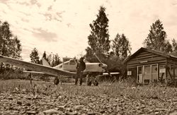
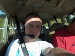
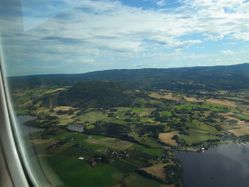
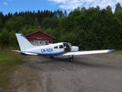
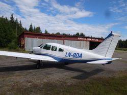
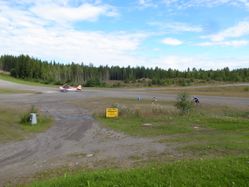
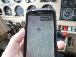
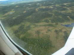
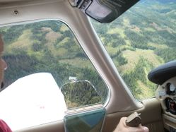
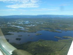
Henrik called me in the morning to invite me for a flight. Of course I was in. I didn't even think about geohashing at that point, but when I checked the closest coordinates in the air, I discovered they were a mere 5km from the airportgravel track we were planning to land on. As Henrik was fueling the plane anyway when we were there (since it was his first time on that airportgravel track), I asked him if he was game to fly to a random point some 5km further on. He was, and so we went. We didn't exactly zero in on the coordinates, but flew over and turned around the point at about 3000 metric feet of altitude.
Photos
|
Achievements
relet earned the Air geohash achievement
|
