Difference between revisions of "2012-09-22 -36 174"
From Geohashing
imported>Jiml m (Adjust result codes) |
imported>FippeBot m (Location) |
||
| (2 intermediate revisions by 2 users not shown) | |||
| Line 22: | Line 22: | ||
== Photos == | == Photos == | ||
<gallery perrow="5"> | <gallery perrow="5"> | ||
| − | + | File:2012-09-22 -36 174 the trip.gif| Nice day for a drive | |
| + | File:2012-09-22 -36 174 arriving in style.JPG| My trusty steed | ||
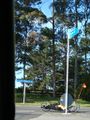
| + | File:2012-09-22_-36_174_hash_on_the_left.JPG| Spot the hash | ||
| + | File:2012-09-22_-36_174_street_signs.JPG| Follow the signs | ||
</gallery> | </gallery> | ||
| Line 31: | Line 34: | ||
[[Category:Expeditions]] | [[Category:Expeditions]] | ||
| + | [[Category:Expeditions with photos]] | ||
| + | [[Category:Expeditions with videos]] | ||
[[Category:Coordinates reached]] | [[Category:Coordinates reached]] | ||
| + | {{location|NZ|AUK}} | ||
Latest revision as of 06:13, 13 August 2019
| Sat 22 Sep 2012 in -36,174: -36.7755541, 174.6864571 geohashing.info google osm bing/os kml crox |
Location
Next to little tree, Greenhithe, Auckland, New Zealand
Participants
Plans
Woke up, pulled laptop into bed. Over coffee checked wicked XKCD comic, then browsed over to geohash page and saw this beauty sitting nice and exposed. Will get this morning.
Expedition
Really simple, we drove down the road, stopped for coffee and ambled over a bridge to the hash site. Nice day for it.
Photos
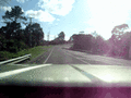
Nice day for a drive

My trusty steed

Spot the hash
Follow the signs


Achievements
- Land geohash