Difference between revisions of "2013-05-06 47 6"
From Geohashing
imported>Crox (last minute plan) |
imported>FippeBot m (Location) |
||
| (2 intermediate revisions by one other user not shown) | |||
| Line 7: | Line 7: | ||
__NOTOC__ | __NOTOC__ | ||
== Location == | == Location == | ||
| − | Neuchâtel, Switzerland | + | [http://map.geo.admin.ch/?Y=560936.2357226&X=206141.16676087&zoom=8&bgLayer=ch.swisstopo.pixelkarte-farbe "Verger au Renard", near Route de Chaumont, Neuchâtel, Switzerland] |
== Participants == | == Participants == | ||
| Line 13: | Line 13: | ||
== Plans == | == Plans == | ||
| − | + | Driving from Neuchâtel train station, ETA 19:50 | |
== Expedition == | == Expedition == | ||
| − | + | Went according to plan. Actually, as far as I remember this was the first time that I arrived before the ETA that I calculated during the planning phase... | |
| − | == | + | == Photos == |
| − | + | {{#vardefine:gaLines|3}} | |
| + | {{#vardefine:gaWidth|250}} | ||
| + | {{#vardefine:gaHeight|230}} | ||
| + | {{Gallery2| | ||
| + | {{GalleryItem | File:2013-05-06_47_6-00-plan.jpg | my notes on how to get there. "le plan" is actually the first place to cross according to the Swisstopo map :o) }} | ||
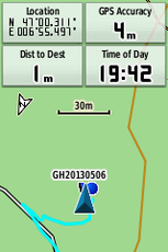
| + | {{GalleryItem | File:2013-05-06_47_6-01-reached_709.png | reached! }} | ||
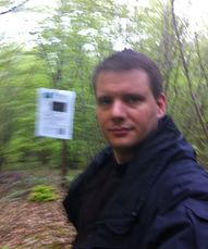
| + | {{GalleryItem | File:2013-05-06_47_6-03-crox_at_hash.jpg | [[user:Crox|me]] at the hash, with the [[user:Crox/Poster|poster]] in the background }} | ||
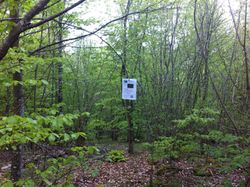
| + | {{GalleryItem | File:2013-05-06_47_6-04-hash.jpg | how the place looked like }} | ||
| + | }} | ||
| − | |||
| − | |||
| − | |||
| − | |||
| − | |||
| − | |||
| − | |||
| − | |||
| − | |||
| − | |||
| − | |||
| − | |||
| − | |||
| − | |||
| − | |||
| − | |||
| − | |||
| − | |||
[[Category:Expeditions]] | [[Category:Expeditions]] | ||
| − | |||
| − | |||
| − | |||
| − | |||
[[Category:Expeditions with photos]] | [[Category:Expeditions with photos]] | ||
| − | |||
| − | |||
| − | |||
| − | |||
| − | |||
[[Category:Coordinates reached]] | [[Category:Coordinates reached]] | ||
| − | + | {{location|CH|NE}} | |
| − | |||
| − | |||
| − | |||
| − | |||
| − | |||
| − | |||
| − | |||
| − | |||
| − | |||
Latest revision as of 05:54, 6 August 2019
| Mon 6 May 2013 in 47,6: 47.0051680, 6.9249640 geohashing.info google osm bing/os kml crox |
Location
"Verger au Renard", near Route de Chaumont, Neuchâtel, Switzerland
Participants
Plans
Driving from Neuchâtel train station, ETA 19:50
Expedition
Went according to plan. Actually, as far as I remember this was the first time that I arrived before the ETA that I calculated during the planning phase...
Photos
|


