Difference between revisions of "2014-04-23 51 -0"
imported>Macronencer (→Photos) |
imported>FippeBot m (Location) |
||
| (9 intermediate revisions by one other user not shown) | |||
| Line 1: | Line 1: | ||
| + | [[Image:{{{image|2014-04-23 51 -0 05 TheTwoNencers.JPG}}}|thumb|left]] | ||
| − | |||
| − | |||
| − | |||
| − | |||
| − | |||
| − | |||
| − | |||
| − | |||
| − | |||
{{meetup graticule | {{meetup graticule | ||
| lat=51 | | lat=51 | ||
| Line 24: | Line 16: | ||
--> | --> | ||
[[User:Macronencer|Macronencer]] | [[User:Macronencer|Macronencer]] | ||
| + | |||
Micronencer (no account page yet) | Micronencer (no account page yet) | ||
| Line 34: | Line 27: | ||
It's a lovely area to be in, anyway. I wouldn't mind living there, apart from the annoying litter dropped by the usual inconsiderate people. | It's a lovely area to be in, anyway. I wouldn't mind living there, apart from the annoying litter dropped by the usual inconsiderate people. | ||
| − | |||
| − | |||
== Tracklog == | == Tracklog == | ||
| Line 64: | Line 55: | ||
{{#vardefine:ribbonwidth|800px}} | {{#vardefine:ribbonwidth|800px}} | ||
<!-- Add any achievement ribbons you earned below, or remove this section --> | <!-- Add any achievement ribbons you earned below, or remove this section --> | ||
| − | |||
| − | + | {{Geotrash | latitude = 51 | longitude = -0 | date = 2014-04-23 | name = Macronencer | image = 2014-04-23 51 -0 10 TrashHaul.JPG }} | |
| − | + | {{drag-along | latitude = 51 | longitude = -0 | date = 2014-04-23 | partner = his son (known as Micronencer) | name = Macronencer | image = 2014-04-23 51 -0 05 TheTwoNencers.JPG }} | |
| − | |||
<!-- ==REQUEST FOR TWITTER BOT== Please leave either the New report or the Expedition planning category in as long as you work on it. This helps the twitter bot a lot with announcing the right outcome at the right moment. --> | <!-- ==REQUEST FOR TWITTER BOT== Please leave either the New report or the Expedition planning category in as long as you work on it. This helps the twitter bot a lot with announcing the right outcome at the right moment. --> | ||
| Line 75: | Line 64: | ||
[[Category:Expeditions]] | [[Category:Expeditions]] | ||
| + | [[Category:Expeditions with photos]] | ||
<!-- An actual expedition: | <!-- An actual expedition: | ||
-- and one or more of -- | -- and one or more of -- | ||
| − | |||
[[Category:Expeditions with videos]] | [[Category:Expeditions with videos]] | ||
[[Category:Expedition without GPS]] | [[Category:Expedition without GPS]] | ||
| Line 83: | Line 72: | ||
[[Category:Coordinates reached]] | [[Category:Coordinates reached]] | ||
| + | {{location|GB|ENG|BKM}} | ||
Latest revision as of 06:17, 14 August 2019
| Wed 23 Apr 2014 in 51,-0: 51.5853154, -0.7706798 geohashing.info google osm bing/os kml crox |
Location
On a path near Marlow Bottom, near Reading. There is parking nearby.
Participants
Micronencer (no account page yet)
Plans
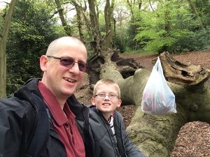
Macronencer plans to visit with his son, who is not a regular geohasher, but goes geocaching a lot, and is informally known as 'Micronencer'. We should be there around lunch time.
Expedition
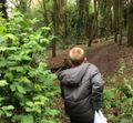
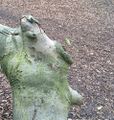
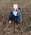
So pleased to say that Micronencer (my son, 11, perhaps I'll make a page for him soon…) has finally come with me on a geohash. It was a really good one, too. We had a lovely walk through the woods, and there was a fallen tree right next to the hash point, allowing us to take a well-earned picnic break. The place was really litter-soiled, and we came away with quite a lot of trash, so that was a good bit of work. Also managed to remember to bring Chuck, my hashscot, this time - and also to do the XKCD marker. I even made a GPX track of the walking portion. The only thing I missed was that I'd planned to do a bit of juggling and tin whistle work. Unfortunately, I forgot the juggling balls and although I brought the whistle, I clean forgot about it and left it in the bag. Next time, we'll make a list…!
It's a lovely area to be in, anyway. I wouldn't mind living there, apart from the annoying litter dropped by the usual inconsiderate people.
Tracklog
Photos
Here is a Link to a panorama photo from near hash point (yes, sorry. I know Dropbox stinks of Rice now…)
Achievements
Macronencer earned the GeoTrash Geohash Achievement
|
Macronencer earned the Drag-along achievement
|


