Difference between revisions of "2015-10-24 49 8"
From Geohashing
imported>Q-Owl |
imported>FippeBot m (Location) |
||
| (4 intermediate revisions by one other user not shown) | |||
| Line 22: | Line 22: | ||
We drove near the top of [[wikipedia:Kalmit|Kalmit]] mountain. From the parking lot we had a 2.5 km walk to the hashpoint. | We drove near the top of [[wikipedia:Kalmit|Kalmit]] mountain. From the parking lot we had a 2.5 km walk to the hashpoint. | ||
After some minutes of "hashdance" we took the photos and on the way we found/picked some tasty mushrooms. On the way back we found one geocache. | After some minutes of "hashdance" we took the photos and on the way we found/picked some tasty mushrooms. On the way back we found one geocache. | ||
| + | |||
| + | 2015-10-25: This area is so nice, that we came back for a hike (and to find some caches) today. | ||
== Photos == | == Photos == | ||
| Line 31: | Line 33: | ||
Image:2015-10-24 49 8 proof.png | Proof | Image:2015-10-24 49 8 proof.png | Proof | ||
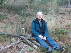
Image:2015-10-24 49 8 hp.jpg | Q-Owl at the hashpoint | Image:2015-10-24 49 8 hp.jpg | Q-Owl at the hashpoint | ||
| − | Image:2015-10-24 49 8 m-hp.jpg | Q- | + | Image:2015-10-24 49 8 m-hp.jpg | Q-Owla with mushrooms at the hashpoint |
Image:2015-10-24 49 8 north.jpg | View north | Image:2015-10-24 49 8 north.jpg | View north | ||
Image:2015-10-24 49 8 west.jpg | View west | Image:2015-10-24 49 8 west.jpg | View west | ||
| Line 83: | Line 85: | ||
[[Category:Expeditions with photos]] | [[Category:Expeditions with photos]] | ||
| − | [[Category: Meetup on 2015-10- | + | [[Category: Meetup on 2015-10-24]] |
[[Category: Meetup in 49 8]] | [[Category: Meetup in 49 8]] | ||
| + | {{location|DE|RP|NW}} | ||
Latest revision as of 01:23, 7 August 2019
| Sat 24 Oct 2015 in 49,8: 49.3388878, 8.0897548 geohashing.info google osm bing/os kml crox |
Location
Near the Kalmit mountain in the Palatinate Forest.
Participants
Plan
To tell the truth: There was no plan. On the way to some caches near Weinheim we just had a look, where todays hashpoint might be. We decided to drive to the hashpoint, located on other rim of the upper Rhine Valley. Distance: 52 km as the beaver flies.
Expedition
We drove near the top of Kalmit mountain. From the parking lot we had a 2.5 km walk to the hashpoint. After some minutes of "hashdance" we took the photos and on the way we found/picked some tasty mushrooms. On the way back we found one geocache.
2015-10-25: This area is so nice, that we came back for a hike (and to find some caches) today.
Photos
Achievements / Honorable Mention
Q-Owl earned the Land geohash achievement
|
Other Geohashing Expeditions and Plans on this Day
Expeditions and Plans
| 2015-10-24 | ||
|---|---|---|
| Córdoba, Argentina | Onicofago, My son, Juan | Rural area in Villa Esquiú. Córdoba, Argentina. |
| Stuttgart, Germany | MisterFog | near by Burladingen, Swabian Alb |
| Vancouver, British Columbia | Rhonda | On a street in North Vancouver, near the north end of the Mosquito Creek tr... |
| Mannheim, Germany | Q-Owl, Q-Owla | Near the Kalmit mountain in the Palatinate Forest. |
| Kassel, Germany | GeorgDerReisende | The hash lay on a field above Landau. |
| Norwich, United Kingdom | Sourcerer | In a field between Thrandeston and Mellis close to and east of the main lin... |
| Stockholm, Sweden | Per S, iA | In a courtyard near Karlaplan. |


