Difference between revisions of "2016-03-26 -37 144"
From Geohashing
imported>Razetoei ([live picture]Bit late, reached the hashpoint at 16:36. [http://www.openstreetmap.org/?lat=-37.96418750&lon=144.56457050&zoom=16&layers=B000FTF @-37.9642,144.5646]) |
m (More specific location) |
||
| (11 intermediate revisions by 3 users not shown) | |||
| Line 1: | Line 1: | ||
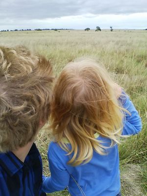
| + | [[Image:{{{image|2016-03-26 -37 144 selfie.jpg}}}|thumb|left]] | ||
| + | |||
{{meetup graticule | {{meetup graticule | ||
| lat=-37 | | lat=-37 | ||
| Line 23: | Line 25: | ||
== Plans == | == Plans == | ||
| − | Be there at | + | Be there at 16:00 for Saturday meetup |
== Expedition == | == Expedition == | ||
| − | + | Running late because kid #3 needed to wee and I needed coffee. Avoided the coppers on the highway trying to do people for speeding on the Eggster weekend. Arrived at the geohash at 16:36. Climbed two fences with only one row of barbed wire between them. Must have been our lucky day. Stepped nimbly over many volcanic rocks. Startled a rabbit. Geohashed successfully. Went off to find the nearest geocache which was a little way down the highway on the other side. | |
| − | |||
| − | |||
| − | |||
== Photos == | == Photos == | ||
| − | |||
| − | |||
| − | |||
<gallery perrow="5"> | <gallery perrow="5"> | ||
| − | + | Image:2016-03-26 -37 144 selfie.jpg | Me and kid #3 | |
| − | Image:2016-03- | + | Image:2016-03-26 -37 144 flora.jpg | A dead thistle? |
| + | Image:2016-03-26 -37 144 feet.jpg | Right this very here | ||
| + | Image:2016-03-26 -37 144 screencap.png | Ta da! | ||
</gallery> | </gallery> | ||
== Achievements == | == Achievements == | ||
{{#vardefine:ribbonwidth|800px}} | {{#vardefine:ribbonwidth|800px}} | ||
| − | + | {{Two to the N achievement| count = 1| latitude = -37| longitude = 144 | date = 2016-03-26 | name = Razetoei}} | |
| + | {{consecutive geohash 2| count = 2| latitude = -37| longitude = 144| date = 2016-03-26| name = Razetoei}} | ||
| − | |||
| − | |||
| − | |||
| − | |||
| − | |||
| − | |||
| − | |||
| − | |||
[[Category:Expeditions]] | [[Category:Expeditions]] | ||
| − | |||
[[Category:Expeditions with photos]] | [[Category:Expeditions with photos]] | ||
| − | |||
| − | |||
| − | |||
| − | |||
| − | |||
[[Category:Coordinates reached]] | [[Category:Coordinates reached]] | ||
| − | + | {{location|AU|VIC|WY}} | |
| − | |||
| − | |||
| − | |||
| − | |||
| − | |||
| − | |||
| − | |||
| − | |||
| − | |||
| − | |||
| − | |||
| − | |||
| − | |||
| − | |||
| − | |||
| − | |||
| − | |||
Latest revision as of 12:47, 1 August 2020
| Sat 26 Mar 2016 in -37,144: -37.9628467, 144.5633580 geohashing.info google osm bing/os kml crox |
Location
Farm in Cocoroc, near Little River, which is halfway between Geelong and Melbourne
Participants
Plans
Be there at 16:00 for Saturday meetup
Expedition
Running late because kid #3 needed to wee and I needed coffee. Avoided the coppers on the highway trying to do people for speeding on the Eggster weekend. Arrived at the geohash at 16:36. Climbed two fences with only one row of barbed wire between them. Must have been our lucky day. Stepped nimbly over many volcanic rocks. Startled a rabbit. Geohashed successfully. Went off to find the nearest geocache which was a little way down the highway on the other side.
Photos
Achievements
Razetoei earned the Two to the N achievement
|
Razetoei earned the Consecutive geohash achievement
|


