Difference between revisions of "2018-04-13 50 11"
imported>Paintedhell |
imported>FippeBot m (Location) |
||
| (One intermediate revision by one other user not shown) | |||
| Line 18: | Line 18: | ||
== Expedition == | == Expedition == | ||
Well, the challenge was not to go there but to know about the Geohash, but luckily, Reinhard undertook the task of checking the coordinates and informing me right on time before my lunch break, so I could save the coordinate to my GPS and put a Hashcot in my pocket before I left my desk. Sadly, a camera did not belong to my expedition gear - I left it at home, but as my lunch break might have been the only non-rainy time of day (spoiler: it wasn't) I just went to the point with my shitty phone camera. | Well, the challenge was not to go there but to know about the Geohash, but luckily, Reinhard undertook the task of checking the coordinates and informing me right on time before my lunch break, so I could save the coordinate to my GPS and put a Hashcot in my pocket before I left my desk. Sadly, a camera did not belong to my expedition gear - I left it at home, but as my lunch break might have been the only non-rainy time of day (spoiler: it wasn't) I just went to the point with my shitty phone camera. | ||
| + | |||
| + | Also, I rode my bike for 3 kms from office to Geohash, no steep ascents or descents, no dirty stinking beet fields, not even rain, and the point lay directly on the sidewalk next to the street and the GPS signal was so stable that I could try about one hundred times to get a non-blurry 0m shot. So once again this is more than justified: | ||
| + | |||
| + | {{Easy_geohash | latitude = 50 | longitude = 11 | date = 2018-04-13 | name = Juja}} | ||
| + | |||
| + | - Was this even a real Geohash? | ||
== Photos == | == Photos == | ||
| Line 31: | Line 37: | ||
[[Category:Expeditions with photos]] | [[Category:Expeditions with photos]] | ||
[[Category:Coordinates reached]] | [[Category:Coordinates reached]] | ||
| + | {{location|DE|TH|J}} | ||
Latest revision as of 03:31, 16 August 2019
| Fri 13 Apr 2018 in 50,11: 50.9061225, 11.5770031 geohashing.info google osm bing/os kml crox |
Location
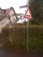
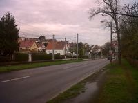
On the roadside or sidewalk of Rudolstädter Straße in Jena-Winzerla, Germany.
Participants
Expedition Planning
This one seems so easy to reach that it might be possible none of the Jena geohashers thinks it is challenging enough to get there.
Expedition
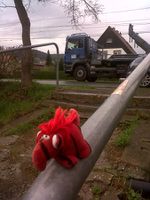
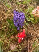
Well, the challenge was not to go there but to know about the Geohash, but luckily, Reinhard undertook the task of checking the coordinates and informing me right on time before my lunch break, so I could save the coordinate to my GPS and put a Hashcot in my pocket before I left my desk. Sadly, a camera did not belong to my expedition gear - I left it at home, but as my lunch break might have been the only non-rainy time of day (spoiler: it wasn't) I just went to the point with my shitty phone camera.
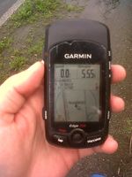
Also, I rode my bike for 3 kms from office to Geohash, no steep ascents or descents, no dirty stinking beet fields, not even rain, and the point lay directly on the sidewalk next to the street and the GPS signal was so stable that I could try about one hundred times to get a non-blurry 0m shot. So once again this is more than justified:
Juja has visited an Easy Geohash
|
- Was this even a real Geohash?
Photos
|
