Difference between revisions of "2020-12-21 -35 138"
From Geohashing
(→Expedition) |
m (Location) |
||
| (9 intermediate revisions by 2 users not shown) | |||
| Line 1: | Line 1: | ||
| − | + | {{meetup graticule | |
| − | + | | lat=-35 | |
| − | + | | lon=138 | |
| − | + | | date=2020-12-21 | |
| − | + | }} | |
| − | |||
| − | |||
| − | |||
| − | |||
| − | | lat= | ||
| − | | lon= | ||
| − | | date= | ||
| − | }} | ||
__NOTOC__ | __NOTOC__ | ||
== Location == | == Location == | ||
<!-- where you've surveyed the hash to be --> | <!-- where you've surveyed the hash to be --> | ||
| + | It was just on the side of the road, on a suburban street, outside someone's home. | ||
== Participants == | == Participants == | ||
| Line 29: | Line 22: | ||
I just walked down there on my lunch break. | I just walked down there on my lunch break. | ||
| − | + | ||
| − | |||
== Photos == | == Photos == | ||
| Line 37: | Line 29: | ||
--> | --> | ||
<gallery perrow="5"> | <gallery perrow="5"> | ||
| + | |||
| + | File:2020-12-21 -35 138 tree.jpg|thumb|A tree | ||
| + | File:2020-12-21 -35 138 GPS.png|thumb|GPS | ||
| + | |||
</gallery> | </gallery> | ||
| Line 42: | Line 38: | ||
{{#vardefine:ribbonwidth|800px}} | {{#vardefine:ribbonwidth|800px}} | ||
<!-- Add any achievement ribbons you earned below, or remove this section --> | <!-- Add any achievement ribbons you earned below, or remove this section --> | ||
| + | {{Walk geohash | ||
| + | | latitude = -35 | ||
| + | | longitude = 138 | ||
| + | | date = 2020-12-21 | ||
| + | | name = [[User:BrendanTWhite|BrendanTWhite]] | ||
| + | | distance = 1.3km | ||
| + | }} | ||
| − | |||
| − | |||
| − | |||
| − | |||
| − | |||
| − | |||
| − | |||
| − | |||
| − | |||
| − | |||
| − | |||
| − | |||
| − | |||
| − | |||
[[Category:Expeditions]] | [[Category:Expeditions]] | ||
| − | + | [[Category:Expeditions with photos]] | |
| − | [[Category:Expeditions with photos]] | ||
| − | |||
| − | |||
| − | |||
| − | |||
| − | |||
[[Category:Coordinates reached]] | [[Category:Coordinates reached]] | ||
| − | + | {{location|AU|SA|MI}} | |
| − | |||
| − | |||
| − | |||
| − | |||
| − | |||
| − | |||
| − | |||
| − | |||
| − | |||
| − | |||
| − | |||
| − | |||
| − | |||
| − | |||
| − | |||
| − | |||
| − | |||
Latest revision as of 09:42, 30 December 2020
| Mon 21 Dec 2020 in -35,138: -35.0053264, 138.6132166 geohashing.info google osm bing/os kml crox |
Location
It was just on the side of the road, on a suburban street, outside someone's home.
Participants
Just me, BrendanTWhite (talk)
Plans
Checked the email on Friday morning, and lo and behold, the Monday hash was close enough to walk to! Never happened to me before. So excitement! :)
Expedition
I just walked down there on my lunch break.
Photos
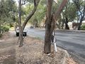
A tree
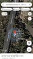
GPS


Achievements
BrendanTWhite earned the Walk geohash Achievement
|