Difference between revisions of "2022-04-11 41 1"
(Expedition planning) |
m |
||
| (2 intermediate revisions by one other user not shown) | |||
| Line 8: | Line 8: | ||
}} | }} | ||
== Location == | == Location == | ||
| − | On a path on what seems to be above the ''Riera de Talamanca'' (Stream of Talamanca) in [[wikipedia: | + | On a path on what seems to be above the ''Riera de Talamanca'' (Stream of Talamanca) in [[wikipedia:Talamanca_(Bages)|Talamanca]] |
== Participants == | == Participants == | ||
| − | [[User:SastRe.O|SastRe.O]][[File:SastReO_logo.png|20px|Logo]] | + | *[[User:SastRe.O|SastRe.O]][[File:SastReO_logo.png|20px|Logo]] |
| + | *Àngel | ||
== Plans == | == Plans == | ||
| Line 17: | Line 18: | ||
== Expedition == | == Expedition == | ||
| + | A very nice expedition! Hash reached, beautiful hike and scenery and positively surprised by this area. | ||
| + | I tend to visit the hash using public transportation. That's what I was planning on Sunday when my friend asked me if I wanted to do something on monday. Well, as it is now I told him my plans on visting this hash and asked him if he wanted to come along. Had to convince him on other things we would see to really sell him the plan, but he was in from the beginning. What was convenient is that his brother goes to work not that far from here, so we carpooled with him and then we drove to Navarcles were our hike started. | ||
| + | First we started to follow the ''Stream of Talamanca'' on the Bages county. Lots of ''cabanes de vinya'' (translated as vineyard cabins) scattered along the way, the stream down there and the path going over the cliffs. So peaceful. We saw absolutely no one the whole time. On this very first part is where the hash was, right in the middle of the path. Quite lucky. 2 hours hadn't still passed that we were already reaching the hash coordinates. No much dancing required and took pictures as proof. | ||
| + | |||
| + | We continued walking over the cliffs when we heard something moving down there. Then I spotted the rear legs of a roar deer hiding behind some trees. Nice, but then something unexpected. We heard what seemed like barking. But single ones. First thought was a dog, but it obviously wasn't. It was indeed the deer makings its call, but had no idea it sounded like that. | ||
| + | |||
| + | [[File:2022-04-11 41 1 cabirols.wav]] | ||
| + | |||
| + | It kept making its call and another one was responding from the distance. We think we event heard a 3rd one joining the conversation from further away. That was a first one. | ||
| + | |||
| + | Then our hike changed sceneries. We left the stream of Talamanca and went on the other side of the mountain range towards the stream of Calders. What an unexpected canyon it forms, and the river was carrying quite an amount of water. Had to be careful crossing it on some points and stopped on a beautiful gorge. Visited a necropolis, some abandoned ''Masies'' and a few churches along the way. Also an old dam. Lot's of curiosities I was totally unaware of their existence. | ||
| + | |||
| + | We found a place to have lunch by a waterfall, this one now a little dry, although it has a permanent spring on the middle part. This waterfall is hidden in a pine tree forest area where you would least expect it such an elevation change. Literally hidden. That was already the final part of the hike. The sun was starting to hit strongly, we were just around 20ºC. Not that much later we were again in Navarcles. | ||
| + | |||
| + | Sadly we had some time constraints, since we had to pick my friends brother back at his workplace so we got to the car and had to leave immediately. I say it's a shame since I was highly recommended visiting a pastry shop here in Navarcles. One of the best. Well, I will have to come back, maybe the hashes will accompany me again? | ||
== Tracklog == | == Tracklog == | ||
| − | + | {{tracklog | 2022-04-11 41 1 tracklog.gpx}} | |
== Photos == | == Photos == | ||
| − | |||
<gallery mode=packed heights=225px> | <gallery mode=packed heights=225px> | ||
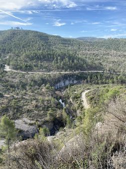
| − | File: | + | File:2022-04-11 41 1 talamancar1.JPG|Riera de Talamanca from above (W). |
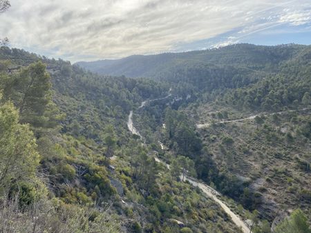
| + | File:2022-04-11 41 1 talamancar2.JPG|Riera de Talamanca from above (E). | ||
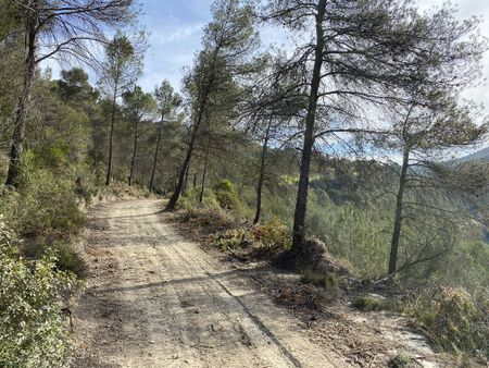
| + | File:2022-04-11 41 1 hashE.JPG|Hashpoint looking East. | ||
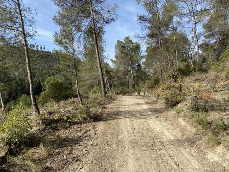
| + | File:2022-04-11 41 1 hashW.JPG|Hashpoint looking West. | ||
| + | File:2022-04-11 41 1 GPSr.JPG|Proof with GPSr. | ||
| + | File:2022-04-11 41 1 balma.JPG|''Balma del camí ral'' | ||
| + | File:2022-04-11 41 1 panorama.jpg|Talamanca and [[wikipedia:Montcau|Montcau]] in the distance. | ||
| + | File:2022-04-11 41 1 necropolis.JPG|Necropolis | ||
| + | File:2022-04-11 41 1 gorg.JPG|''Gorg de Calders''. | ||
| + | File:2022-04-11 41 1 tapies.JPG|''Font de les Tàpies'' | ||
</gallery> | </gallery> | ||
| − | + | ||
== Achievements == | == Achievements == | ||
{{#vardefine:ribbonwidth|800px}} | {{#vardefine:ribbonwidth|800px}} | ||
| − | + | {{drag-along | latitude = 41 | longitude = 1 | date = 2022-04-11 | partner = his friend Àngel | name = SastRe.O}} | |
== Other Geohashing Expeditions and Plans on This Day == | == Other Geohashing Expeditions and Plans on This Day == | ||
| Line 37: | Line 61: | ||
{{Location|ES|CT|B}} | {{Location|ES|CT|B}} | ||
| − | {{user categories|user=SastRe.O}} | + | {{user categories|user=SastRe.O|foot=27.6}} |
[[Category:Expeditions]] | [[Category:Expeditions]] | ||
| − | [[Category: | + | [[Category:Expeditions with photos]] |
| − | + | [[Category:Expeditions with audio]] | |
| − | [[Category:Coordinates reached]] | + | [[Category:Coordinates reached]] |
<!-- | <!-- | ||
| + | |||
| + | [[Category: Meetup on 2022-04-11]] | ||
| + | [[Category: Meetup in 41 1]] | ||
| + | [[Category:Photos_by_SastReO]] | ||
| + | |||
Categories de fotografies: http://wiki.xkcd.com/geohashing/Category:Galleries_by_topic | Categories de fotografies: http://wiki.xkcd.com/geohashing/Category:Galleries_by_topic | ||
| Line 54: | Line 83: | ||
[[Category:Hashpoints]] | [[Category:Hashpoints]] | ||
[[Category:Ways]] | [[Category:Ways]] | ||
| − | |||
| − | |||
| − | |||
| − | |||
| − | |||
| − | |||
--> | --> | ||
Latest revision as of 21:26, 13 April 2022
| Mon 11 Apr 2022 in Tarragona, Catalonia: 41.7429682, 1.9475058 geohashing.info google osm bing/os kml crox |
Location
On a path on what seems to be above the Riera de Talamanca (Stream of Talamanca) in Talamanca
Participants
- SastRe.O

- Àngel
Plans
Apparently I am dragging a friend with me this time. We might park in Navarcles more or less at 09h and start walking then. Hash should be reached before noon and then our hike will continue, discovering this area, unknown at least for me. --SastRe.O (talk) 17:47, 10 April 2022 (UTC)
Expedition
A very nice expedition! Hash reached, beautiful hike and scenery and positively surprised by this area.
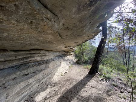
I tend to visit the hash using public transportation. That's what I was planning on Sunday when my friend asked me if I wanted to do something on monday. Well, as it is now I told him my plans on visting this hash and asked him if he wanted to come along. Had to convince him on other things we would see to really sell him the plan, but he was in from the beginning. What was convenient is that his brother goes to work not that far from here, so we carpooled with him and then we drove to Navarcles were our hike started.
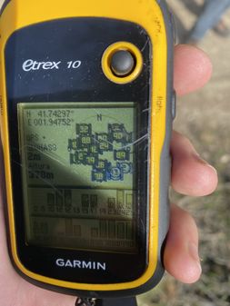
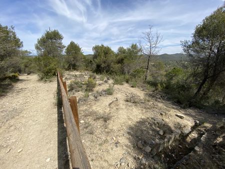
First we started to follow the Stream of Talamanca on the Bages county. Lots of cabanes de vinya (translated as vineyard cabins) scattered along the way, the stream down there and the path going over the cliffs. So peaceful. We saw absolutely no one the whole time. On this very first part is where the hash was, right in the middle of the path. Quite lucky. 2 hours hadn't still passed that we were already reaching the hash coordinates. No much dancing required and took pictures as proof.
We continued walking over the cliffs when we heard something moving down there. Then I spotted the rear legs of a roar deer hiding behind some trees. Nice, but then something unexpected. We heard what seemed like barking. But single ones. First thought was a dog, but it obviously wasn't. It was indeed the deer makings its call, but had no idea it sounded like that.
It kept making its call and another one was responding from the distance. We think we event heard a 3rd one joining the conversation from further away. That was a first one.
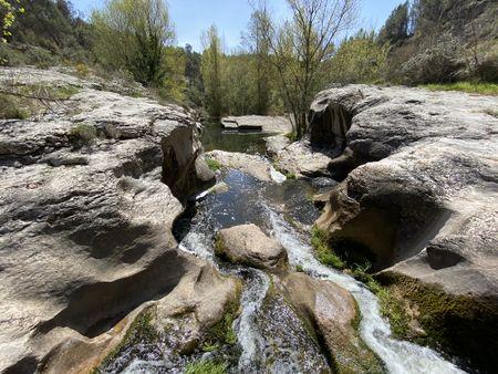
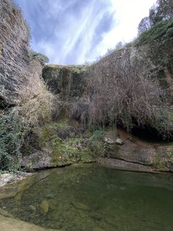
Then our hike changed sceneries. We left the stream of Talamanca and went on the other side of the mountain range towards the stream of Calders. What an unexpected canyon it forms, and the river was carrying quite an amount of water. Had to be careful crossing it on some points and stopped on a beautiful gorge. Visited a necropolis, some abandoned Masies and a few churches along the way. Also an old dam. Lot's of curiosities I was totally unaware of their existence.
We found a place to have lunch by a waterfall, this one now a little dry, although it has a permanent spring on the middle part. This waterfall is hidden in a pine tree forest area where you would least expect it such an elevation change. Literally hidden. That was already the final part of the hike. The sun was starting to hit strongly, we were just around 20ºC. Not that much later we were again in Navarcles.
Sadly we had some time constraints, since we had to pick my friends brother back at his workplace so we got to the car and had to leave immediately. I say it's a shame since I was highly recommended visiting a pastry shop here in Navarcles. One of the best. Well, I will have to come back, maybe the hashes will accompany me again?
Tracklog
Photos
Talamanca and Montcau in the distance.
Achievements
SastRe.O earned the Drag-along achievement
|
Other Geohashing Expeditions and Plans on This Day
Expeditions and Plans
| 2022-04-11 | ||
|---|---|---|
| Melbourne West, Australia | Stevage, Lachie, Cam, EdBordin, Laura M, Max | Steve led the expedition's first phase, which consisted of cycling all the ... |
| Beersheba, Israel | Yerushalmi, #1, #2, #3, #4, #5 | located in a forest just outside the police academy. |
| Tarragona, Spain | SastRe.O, Àngel | On a path on what seems to be above the Riera de Talamanca (Stream of T... |
| Rheine, Germany | Jan, his mother | located on a field in Bokel. |
| Hamburg (West), Germany | π π π | on the Autobahn 7, on the leftmost lane coming from the south in Quickborn,... |
| Stavanger, Norway | Pica42 | The hash was on a slope in Kyllingstad, Gjesdal, Norway. |
