Difference between revisions of "2023-12-10 44 -123"
Michael5000 (talk | contribs) (Created page with "{{subst:Expedition}}") |
m (subst-ing) |
||
| (3 intermediate revisions by 2 users not shown) | |||
| Line 8: | Line 8: | ||
And DON'T FORGET to add your expedition and the best photo you took to the gallery on the Main Page! We'd love to read your report, but that means we first have to discover it! :) | And DON'T FORGET to add your expedition and the best photo you took to the gallery on the Main Page! We'd love to read your report, but that means we first have to discover it! :) | ||
-->{{meetup graticule | -->{{meetup graticule | ||
| − | | lat= | + | | lat=44 |
| − | | lon= | + | | lon=-123 |
| − | | date= | + | | date=2023-12-10 |
}}<!-- edit as necessary --> | }}<!-- edit as necessary --> | ||
== Location == | == Location == | ||
| − | + | In an assisted living complex in South Albany. | |
== Participants == | == Participants == | ||
| − | + | *[[user:Michael5000|Michael5000]] | |
| − | |||
| − | == | + | == Expedition == |
| − | + | It had been almost two months since I last stood on a hashpoint, so I pointed the prow of the expedition vehicle south by southwest and struck out in the grey December weather on the day of the year's earliest sunset. It was a straight shot on I-5, and I reached Albany without incident, except for entering a belt of steady rain a few minutes before reaching town. | |
| − | + | I parked at South Albany High School -- go RedHawks -- and got my running gear organized, then ran roughly a mile south to the open-campus retirement community that hosted the hashpoint. I stopped briefly on the hashpoint, as one does, but deferred picture taking and gloating due to the ongoing cold rain. | |
| − | |||
| − | + | A nice little trail looped me back to the main road; I ran back up and past where I'd parked before I crapped out and walked for a bit. Then I got to a nicer and longer trail, the Periwinkle Creek Trail, and jogged along for a while again before eventually pitching it in at four and a half miles and walking back to the vehicle. And then, after changing clothes, I drove back to the hashpoint for more comfortable photographing and gloating. | |
| − | |||
== Photos == | == Photos == | ||
| − | |||
| − | |||
| − | |||
<gallery perrow="5"> | <gallery perrow="5"> | ||
| + | File:2023-12-10 44 -123 c.jpg|Just inside the "atomospheric river" | ||
| + | File:2023-12-10 44 -123 a.jpg|Turning left into the development | ||
| + | File:2023-12-10 44 -123 b.jpg|View from the hashpoint | ||
| + | File:2023-12-10 44 -123 d.jpg | ||
</gallery> | </gallery> | ||
== Achievements == | == Achievements == | ||
{{#vardefine:ribbonwidth|100%}} | {{#vardefine:ribbonwidth|100%}} | ||
| − | + | ||
| + | *2023 is now tied for my year with the most successful expeditions. | ||
__NOTOC__ | __NOTOC__ | ||
| − | |||
| − | |||
| − | |||
| − | |||
| − | |||
| − | |||
| − | |||
| − | |||
| − | |||
| − | |||
| − | |||
| − | |||
| − | |||
| − | |||
[[Category:Expeditions]] | [[Category:Expeditions]] | ||
| − | |||
[[Category:Expeditions with photos]] | [[Category:Expeditions with photos]] | ||
| − | |||
| − | |||
| − | |||
| − | |||
| − | |||
[[Category:Coordinates reached]] | [[Category:Coordinates reached]] | ||
| − | + | {{location|US|OR|LN}} | |
| − | |||
| − | |||
| − | |||
| − | |||
| − | |||
| − | |||
| − | |||
| − | |||
| − | |||
| − | |||
| − | |||
| − | |||
| − | |||
| − | |||
| − | |||
| − | |||
| − | |||
Latest revision as of 21:11, 24 May 2024
| Sun 10 Dec 2023 in 44,-123: 44.5983240, -123.0740951 geohashing.info google osm bing/os kml crox |
Location
In an assisted living complex in South Albany.
Participants
Expedition
It had been almost two months since I last stood on a hashpoint, so I pointed the prow of the expedition vehicle south by southwest and struck out in the grey December weather on the day of the year's earliest sunset. It was a straight shot on I-5, and I reached Albany without incident, except for entering a belt of steady rain a few minutes before reaching town.
I parked at South Albany High School -- go RedHawks -- and got my running gear organized, then ran roughly a mile south to the open-campus retirement community that hosted the hashpoint. I stopped briefly on the hashpoint, as one does, but deferred picture taking and gloating due to the ongoing cold rain.
A nice little trail looped me back to the main road; I ran back up and past where I'd parked before I crapped out and walked for a bit. Then I got to a nicer and longer trail, the Periwinkle Creek Trail, and jogged along for a while again before eventually pitching it in at four and a half miles and walking back to the vehicle. And then, after changing clothes, I drove back to the hashpoint for more comfortable photographing and gloating.
Photos
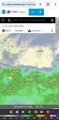
Just inside the "atomospheric river"
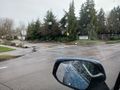
Turning left into the development
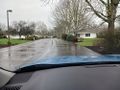
View from the hashpoint


Achievements
- 2023 is now tied for my year with the most successful expeditions.