Difference between revisions of "Slave Lake, Alberta"
From Geohashing
imported>Robyn (Maybe I can do it!) |
(per Renaming Proposal) |
||
| (24 intermediate revisions by 9 users not shown) | |||
| Line 1: | Line 1: | ||
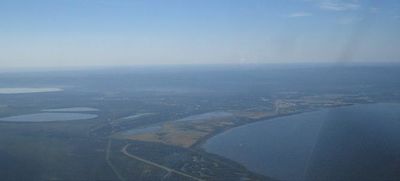
| + | [[Image:SlaveLake.JPG|thumb|400px|Aerial view of the southern portion of the Slave Lake graticule]] | ||
{{graticule | {{graticule | ||
| − | | | + | | lat= 55 |
| − | |nw | + | | lon= -114 |
| − | |n | + | | nw = [[Red Earth Creek, Alberta|Red Earth Creek]] |
| − | |ne | + | | n = [[Trout Lake, Alberta|Trout Lake]] |
| − | |w | + | | ne = [[Chipewyan Lake, Alberta|Chipewyan Lake]] |
| − | |e | + | | w = [[Utikuma Lake, Alberta|Utikuma Lake]] |
| − | |sw | + | | name = [[Slave Lake, Alberta|Slave Lake]] |
| − | |s | + | | e = [[Calling Lake, Alberta|Calling Lake]] |
| − | |se | + | | sw = [[Whitecourt, Alberta|Whitecourt]] |
| − | + | | s = [[Barrhead, Alberta|Barrhead]] | |
| + | | se = [[Athabasca, Alberta|Athabasca]] | ||
}} | }} | ||
| − | + | the {{PAGENAME}} [[graticule]] is at {{Today's location|lat=55|lon=-114|text=55, -114}}. There's Slave Lake, which has a small airport, and a highway. And there's part of Lesser Slave Lake. And mosquitoes. And bears. Also there is better Google Maps imagery for Ulaanbaator, Mongolia than for Slave Lake. Compare for yourself. | |
| − | |||
| − | |||
| − | |||
== Activities == | == Activities == | ||
| Line 23: | Line 22: | ||
*[[2008-08-15 55 -114|2008-08-15]] - Unsuccessful expedition by [[User:Robyn|Robyn]]. | *[[2008-08-15 55 -114|2008-08-15]] - Unsuccessful expedition by [[User:Robyn|Robyn]]. | ||
*[[2008-08-16 55 -114|2008-08-16]] - Robyn gets to within 0.22 nm of the geohash. | *[[2008-08-16 55 -114|2008-08-16]] - Robyn gets to within 0.22 nm of the geohash. | ||
| + | *[[2008-08-21 55 -114|2008-08-21]] - [[User:Robyn|Robyn]] goes all the way. | ||
| + | *[[2008-08-24 55 -114|2008-08-24]] - [[User:Robyn|Robyn]] and [[Robyn/Incredibly Crappy Walmart Bicycle|ICWB]] do it again. | ||
| + | *[[2008-08-26 55 -114|2008-08-26]] - [[User:Robyn|Robyn]] makes it a hat trick, without [[User:Robyn/Incredibly Crappy Walmart Bicycle|ICWB]]. | ||
| + | *[[2008-08-29 55 -114|2008-08-29]] - Another air hash from [[User:Robyn|Robyn]]. | ||
== Notable Events == | == Notable Events == | ||
*2008-08-19 - The hash is '''right on a road''' but it's 75 km away. | *2008-08-19 - The hash is '''right on a road''' but it's 75 km away. | ||
| − | *[[2008-08-21 55 -114|2008-08-21]] | + | *[[2008-08-21 55 -114|2008-08-21]] - First successful geohash in the graticule. |
| + | {{most active graticule | ||
| + | |||
| + | | graticule = Slave Lake, Alberta | ||
| + | | coordinates = 55 -114 | ||
| + | | month = August 2008 | ||
| + | | reached = true | ||
| + | | count = 4 | ||
| + | |||
| + | }} | ||
| + | {{Graticule unlocked | latitude = 55 | longitude = -114 | date = 2008-08-21 | name = [[User:Robyn|Robyn]]|image = 2008-08-21.Grin.JPG}} | ||
== Local Geohashers == | == Local Geohashers == | ||
| − | [[User:Robyn|Robyn]] | + | *[[User:Robyn|Robyn]] was here for the month of August 2008. |
| + | *[[User:Robyn/Incredibly Crappy Walmart Bicycle|ICWB]] remains here, but will not geohash again. | ||
[[Category:Alberta]] | [[Category:Alberta]] | ||
| − | [[Category:Inactive | + | [[Category:Inactive graticules]] |
| + | [[Category:Unlocked graticules]] | ||
Latest revision as of 11:37, 20 March 2024
| Red Earth Creek | Trout Lake | Chipewyan Lake |
| Utikuma Lake | Slave Lake | Calling Lake |
| Whitecourt | Barrhead | Athabasca |
|
Today's location: geohashing.info google osm bing/os kml crox | ||
the Slave Lake, Alberta graticule is at 55, -114. There's Slave Lake, which has a small airport, and a highway. And there's part of Lesser Slave Lake. And mosquitoes. And bears. Also there is better Google Maps imagery for Ulaanbaator, Mongolia than for Slave Lake. Compare for yourself.
Activities
If you are lucky enough to be in this graticule in mid-July, you can attend the Alberta Open Sandsculpture Championships.
Expeditions
- 2008-08-15 - Unsuccessful expedition by Robyn.
- 2008-08-16 - Robyn gets to within 0.22 nm of the geohash.
- 2008-08-21 - Robyn goes all the way.
- 2008-08-24 - Robyn and ICWB do it again.
- 2008-08-26 - Robyn makes it a hat trick, without ICWB.
- 2008-08-29 - Another air hash from Robyn.
Notable Events
- 2008-08-19 - The hash is right on a road but it's 75 km away.
- 2008-08-21 - First successful geohash in the graticule.
The Slave Lake, Alberta graticule (55 -114) earned the Mostly Active Graticule achievement
|
Robyn earned the Graticule Unlocked Achievement
|
