Difference between revisions of "2009-02-14 35 -76"
imported>FippeBot m (Location) |
m (Replacing http://wiki.xkcd.com/geohashing/Image:02_14_09_Viking_pirates_038.jpg with :Image:02 14 09 Viking pirates 038.jpg) |
||
| Line 8: | Line 8: | ||
==Report== | ==Report== | ||
| − | This Geohash was located in a field near the [http://www.fws.gov/pocosinlakes/ Pocosin Lakes National Wildlife Refuge] and promised a great opportunity to see wildlife and dress up as [ | + | This Geohash was located in a field near the [http://www.fws.gov/pocosinlakes/ Pocosin Lakes National Wildlife Refuge] and promised a great opportunity to see wildlife and dress up as [[:Image:02 14 09 Viking pirates 038.jpg|10th Century Scandinavian pirates]] (i.e. Vikings). We grabbed the easy [[2009-02-14_35_-77|N35 W77]] Geohash on the way east and after a quick stop at the Refuge Visitor’s Center in Columbia we headed south to Frying Pan Road. We knew a canal lay between the road and the hash, but we weren’t quite expecting the slimy death trap we encountered. We drove up and down the road looking for some entrance into the field (tractors had to get in there somehow), and we did find one - ½ mile (0.8km) north. But there were still 6 smaller, and equally slimy, canals separating the fields, which had to be crossed to reach the hash. |
Now, I’m an aging Brachiosaurus, a half-century old, and no longer agile and robust like today’s new race of super hashers. So bounding over deep canals with $300+ of electronic gear was a knee and ankle crushing proposition. But I’ve not traveled this far and looked this foolish to be thwarted by slimy, alligator-infested ditches. | Now, I’m an aging Brachiosaurus, a half-century old, and no longer agile and robust like today’s new race of super hashers. So bounding over deep canals with $300+ of electronic gear was a knee and ankle crushing proposition. But I’ve not traveled this far and looked this foolish to be thwarted by slimy, alligator-infested ditches. | ||
Latest revision as of 11:04, 19 February 2020
| Sat 14 Feb 2009 in 35,-76: 35.8253397, -76.1710255 geohashing.info google osm bing/os kml crox |
Report
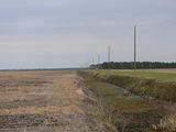
This Geohash was located in a field near the Pocosin Lakes National Wildlife Refuge and promised a great opportunity to see wildlife and dress up as 10th Century Scandinavian pirates (i.e. Vikings). We grabbed the easy N35 W77 Geohash on the way east and after a quick stop at the Refuge Visitor’s Center in Columbia we headed south to Frying Pan Road. We knew a canal lay between the road and the hash, but we weren’t quite expecting the slimy death trap we encountered. We drove up and down the road looking for some entrance into the field (tractors had to get in there somehow), and we did find one - ½ mile (0.8km) north. But there were still 6 smaller, and equally slimy, canals separating the fields, which had to be crossed to reach the hash.
Now, I’m an aging Brachiosaurus, a half-century old, and no longer agile and robust like today’s new race of super hashers. So bounding over deep canals with $300+ of electronic gear was a knee and ankle crushing proposition. But I’ve not traveled this far and looked this foolish to be thwarted by slimy, alligator-infested ditches.
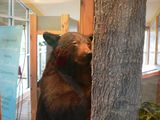
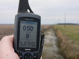
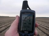
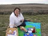
Bear watched (laughed) from the road as I leapt over the canals, proceeding from field to field. Bones, turtle shells, and the eerily singing power lines overhead added a foreboding atmosphere. Still, I reached the hash, took pictures, and made my way back, bouncing more like a limping Winnie the Pooh. Bear had the picnic prepared for us when I reached the crossing, and we enjoyed green tea and ham ‘n cheese sandwiches before heading west to the Pocosin Lakes National Wildlife Refuge.
Participants
Eisen & Bear - NCBears
Geological Features
Flat coastland wetlands and vast farms. Geohash was located near Pocosin Lakes National Wildlife Refuge, in field ~90m from edge of road.
Wildlife Encounters
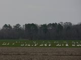
Whistling Swans, Wood Ducks, Blue Herrons, Great Horned Owl (heard at Pettigrew State Park), Canada Geese, Harrier Hawks, other smaller birds
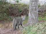
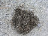
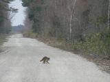
White tailed deer, Raccoon, Red Fox, Squirrels, domestic kitty cats. Saw lots of Black Bear scat and tree clawings!!
Weather
Low 60.2°F/15.7°C, clear skies, wind 5mph/8kph
