Difference between revisions of "2009-08-15 50 -1"
imported>Sermoa m (add a thumbnail to the location summary.) |
imported>Sermoa m (add achievement ribbons) |
||
| Line 80: | Line 80: | ||
Image:2009-08-15_50_-1_3276.JPG | coming home on the ferry, a view of Fawley power station as the sun was setting. | Image:2009-08-15_50_-1_3276.JPG | coming home on the ferry, a view of Fawley power station as the sun was setting. | ||
</gallery> | </gallery> | ||
| + | |||
| + | == Achievement ribbons == | ||
| + | |||
| + | {{Public transport geohash | ||
| + | | latitude = 50 | ||
| + | | longitude = -1 | ||
| + | | date = 2009-08-15 | ||
| + | | busline = a train, a ferry and three buses | ||
| + | | name = Sermoa and David | ||
| + | | image = 2009-08-15_50_-1_3265.JPG | ||
| + | }} | ||
| + | |||
| + | {{drag-along | ||
| + | | latitude = 50 | ||
| + | | longitude = -1 | ||
| + | | date = 2009-08-15 | ||
| + | | partner = David | ||
| + | | name = Sermoa | ||
| + | }} | ||
| + | |||
| + | {{Hashcard | ||
| + | | latitude = 50 | ||
| + | | longitude = -1 | ||
| + | | date = 2009-08-15 | ||
| + | | recipient = friends and family | ||
| + | | name = Sermoa | ||
| + | | image = 2009-08-15_50_-1_3264.JPG | ||
| + | }} | ||
| + | {{Picnic_geohash | ||
| + | | latitude = 50 | ||
| + | | longitude = -1 | ||
| + | | date = 2009-08-15 | ||
| + | | name = Sermoa, Macronencer and David | ||
| + | | food = brioche | ||
| + | }} | ||
| + | |||
| + | {{gratuitous ribbon | ||
| + | | color = #d6280f | ||
| + | | icon = Playing_card.jpg | ||
| + | | latitude = 50 | ||
| + | | longitude = -1 | ||
| + | | date = 2009-08-15 | ||
| + | | achievement = Card Game achievement | ||
| + | | description = playing cards at the geohash | ||
| + | | name = Sermoa, Macronencer and David | ||
| + | | image = 2009-08-15_50_-1_3256.JPG | ||
| + | }} | ||
| + | |||
| + | {{XKCD Centurion | ||
| + | | count = 2 | ||
| + | | name = Sermoa | ||
| + | }} | ||
Revision as of 22:15, 15 August 2009
| Sat 15 Aug 2009 in 50,-1: 50.5997355, -1.2830193 geohashing.info google osm bing/os kml crox |
Location
In a field near Bierley, Isle of Wight.
Participants
- Macronencer
- Sermoa
- David (first geohash!)
Plans
Macronencer plans to take the ferry from Southampton (obviously) but is not yet sure whether to cycle down to the hash or take a bus. Probably he will cycle, as he is still too fat and needs shrinking :|
Sermoa and David will take the train from Winchester to Southampton, the ferry from Southampton to West Cowes, the Number 1 Southern Vectis bus to Newport where we will probably stop for some lunch. Then we take the Number 6 bus towards Ventnor, getting off at Niton or Whitwell. We will probably have time to look around a bit. I want to get some geohashing postcards to send to people! The meetup will be at 4pm. We'll probably try to take some food in the hope of having a geohash picnic! Later on we might go to Blackgang Chine ... i particularly want to see the hedge maze there.
Note to others: you can pre-book train and ferry together from thetrainline.com. It was £12.10 from winchester, with a network railcard, £18.30 without.
Planning resources
Expedition
Sermoa and David
We met at Winchester train station at a few minutes to 11, picked up our prepaid tickets and boarded a (very crowded) train to southampton. From there we took the (even more crowded) (look, the bus is full, wouldn't it be a good idea to go now?!) free bus to the docks and soon we were on the ferry to the isle of wight!
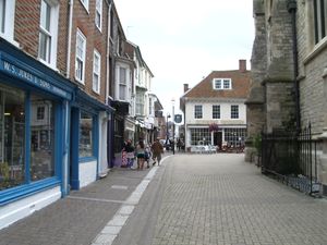
Having got over the shock of a day-rover bus ticket being £10 each, we were on our way down to Newport where we stopped for some lunch and a look around. Newport is the isle of wight's biggest town, which is not saying much at all. But it felt so exciting: because we had got there on a ferry it totally felt like we were in a completely different place. I caught myself marvelling that David's phone still worked - 'abroad' lol! We ate lunch at OGGIES chip shop. I bought some postcards.
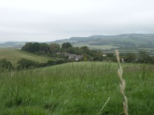
Having exhausted almost everything that Newport has to offer, we took another bus down to the south of the island. This is where you see the very best views. It's all hills, fields, sheep, sky and sea. Just beautiful. We were looking out for Mike every time we passed a cyclist, heheh!
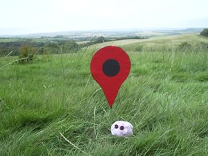
We came to Niton and got off the bus. We visited a little shop to get some picnic components and walked about half an hour up the road, stopping occasionally to take photos of the scenery and other random things. We arrived at the geohash field at about 15:45, just minutes after Mike had arrived from the other direction. We whooped with glee at the ease of access into the field and eagerly clambered over the stile (with mike's bike!) and followed the gps to the exact location. Whereupon we got straight to business planting the google pin, taking photos and videos, having a picnic, playing a card game, doing cartwheels, making music on the iphone and, most especially, marvelling at the phenomenal view from the hashpoint.
In summary: the Dow Jones was most excellently kind to us today! What a fantastic day!
Macronencer
Brief summary: Had a wonderful day, did about 65km of cycling which I haven't done for probably 25 years at least. The Isle of Wight is exceedingly hilly!! Due to the aforementioned, I don't feel like writing anything just yet as I'm exhausted. Suffice to say that it was the best Saturday meetup any of us could possibly have wished for! A detailed report will appear, along with photos and a tracklog. Watch this space!
Tracklog
There will be a tracklog soon from Macronencer
Photos
Sermoa playing The Lying Down Game.
Achievement ribbons
Sermoa and David earned the Public transport geohash achievement
|
Sermoa earned the Drag-along achievement
|
Sermoa earned the Hashcard achievement
|
Sermoa, Macronencer and David earned the Picnic achievement
|
Sermoa, Macronencer and David earned the Card Game achievement
|
Sermoa earned the xkcd Nullaturion achievement
|


