Difference between revisions of "Pyhäjärvi, Finland"
From Geohashing
imported>Fippe (Marking Pyhäjärvi, Finland as inactive, since there has been no activity in the last six months. If this was a mistake or you intend to geohash here, feel free to undo this edit.) |
m (Replacing Peeron with Geohashing.info) |
||
| Line 14: | Line 14: | ||
}} | }} | ||
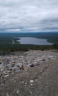
[[File:2017-06-22 67 27IMG 20170619 160625 1500px.jpg|200px|thumb|left|Pyhäjärvi]] | [[File:2017-06-22 67 27IMG 20170619 160625 1500px.jpg|200px|thumb|left|Pyhäjärvi]] | ||
| − | This graticule is located at [[67,27]]. | + | This graticule is located at [[67,27]]. {{Today's location|lat=67|lon=27}} |
[[Category:Inactive graticules]] [[Category:Finland]] | [[Category:Inactive graticules]] [[Category:Finland]] | ||
Revision as of 13:01, 15 January 2022
|
Latest Coordinates and Map Quick-Links | |
|---|---|
| Friday 2024-11-29 | 67.9938000, 27.7099028 |
| Hammastunturi | Inari | Raja-Jooseppi |
| Sodankylä | Pyhäjärvi | Savukoski |
| Vanttauskoski | Kemijärvi | Salla |
|
Today's location: geohashing.info google osm bing/os kml crox | ||
This graticule is located at 67,27. Today's location
The Pyhäjärvi graticule has been named after a lake of the same name. Half of the Pyhä-Luosto National Park (http://www.luontoon.fi/pyhaluosto) founded in 2005, is located in this graticule. The other half is in the Sodankylä graticule. Most of this graticule is part of the Pelkosenniemi municipality, which has unique Laplandic nature – an infinity of swamps, the golden surge of river Kemijoki, the force of river Kitinen and the soft song of river Luiro.
Local Geohashers
None
Meetups
- 1. 2017-06-22 Reached successfully by Pastori and The Wife
