Difference between revisions of "2012-01-05 52 1"
imported>Sourcerer m (→Links) |
imported>FippeBot m (Location) |
||
| Line 33: | Line 33: | ||
[[Category:Expeditions with photos]] | [[Category:Expeditions with photos]] | ||
[[Category:Coordinates reached]] | [[Category:Coordinates reached]] | ||
| + | {{location|GB|ENG|NFK}} | ||
Latest revision as of 01:57, 13 August 2019
| Thu 5 Jan 2012 in Norwich: 52.5589499, 1.3743233 geohashing.info google osm bing/os kml crox |
Contents
Location
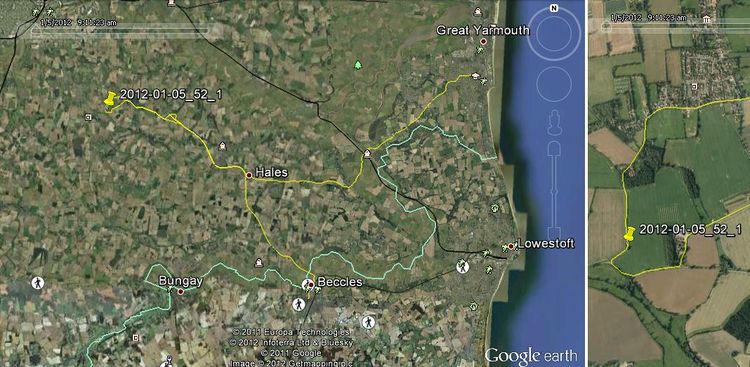
On Reeder's Lane between Poringland and Bergh Apton southeast of Norwich, Norfolk, UK.
Participants
Expedition
I altered my route to work and braved the morning traffic commuting to Norwich. It was a wild and windy day and there were fallen branches but, as ever, the chief risk was the other morons on the road. I had to emergency brake twice to avoid other clueless motorists who were probably late for work. Thankfully my normal commute is less busy. Twice thankfully I don't live near one of the big cities where the madness is much worse. The hashpoint was more or less on Reeder's Lane. Even sitting in the car, I was inside the circle of uncertainty. I got out and braved the wind and driving rain for a few seconds to get closer and have a look at the soggy mud and half dead winter vegetation in the stormy dawn twilight. Why do we do this? Getting up earlier was easy as my body clock has still not adjusted from Cyprus time back to Grenwich Mean Time.
Tracklog
Expeditions and Plans
| 2012-01-05 | ||
|---|---|---|
| Norwich, United Kingdom | Sourcerer | On Reeder's Lane between Poringland and Bergh Apton southeast of Norwich, N... |
| Sheffield, United Kingdom | Monty | Just off Park Spring Road/A6195, near Barnsley. |
Sourcerer's Expedition Links
2011-12-19 34 32 - 2012-01-05 52 1 - 2012-01-07 52 1 - KML file download of Sourcerer's expeditions for use with Google Earth.
