Difference between revisions of "2014-03-19 48 8"
imported>DODO |
imported>Jiml m (Typo fix) |
||
| Line 15: | Line 15: | ||
}} | }} | ||
| − | + | ||
__NOTOC__ | __NOTOC__ | ||
== Location == | == Location == | ||
| − | A path between Neuburg am Rhein and the | + | A path between Neuburg am Rhein and the French border. |
== Participants == | == Participants == | ||
| − | + | ||
| − | + | * [[User:DODO|DODO]] | |
| − | [[User:DODO|DODO]] | ||
== Plans == | == Plans == | ||
| − | + | ||
| − | It's | + | It's too far away from home to do it by bike or even bull this evening, as I can't start from home before 7 pm. And to go there by car violates my private fuel policy. But on the other hand, this graticule has just a 30 km<sup>2</sup> part of Rheinland-Pfalz, and whoever wants to reach a [[Regional geohashing achievement]] for Rheinland-Pfalz or even for the Kreis Germersheim or a [[Reverse regional achievement]] for this graticule simply has to go. |
So I plan to drive there by car this evening, starting around 7 pm. I'd be happy, if anyone wants to join me, I can offer a free ride from Speyer for up to 6 persons. I can also fetch you from the station in Germersheim or Wörth. | So I plan to drive there by car this evening, starting around 7 pm. I'd be happy, if anyone wants to join me, I can offer a free ride from Speyer for up to 6 persons. I can also fetch you from the station in Germersheim or Wörth. | ||
== Expedition == | == Expedition == | ||
| − | + | ||
I'm not proud of this. Just sitting in a car, driving for an hour, violating my own fuel policy and walk some 300 m (both ways) isn't exactly the spirit of geohashing for me, but anyway: this hash is to valuable to let it pass by. | I'm not proud of this. Just sitting in a car, driving for an hour, violating my own fuel policy and walk some 300 m (both ways) isn't exactly the spirit of geohashing for me, but anyway: this hash is to valuable to let it pass by. | ||
| − | Girlfriend and car came home an hour later than expected, and so I headed of at 8 pm. The way was more or less boring. 500 m of the hash I had to turn right to a dirt road which was drivable for 300 additional meters before it turned into a footpath in front of an airfield for model | + | Girlfriend and car came home an hour later than expected, and so I headed of at 8 pm. The way was more or less boring. 500 m of the hash I had to turn right to a dirt road which was drivable for 300 additional meters before it turned into a footpath in front of an airfield for model aircraft. |
| + | |||
| + | Following the footpath for another 150 m I reached the hash. Air was clear and fresh, The moon hasn't risen (it was half past eighth and moonrise is scheduled for 10 pm today), and so it was perfectly dark with only the stars bright above me. The hash was maybe one meter off the path, and was not clearly distinguishable in the dark. | ||
| + | |||
| + | Took some - almost horrible - photos, went back to the car and drove home again. | ||
| Line 45: | Line 48: | ||
== Tracklog == | == Tracklog == | ||
| − | + | ||
[http://www.gpsies.com/map.do?fileId=wiadbuzwbhcnyokr track] | [http://www.gpsies.com/map.do?fileId=wiadbuzwbhcnyokr track] | ||
== Photos == | == Photos == | ||
| − | + | ||
| − | |||
| − | |||
<gallery perrow="5"> | <gallery perrow="5"> | ||
Image:2014-03-19_48_8-1.jpg | Attention air-traffic | Image:2014-03-19_48_8-1.jpg | Attention air-traffic | ||
Revision as of 12:22, 25 March 2014
| Wed 19 Mar 2014 in 48,8: 48.9746244, 8.2364119 geohashing.info google osm bing/os kml crox |
Location
A path between Neuburg am Rhein and the French border.
Participants
Plans
It's too far away from home to do it by bike or even bull this evening, as I can't start from home before 7 pm. And to go there by car violates my private fuel policy. But on the other hand, this graticule has just a 30 km2 part of Rheinland-Pfalz, and whoever wants to reach a Regional geohashing achievement for Rheinland-Pfalz or even for the Kreis Germersheim or a Reverse regional achievement for this graticule simply has to go.
So I plan to drive there by car this evening, starting around 7 pm. I'd be happy, if anyone wants to join me, I can offer a free ride from Speyer for up to 6 persons. I can also fetch you from the station in Germersheim or Wörth.
Expedition
I'm not proud of this. Just sitting in a car, driving for an hour, violating my own fuel policy and walk some 300 m (both ways) isn't exactly the spirit of geohashing for me, but anyway: this hash is to valuable to let it pass by.
Girlfriend and car came home an hour later than expected, and so I headed of at 8 pm. The way was more or less boring. 500 m of the hash I had to turn right to a dirt road which was drivable for 300 additional meters before it turned into a footpath in front of an airfield for model aircraft.
Following the footpath for another 150 m I reached the hash. Air was clear and fresh, The moon hasn't risen (it was half past eighth and moonrise is scheduled for 10 pm today), and so it was perfectly dark with only the stars bright above me. The hash was maybe one meter off the path, and was not clearly distinguishable in the dark.
Took some - almost horrible - photos, went back to the car and drove home again.
Just stumbled over the "Tale of two Hashes"-Achievement and can't resist, as Neuburg/Newcastle seems a pretty good place. Well, there is
- You must issue a challenge when reporting a hash; don't challenge for hashes you've done in the past, and add the challenge ribbon to both this page and your hash report page.
but I think, two days of counts as reporting, doesn't it?
Tracklog
Photos
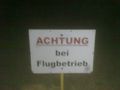
Attention air-traffic
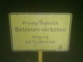
private property, no trespassing, Attention air-traffic
Proof

Obligatory
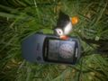
Dodo couldn't come with me, so I proofed that Pago was there


Achievements
DODO earned the Land geohash achievement
|
DODO achieved level 1 of the Minesweeper Geohash achievement
|
DODO issued a challenge for the Tale of Two Hashes achievement
|