Difference between revisions of "2017-04-04 50 11"
imported>Paintedhell |
imported>FippeBot m (Location) |
||
| Line 29: | Line 29: | ||
[[Category:Expeditions with photos]] | [[Category:Expeditions with photos]] | ||
[[Category:Coordinates reached]] | [[Category:Coordinates reached]] | ||
| + | {{location|DE|TH|SHK}} | ||
Latest revision as of 02:21, 16 August 2019
| Tue 4 Apr 2017 in 50,11: 50.8483098, 11.8678459 geohashing.info google osm bing/os kml crox |
Location
In the forest near St. Gangloff, East Thuringia.
Participants
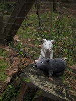
- Juja, Benjy and Frankie Mouse
Expedition
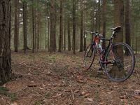
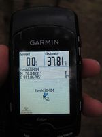
Today was my birthday, so I was not working and had lots of free time that I wanted to spend on my bike, and having a Geohash in reasonable distance for a tour was a nice extra! So I started cycling after breakfast, the weather was dry but grey with occasional drizzle, not too bad but also not photogenic at all. I went to the point using a forest path I saw on OSM and got off my bike at 44m distance. Not bad. But there was a small patch of forest with a fence around it, just where the Geohash might be... well, I approached it from one side, saw the Geohash in 20m distance, then circled the fence and hoped the other side would be 20m (or less) away. Luckily, I got within GPS accuracy on the other side of the fence, and as the fence was in the way for wild GPS dances I just waited for the signal to eventually drift and show me the precious 0m screen. Reached, then went on home via some nicer routes, returning after 102km and almost dry, minutes before some real rain started - lucky me!
Photos
|
Achievements
Juja earned the Birthday Geohash Achievement
|


