Difference between revisions of "Template:Expeditions/2008-06-12"
From Geohashing
imported>JackTheRippah |
imported>Tjtrumpet2323 m (Replacing page with '== {{date link|2008-06-12}} == {{:2008-06-12}}') |
||
| Line 1: | Line 1: | ||
| − | + | == {{date link|2008-06-12}} == | |
| − | + | {{:2008-06-12}} | |
| − | |||
| − | |||
| − | |||
| − | |||
| − | |||
| − | |||
| − | |||
| − | |||
| − | |||
Latest revision as of 14:07, 13 June 2008
Thursday 12 June 2008
Coordinates
West of -30°: 0.511448896121, 0.633266302008
East of -30°: 0.790670603195, 0.33553275755
Expeditions
- 2008-06-12 55 13 - The point in the Malmö graticule is on a gravel road south of Eslöv. Only 20 mins by car from HannesL's home in Lund and VERY accessible! Me and David are most probably going. [http://kartor.eniro.se/query?
- 2008-06-12 47 -122 - East Port Orchard, just blocks from Cosmo's Deli.
- 2008-06-12 45 -73 - Matt and Jack discovered the Head Office of the National Body Building Federation at today's graticule in Montréal.
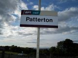
- 2008-06-12 55 -4 - Patterton Railway Station just south of Glasgow, visited by James at 7:40 pm local time.
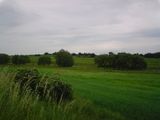
- 2008-06-12 47 19 The location for the Budapest graticule was in a valley amongst pretty slopes of wheat fields, close to a beautiful lake. Me and Tom (probably the only two geohashers in the whole country) accessed the place at 18:45 local time. First geohash in Hungary! --Dem
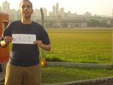
- 2008-06-12 -23 -46 São Paulo, Brazil - Inside the Campo de Marte airport, in the civilian-accessible part. Hands-down the most centrally located and easily reachable in our graticule so far, reached around 4:30 PM local time by Brunoparga.
- 2008-06-12 50 16 – Jajcuś has nearly reached the point in Wałbrzych, Poland.
- Newark, New Jersey - Jevanyn claims "closest so far" (but he never went to the spot) for a Cubicle Geohash, with the location only three miles from where he works. Discussion is on Talk:Cubicle Geohash.
Photo Gallery
Add your own photo for Thursday 12 June


