Difference between revisions of "2020-02-17 54 12"
(New Expedition) |
m (Location correction) |
||
| Line 69: | Line 69: | ||
{{Expedition summaries|2020-02-17}} | {{Expedition summaries|2020-02-17}} | ||
| − | {{Location|DE|MV| | + | {{Location|DE|MV|VR}} |
[[Category:Expeditions]] | [[Category:Expeditions]] | ||
[[Category:Expeditions with photos]] | [[Category:Expeditions with photos]] | ||
[[Category:Coordinates reached]] | [[Category:Coordinates reached]] | ||
Revision as of 17:49, 19 February 2020
| Mon 17 Feb 2020 in Rostock, Germany: 54.0689695, 12.8909013 geohashing.info google osm bing/os kml crox |
Location
In the edge of a field in Gransebieth, VR, MV, Germany.
Participants
Plans
Going there with the bus. Go to Kirch-Baggendorf, walk to the hash, back to Kirch-Baggendorf, and take the bus back home. Easy peasy.
Expedition
So, today I went to visit my western neighbour graticule to report my first regular expedition here (without counting the retro I did a few months ago).
I probably chose to go after this one because I had a Columbian friend who used to live in Kirch-Baggendorf, and I thought it would be nice to re-visit this little village again. Not having a car and not having time to go there by bike, I chose to take the bus there. Direct, no transfers, which saves time.
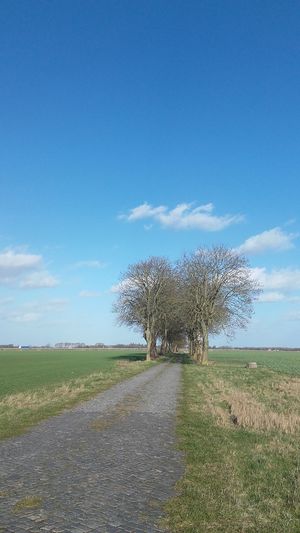
Once there I only had to walk there. Easy plan. The only thing is that it was very windy. Here in the north it is usually windy, but today it was a little more. I thanked me not to be there with my bike, I really hate to bike against the wind. It's like you can't get forward.
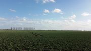
A few kilometers later I was already in the hash field. Some trucks lanes lead me gently to the precise hashpoint without damaging the corps. Again, you wouldn't guess it, it was a sugar-beet field, what a surprise (as in here, here, here...).
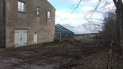
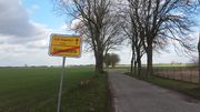
Then I visited the few houses which make Gransebieth. 2/3 streets with some houses en each side and some farms. Actually, some of them looked like abandoned. Actually it was quite funny, there was this big cowshed, which looked old and abandoned but its roof was full of solar panels. The old and the new. There in Gransebieth I also looked for some random coordinates, that I also seek: in this case, some palindromic coordinates. Since I was there and had the time...
There I had this kind of realisation of the randomness of all of this. There I was, in a complete random village of a name I will forget, almost as a tourist, seeking some coordinates the internet told me search. And it was a place I am pretty sure I would have never been to. I mean, if some the people living there told me what I was doing there, and told them that, the internet told me to be here. Such a weird beauty I found in that thought.
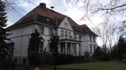
After that I went back to Kirch-Baggendorf, but I still had some time before the bus came. So I went to visit the church. Walked there for a while, took some pictures, and right on time I was again in the bus stop. Ready to go back home.
Tracklog
Photos
|
Achievements
SastRe.O earned the Land geohash achievement
|
SastRe.O earned the Public transport geohash achievement
|
SastRe.O achieved level 2 of the Minesweeper Geohash achievement
|
Almost Hash collision achievement, in direct line of sight, but not close enough (~150m) and I did not find the cache (since it was a T5 and I had no equipment to climb trees).
Other Geohashing Expeditions and Plans on This Day
Expeditions and Plans
| 2020-02-17 | ||
|---|---|---|
| Frankfurt am Main, Germany | GeorgDerReisende | The hash lay besides the cycle path at the junction of B 45 and L 3416 east... |
| Rostock, Germany | SastRe.O | In the edge of a field in Gransebieth, VR, MV, Germany. |
