Difference between revisions of "2011-02-22 51 11"
m (Replacing http://wiki.xkcd.com/geohashing/File:Track110222_51_11.png with :File:Track110222 51 11.png) |
m (Replacing tracklog = File:Track110222 51 11.png with tracklog = {{canonicalurl:File:Track110222 51 11.png}}) |
||
| Line 36: | Line 36: | ||
== Achievements == | == Achievements == | ||
Unbelievable, but I did not have this one yet: | Unbelievable, but I did not have this one yet: | ||
| − | {{Tron | latitude = 51 | longitude = 11 | date = 2011-02-22 | name = [[User:Paintedhell|Juja]] | tracklog = | + | {{Tron | latitude = 51 | longitude = 11 | date = 2011-02-22 | name = [[User:Paintedhell|Juja]] | tracklog = {{canonicalurl:File:Track110222 51 11.png}} | possessive = her}} |
As if that makes the whole thing any less stupid. | As if that makes the whole thing any less stupid. | ||
Latest revision as of 12:48, 19 February 2020
| Tue 22 Feb 2011 in 51,11: 51.0047060, 11.5717984 geohashing.info google osm bing/os kml crox |
Location
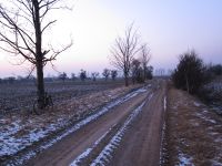
Near Stobra, next to a road (or a fieldway at least). Anyway, everything should be frozen by now, so dirt doesn't matter.
Participants
Plans
Juja will cycle there after work and should arrive at the point between 5:30 and 6 pm, hopefully with a body heat above 30°C.
Expedition: Juja
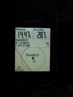
After I had finished work a little early, I started my bike trip from Jena, in the sunshine but still at about -10°C. For the warm-up, I cycled up to Cospeda (which is nearly 200m above Jena) through the remains of this morning's snowstorm (my front derailleur was frozen at the beginning, but things like this just add to the challenge). After that sweaty experience it got worse: flat roads or even descents! I had a great sunset, but at Altengönna I first thought this could have been a rather bad idea. Still, I reached the Geohash point without further problems shortly before 6 pm, took some photos of the place and Hasi, my long-eared companion (of course I had to change the battery in this f***ing cold... but at least I had a charged one with me!), marked the road with chalk and snow (only possible because it was frozen so hard) and then tried the fieldway to Nerkewitz, which was okay considering it was frozen hard like asphalt (only not so even). In Rödigen the next challenge was waiting: it got dark, so i had to get my bike lights out of the backpack with my frozen fingers - not as easy as it sounds... and on the way up to Rödigen, where I got warm again, my fingers slowly and painfully defreezed and made me wish to die on this very spot. Anyway, I survived (also the even colder descent down to Jena), had some hot tea, went to warm-up sports and now I'm up and alive again! Lessons learned: no biking below -5°C... tomorrow. ;)
Expedition: Reinhard
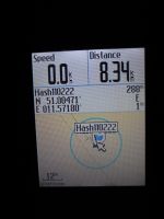
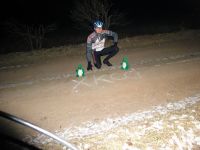
After Reinhard had finished work and driven home to Cospeda he got ready for the short bike trip (8 km each direction) to the hashpoint near Stobra. When he got there shortly before 7 p.m. he noticed that someone has marked the spot with xkcd chalk letters. After taking two photos with two accompanying dragons he rode back to Cospeda. Since it was about -10°C, he was glad that he didn't have to do the trip from Jena which is 200 m lower and would have meant several additional kilometers.
Photos
|
Achievements
Unbelievable, but I did not have this one yet:
Juja earned the Tron achievement
|
As if that makes the whole thing any less stupid.


