Difference between revisions of "2009-10-14 52 13"
From Geohashing
imported>Relet m |
imported>Relet |
||
| Line 24: | Line 24: | ||
<gallery perrow="4"> | <gallery perrow="4"> | ||
| − | + | Image:200910145213-P1050189.JPG | Near the hash, facing west | |
| + | Image:200910145213-P1050190.JPG | Near the hash, facing south | ||
| + | Image:200910145213-P1050191.JPG | Near the hash, facing north (the camera, that is) | ||
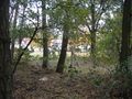
| + | Image:200910145213-P1050192.JPG | At the hash | ||
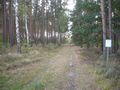
| + | Image:200910145213-P1050193.JPG | Not much of a sight | ||
| + | Image:200910145213-P1050194.JPG | Geobottle | ||
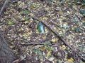
| + | Image:200910145213-P1050195.JPG | Left a mark | ||
| + | Image:200910145213-P1050196.JPG | What, a sperical tree? | ||
| + | Image:200910145213-P1050197.JPG | Indeed. | ||
| + | Image:200910145213-P1050199.JPG | Prominent quench water fountain | ||
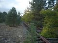
| + | Image:200910145213-P1050200.JPG | Rails | ||
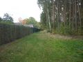
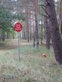
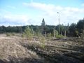
| + | Image:200910145213-P1050201.JPG | Double fence guarding the airport | ||
</gallery> | </gallery> | ||
Revision as of 18:07, 14 October 2009
| Wed 14 Oct 2009 in 52,13: 52.1642309, 13.3248563 geohashing.info google osm bing/os kml crox |
Location
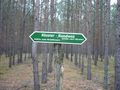
- A piece of forest near Alexanderdorf. They have a monastery there, and a disused Soviet airport further to the south.
Participants
Plans
- ---
Expedition
Tracklog
Photos
Near the hash, facing west
Near the hash, facing south

Near the hash, facing north (the camera, that is)

At the hash
Not much of a sight
Geobottle
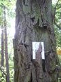
Left a mark
What, a sperical tree?
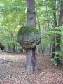
Indeed.
Prominent quench water fountain
Rails
Double fence guarding the airport


