Difference between revisions of "2013-12-29 31 35"
imported>LiNaK |
imported>LiNaK |
||
| Line 70: | Line 70: | ||
| date = 2013-12-29 | | date = 2013-12-29 | ||
| name = [[User:LiNaK|Omri]] | | name = [[User:LiNaK|Omri]] | ||
| − | | image = | + | | image = 2013-12-29_31_35_dino.jpg |
}} | }} | ||
| Line 79: | Line 79: | ||
| date = 2013-12-29 | | date = 2013-12-29 | ||
| name = [[User:LiNaK|Omri]] | | name = [[User:LiNaK|Omri]] | ||
| − | | image = | + | | image = 2013-12-29_31_35_us.jpg |
}} | }} | ||
| Line 88: | Line 88: | ||
| date = 2013-12-29 | | date = 2013-12-29 | ||
| name = [[User:LiNaK|Omri]] | | name = [[User:LiNaK|Omri]] | ||
| − | | description = | + | | description = in at a holy mountain, next to the Holy City, at the Holy Land, to more than one religion |
| − | | image = | + | | image = 2013-12-29_31_35_church.jpg |
}} | }} | ||
Revision as of 20:23, 30 December 2013
| Sun 29 Dec 2013 in 31,35: 31.7846778, 35.1664268 geohashing.info google osm bing/os kml crox |
Location
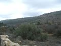
At the forest right next to the road leading to Beit Zait, a small town on a hill facing Jerusalem.
Participants
Lilac
Plans
Bike to Lilac at Kiryat Ono, take a bus to Bar Ilan Bridge, another bus to Har'el Junction, and than another one to Ramat Motsa. From there we'll walk through the forst (or along the road) to Beit Zait. And than take three more buses home. And if we'll be lucky it won't even rain...
Expedition
Photos
The map we used.

Snow! In Israel!
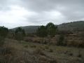
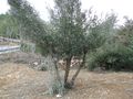
Along the road.
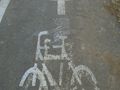
We don't know who did this, but that is so cute!
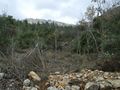
The road was longer than we expected.
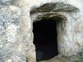
We found a cave!
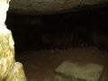
Inside the cave.
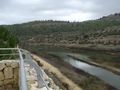
We found a river!
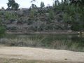
Walking along the river.
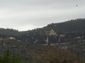
Moscovia Monastery and the Catholic Church of St. John the Baptist.
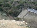
The useless dam.
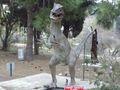
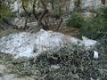
A Velociraptor attacking us!

Oh no! More Velociraptors!
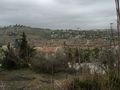
View from Beit Zait.
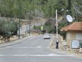
Finally! The hashpoint!
The hashpoint itself.
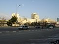
You can see Jerusalem from the hashpoint.
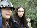
Lilac and Omri at the coordinates.
Snow in Jerusalem.
Didn't have time to take more photos in Jerusalem. Sorry.
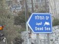
Dead Sea-watch out! Someday we're gonna geohash in you and win the lowest geohash achievement. And it'll be awesome!


Achievements
Omri earned the Velociraptor Geohash Achievement
|
Omri earned the Holy hash achievement
|