Difference between revisions of "Tooele, Utah"
From Geohashing
imported>Moose Hole m (Updated neighbor) |
imported>Moose Hole m (Updated neighbor) |
||
| Line 6: | Line 6: | ||
|w = [[Bonneville Salt Flats, Utah]] | |w = [[Bonneville Salt Flats, Utah]] | ||
|e = [[Salt Lake City, Utah]] | |e = [[Salt Lake City, Utah]] | ||
| − | |sw = | + | |sw = [[Partoun, Utah]] |
|s = | |s = | ||
|se = | |se = | ||
Revision as of 17:43, 30 June 2008
| Park Valley, Utah | Clearfield, Utah | Ogden, Utah |
| Bonneville Salt Flats, Utah | Tooele, Utah | Salt Lake City, Utah |
| Partoun, Utah | – | – |
[[Category:Meetup in {{{lat}}} {{{lon}}}| ]]
The Tooele, Utah graticule is at latitude 40, longitude -112.
Activities
Notable Events
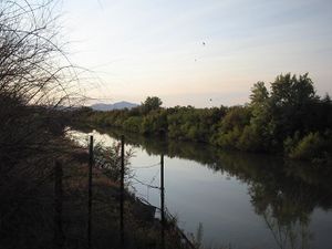
2008-06-14 Robyn got within a mile of the hash, in a small lake north west of the airport, but a wide ditch named Goggin Drain barred the way.
