Difference between revisions of "2009-02-22 36 -77"
m (Replacing http://wiki.xkcd.com/geohashing/Image:07_09_06_Deja_vu_Bear_001.jpg with :Image:07 09 06 Deja vu Bear 001.jpg) |
m (→Achievements) |
||
| Line 52: | Line 52: | ||
Image:Police2.png|[[Police_Geohash|Park Ranger Ed Geohash]] | Image:Police2.png|[[Police_Geohash|Park Ranger Ed Geohash]] | ||
Image: Wet_cat.JPG|[[ Drowned_Rat_Geohash|Drowned Rat Geohash]] | Image: Wet_cat.JPG|[[ Drowned_Rat_Geohash|Drowned Rat Geohash]] | ||
| − | Image:Preminitionicon.PNG| | + | Image:Preminitionicon.PNG|Premonition Geohash |
Image: Dejavu.png|[[D%C3%A9j%C3%A0_Vu_Geohash|Déjà vu Geohash Honorable Mention]] | Image: Dejavu.png|[[D%C3%A9j%C3%A0_Vu_Geohash|Déjà vu Geohash Honorable Mention]] | ||
Image:Consecutivegeohash.jpg|[[Consecutive Geohash|2nd Consecutive Geohash]] | Image:Consecutivegeohash.jpg|[[Consecutive Geohash|2nd Consecutive Geohash]] | ||
Latest revision as of 19:34, 5 March 2020
| Sun 22 Feb 2009 in 36,-77: 36.2803137, -77.8701622 geohashing.info google osm bing/os kml crox |
Report
Today’s hash was located in the north east portion of Medoc Mountain State Park. We are frequent visitors to this park, doing volunteer work and hiking on and off the trails 2-3 times a month. In fact, we were planning to attend a Park program yesterday, but the Alligator River NWR Geohash was simply too good to pass up.
Even more incredible is the fact that we were planning to hike into this part of Medoc this weekend to search for an old homestead. So we were thrilled and somewhat in awe to discover that today’s coordinates landed in the very area we planned to visit. Surely this deserves a "Premonition Geohash Achievement"...so we made one up by modifying the Cubicle Geohash Icon.
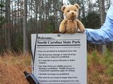
When we pulled into the parking area at the Visitor Center, Ed, a Park Ranger we’ve known for years, walked over to greet us. Little did he know that he had become an unsuspecting pawn in our Police/Park Ranger Geohash Achievement. Ed even offered to leave the Center’s bathrooms unlocked for us, proving that Medoc Mountain is the best State Park in North Carolina.
We had originally planned a No-Batteries hike from the Visitor Center, across the Bear Swamp Creek bridge, and then cross country 2+ miles/3.2km, to the homestead area/Geohash. We’d been this way before last year, to within at least a ½ mile of the hash area. But the cold rain and wind were a real concern – we’re not of the weather-hardened caliber of The Ru or the fearless youthfulness of…well, almost all the other hashers. So, after hiking in a kilometer and getting wetter and colder by the second, we decided to abandon the death march and drive north and park to within about 0.25 miles/0.4km from the hash.
We parked along the edge of the road and headed out again the pouring down rain. After a quick survey of the homestead, we hiked further southwest into the woods and crossed a stream before climbing the hill to the Geohash. The GPS had a hard time staying locked on through the rain and dense trees, but we managed to get there. Bear wisely suggested we could do the Picnic Geohash back in the truck.
Participants
Geological Features
Medoc Mountain State Park, hilly and wooded terrain with numerous streams and outcroppings. Old growth hardwoods and pines.
Wildlife Encounters
Sightings - Geese, ducks, swans, sea gulls(!?!), song birds, domestic cats, goat.
Other - Coyote (heard howl!), Bobcat prints, deer prints, domestic dog prints (these are from hunting dogs who were running on the State Park yesterday as part of “field trials”…grrrr!!!)
Weather
Low 41.7.0°F/5.4°C, rain, winds steady 5+mph/8+kph gusting to 12mph/19kph


