Difference between revisions of "2022-04-12 40 -3"
m (Location) |
(→Plans) |
||
| Line 18: | Line 18: | ||
The [https://goo.gl/maps/1ykgRQzfm51hwxLj7 Streetview] showed the geohash | The [https://goo.gl/maps/1ykgRQzfm51hwxLj7 Streetview] showed the geohash | ||
behind a closed gate and it looked not accessible to me. However, it would be | behind a closed gate and it looked not accessible to me. However, it would be | ||
| − | short motorcycle ride, less than half an hour, and I could do some shopping and | + | a short motorcycle ride, less than half an hour, and I could do some shopping and |
pick up something for dinner on the way back, so I decided to give it a try. | pick up something for dinner on the way back, so I decided to give it a try. | ||
There were rain showers that day, so I took “die Krähe”, the | There were rain showers that day, so I took “die Krähe”, the | ||
| − | bike with roof and windshield wiper. | + | bike with roof and windshield wiper, like last time in expedition |
| + | [[2022-03-11_40_-4]]. | ||
== Expedition == | == Expedition == | ||
Latest revision as of 06:01, 15 April 2022
| Tue 12 Apr 2022 in 40,-3: 40.4340560, -3.9231949 geohashing.info google osm bing/os kml crox |
Location
In a (dry) creek at the outskirts of Boadilla del Monte.
Participants
Plans
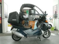
The Streetview showed the geohash behind a closed gate and it looked not accessible to me. However, it would be a short motorcycle ride, less than half an hour, and I could do some shopping and pick up something for dinner on the way back, so I decided to give it a try. There were rain showers that day, so I took “die Krähe”, the bike with roof and windshield wiper, like last time in expedition 2022-03-11_40_-4.
Expedition
“Die Krähe” was low on fuel, so I first topped her off. It took 6.30 liters, which at a price of 1.769 €/liter would amount to 11.30 €, however, in Spain there was currently a discount of 25 cts/liter, 20 cts paid by the state and 5 cts paid by the oil company. Thus I had to pay only 9.70 €.
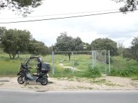
After a short ride with a bit of rain I arrived at the gate I had seen in Streetview. It's two large wings were indeed closed and locked with a chain, but the small wing was open!
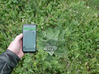
It was only a short stroll of about 30 meters until I reached the geohash. This was really an easy one.
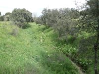
This was a final view from the gate back to the geohash. It was at the bottom of the creek bed, slightly left of the center of the photo.
On the ride home, I picked something up for dinner and did the shopping as planned. Not a very spectacular expedition, but after the laborious last one 2022-04-02_40_-4, I enjoyed it.


