2012-12-23 26 -80
| Sun 23 Dec 2012 in Belle Glade, Florida: 26.5585921, -80.5100048 geohashing.info google osm bing/os kml crox |
Expedition
The Plan
In the sugar farms southeast of Lake Okeechobee.
The Geohashers
- Geoff
- Geoff's Dad
The Adventure
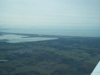
Turning south from Fort Pierce, the turn towards Lake Okeechobee was interesting. First of all, it gives an idea of scale for how incredibly large Lake Okeechobee is. The patron saint of knowledge, Wikipedia, lists it as the second largest freshwater lake contained entirely within the continental US, and that fact doesn't really sink in until you're flying in a small airplane and realize you can't really see the other end.
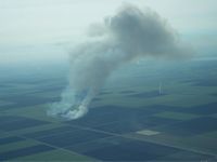
The other bit that was interesting was all the sugar farms in flames. Okay, slight exaggeration, we didn't see flames. We did see giant plumes of smoke coming from some of them, and after we had hit the hash and turned west, we could see some of the smoke floating around like clouds, the result of the controlled fires over the past several days without the wind dissipating them. (Is that grammatically proper? Who cares, I'm sure you got it.)
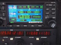
At this point, Dad was getting a little more comfortable with the idea of geohashing. Instead of using the visual GPS and only switching to coordinates within the last nautical mile or so, we switched out earlier, got onto the northern line, and continued south until we hit it. Geohashing: Good IFR training?
Once again, no card left here. We turned west to go back home, but not before paying Lehigh Acres a visit.
Gallery
- Photo Gallery
Achievables
Geoff earned the Air geohash achievement
|


