Category:Regional geohash map
From Geohashing
Revision as of 17:05, 26 September 2011 by imported>Dvdllr (irc --> carabiner)
The pages linked here show maps or other pictorial representations of the graticules in selected regions. Users have created them while working towards the Regional Geohashing achievement or for other wiki work. You're welcome to make your own, for any size of region.
To see a simple list of all the named graticules in your region, visit the All Graticules page. To see the names on a google map interface, click on the Coordinate Calculator.
Pages in category "Regional geohash map"
The following 155 pages are in this category, out of 155 total.
A
C
- Regional geohashing maps/Canada1
- Regional geohashing maps/Canada2
- Regional geohashing maps/Canada3
- Regional geohashing maps/Chile1
- Regional geohashing maps/Chile2
- Regional geohashing maps/Chile3
- California
- California/Counties
- California/Southern California
- Chad
- Colorado
- Connecticut
- Croatia
- Cyprus
- Czechia
M
N
- National Radio Quiet Zone
- Nebraska
- Nepal
- Netherlands
- Nevada
- New Brunswick
- New Hampshire
- New Jersey
- User:Jevanyn/New Jersey
- New Mexico
- New York
- Regional Geohash areas of New Zealand
- North American Graticules
- North Carolina
- North Dakota
- North Macedonia
- Northern Cyprus
- Northern Ireland
- Norway
- Nova Scotia
S
Å
Media in category "Regional geohash map"
The following 11 files are in this category, out of 11 total.
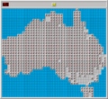
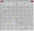
- AUS virgin grats.png 680 × 626; 69 KB
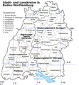
- Danatar-regio-DE-BW.png 232 × 242; 2 KB
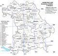
- Danatar-regio-DE-BY.png 232 × 242; 2 KB
- Danatar-regio-DE-SN.png 200 × 210; 2 KB
- Districts EU-DE-BW.png 575 × 624; 146 KB
- Districts EU-DE-BY.png 643 × 620; 148 KB
- Districts EU-DE.png 1,650 × 2,067; 266 KB
- TexasRegionalMap Neimster.png 280 × 290; 2 KB
- XXOs regiohashing au sa.png 680 × 626; 22 KB
- ZettS regional Dadm1.png 1,653 × 2,338; 768 KB
- ZettS regional Dadm3.png 1,653 × 2,338; 1.53 MB
