2009-04-23 48 -122
An overnight bicycle camping geohash involving a ferry, an international border, deer, and many, many hills.
| Thu 23 Apr 2009 in Bellingham: 48.6592781, -122.7917673 geohashing.info google osm bing/os kml crox |
Location
In woods of unknown ownership on a hilltop near Doebay on Orcas Island. Orcas is a horseshoe-shaped island in the Strait of Juan de Fuca, between Washington State in the US and Vancouver Island in Canada. It is accessible via ferry from Anacortes, Washington.
Planning
The 235 km each way bike trip from Vancouver was more than Robyn wanted to tackle, so she decided to drive across the US border to park at Anacortes, the ferry terminal. Consultation of the ferry schedule revealed that she could leave immediately, take the special express lane at the border, and just make the 12:05 ferry, or leave at noon and have time to pick up Rhonda, go through the normal border lane (because Rhonda hasn't had the background checks required for the express lane), and arrive in time for the next ferry, the 3:30.
That was kind of late in the day, and the only available return ferry was at 8:05 p.m. It was unlikely we'd be able to bike 66 km and climb up and down a mountain in time to catch that return ferry, so the plan was to bring a tent.
Specifically:
- Take 3:30 ferry from Anacortes to Orcas (arrive Orcas 4:45)
- Bike 33 km to Point Lawrence Road
- Hike 1.5 km up hill to geohash
- Camp!
- Bike back to ferry terminal for 10:20 am ferry
- Arrive Anacortes 11:40 next day
How hard can that be? A 33 km bike ride is a warm-up, really. Robyn had biked 87 km the day before and while the hill was high, it was not the highest point on the island.
Expedition
Robyn
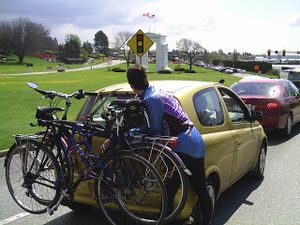
I printed out the best Orcas Island maps I could find and wrote out turn by turn directions to the geohash. I found and attached my bike rack to car using about eight thousand different straps, pointing in all directions, as per the instructions. I attached my bike to bike rack using two teeny little Velcro straps provided and a couple of cargo tie-downs. Then I threw tent, dinosaur, sleeping bag geohashing knapsack and other random camping-related items that I thought might fit in my bicycle panniers into the left side of the back of the car. And then I drove to the SkyTrain to pick up Rhonda.
Rhonda
I broke my rule about not checking the day's location until after I did my morning exercise, and saw Robyn posting about going to Orcas Island for a bike hash. A brief flurry of discussion on the talk page ensued, and I scrapped my planned run, packed camping gear into bike bags, and ran for the seabus, making it on with under a minute to spare.
I had never been to Orcas Island, or any of the San Juan Islands, before, so I really had no idea what to expect. But, Robyn said it should be a fairly light trip with only 32km of cycling each way. No problem.
As I stepped off the skytrain to meet Robyn, I looked around for her car and then saw her, standing on the corner across the street in her distinctive purple cycling jacket. I waved then carefully walked my bike down the stairs from the station and across the street to join her.
Driving to Anacortes
We drove across the Alex Fraser bridge (hey, I was just here) and then merged onto highway 99 (hey, I was just here, too), towards the United States. The programmable sign indicated that southbound border crossing times were 50 minutes at the Peace Arch and 30 minutes at the Pacific crossing, so Robyn took the exit right before the sign for the Pacific crossing. Yeah, right before. You're supposed to take exits after signs. Never mind, Robyn figured she could get onto the overpass to the Pacific crossing from there.
Sure enough, the off-ramp led toward a traffic circle with branches going off in all directions.
"Peace Arch is straight through!" Rhonda said after reading the sign, and Robyn took that exit from the traffic circle.
Right after it wasn't possible to abort and get back into the circle, we both realized that we didn't want the Peace Arch crossing.
But, we were stuck with it, so we shrugged and got into the lineup behind a stalled car and a truck giving it a boost with the jumper cables. Fortunately the car-batching light was red, so that wasn't actually holding us up, just holding us back about three car lengths from the regular stop line. We shut off the engine to wait, because this is genuinely the longest red light ever.
About half an hour or so later, the light turned green and the batch of cars we were in turned on their engines and joined the regular inching-forward lineup.
Robyn attempted to explain the game of geohashing to the border guard, who seemed somewhat baffled that we didn't know if we were coming back that night or the next day and didn't seem to care. He asked about fresh fruits and vegetables, which Robyn assured him consisted of a banana she ate in the lineup, then waved us on without a search. As we drove into the US, Rhonda suddenly remembered that she had packed fresh fruit in her bag as part of her food contribution to the trip.
The road dropped us down the I-5 exit ramp into Blaine (hey, we were both just here!) and after turning onto the Blaine main street, turning around, and getting onto the I-5 southbound onramp with the "end detour" sign directly across the street from the exit ramp we had just been on, we were on our way.
Because we had crossed the border in good time, we decided to take highway 20 for the scenic route, going through twisty forest mountain roads, then open straight farmland roads, then past a power station, before rejoining I-5 heading for Anacortes.
The signs pointed the way, and we very quickly found ourselves at the ferry terminal. In the lanes approaching the ticket booths, in fact. Rhonda spotted a parking lot to the right and down a slope, so Robyn turned around in the (empty) ticketing lanes and back to the parking lot entrance ramp.
We had all of our stuff arranged on the bikes and the car locked up with its parking paid for as the loudspeaker splattered the announcement for our ferry all over the ferry terminal. We looked left, right, and straight at the ticket booths, and opted to ride back up the entrance ramp rather than try to lift our bikes up the rather long flight of stairs or chance the gravel end of the lot that may or may not connect with the terminal beyond the ticket booths.
The ticket agent assured us that there was no extra charge for dinosaurs on the ferry, and we rode past all the cars lined up in tidy rows to the pedestrian waiting area to board ahead of the cars. Way down at the far end of the ferry were bicycles stencilled on the wall and short ropes to tie the bikes down. Robyn also put a wheel chock in front of her bike's wheel. Then we went up to get some food and enjoy the trip to Orcas Island.
Orcas Island
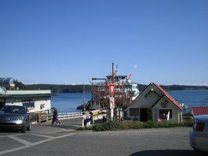
We offloaded at Orcas, up the ramp and across a crosswalk, marshalled by a cheerful guy in a reflective vest, whose job it was to keep the cars from running into the pedestrians and bikes as they all tried to get off the ferry onto the island. We checked the security of our gear, made sure our GPS receivers were set, and then when the ferry traffic was gone, we started riding.
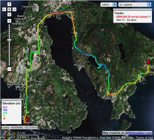
The straight line distance from the ferry terminal to the geohash was 13 km, but that ride took a lot longer than you might expect, for two reasons. The first is that Orcas Island is horseshoe-shaped, and while the ferry docks at the left bulb of the horse's hoof, the geohash was almost all the way around to the right bulb. And because of the presence of a lake and a mountain on the right side of the island, to reach the geohash we would have to go north from the ferry to the north end of the island, south from there to the south tip of the other side, and then north again, around the lake to the geohash. This measured by road totalled 35 km. Still not so bad.
We rode away from the ferry, around the corner on the main road, up a little rise and then down a steep hill around a sharp corner. There was second growth forest on the right, agricultural fields on the left, and blue sky above. This was worth it already. It didn't really matter if we never got any closer than this. Around another corner and up a hill. Quite a steep hill, really. A really really fricking nasty steep hill. That was the other reason that a geohash 13 km away was not going to be easy pickings. Most of those 33 km of road sloped viciously. The shoulder varied from narrow to nil, but the island is a popular cycling destination (cyclists must be masochists) and the road-builders had thoughtfully provided and signposted widened areas of the shoulder every so often on the uphill side for cyclists to pull over and gasp for air. Robyn was on her second rest stop only 2.5 km from the ferry. This was going to be a long 35 km.
It was still beautiful, and while frequently defying the 25 m.p.h. (40 km/h) speed limit signs was fun on the downhills, it didn't make up for the 4 km/h grinding on the steep uphills. Deer watched us unafraid, grazing beside the road or even trotting across it right in front of us. After about 15 km (and at least a hour and a half) we reached East Sound, the village at the toe of the horseshoe. The road ran along the south edge of the village, at the northernmost tip of the sheltered central bay. It was quite beautiful and Vancouver geohashers might even be willing to ride that road lugging a kayak, in order to geohash a point out in that bay. Kayak rental was available there, as well.
On the main street in East Sound, children waved signs advertising a fund-raising car wash. "We wash bikes, too!" they attempted, but we steamed right through, past the Crescent Beach waterfowl preserve and then down (and inevitably up) another hill. And that uphill seemed as if it would never end. Every time the road disappeared ahead we would hold out hope that it was out of sight because it was heading downhill, but it was always just turning the corner for another hill. That or we'd only stopped seeing the endless uphill because of fatigue-blurred vision.
Finally we reached a side street (it went further uphill) marked Orcas Highlands with a big sign. This we fervently (and it seems correctly) believed was the top of the road, or at least of that hill. We had some downhill then, which as said before is pleasant, but it goes by so quickly it doesn't prepare you for the next uphill. We rode through Moran State Park, beside a startlingly beautiful lake, right at road level, but by this time the sun was low at the other side of the lake, preventing us from taking pictures.
A bit more up, and then a very steep down. Rhonda had just had a bike tuneup, so her brakes were in excellent, albeit squeaky, condition. A replacement rear rim, however, was backordered, so she'd been warned to go easy on the back brakes. She went rocketing past Robyn on this downhill then had to squeal to a stop anyway, to make a hard left turn onto a very cruel road. Its nasty trick was to again plummet downhill, then, just at the very bottom of the hill, make a turn through about 130 degrees, back in the other direction and up, up hill. No way to carry the momentum through the turn, just brake, turn and climb.
This was Point Lawrence Road, the last named road on our map. We had seen a lot of private roads so far, most with a single "No Trespassing" and/or "No Hunting" sign that was POSTED, but people on the island seemed nice, so we would just go up to the door and ask permission to reach our point. It's not trespassing if you're on your way to someone's front door to talk to them.
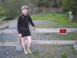
We knew that our unnamed road was the first left shown on the map after Bond Mills Road. We passed the latter and the next left was ... a private drive marked with a forest of "Keep Out" and "No Trespassing" signs scattered all around the entrance to their driveway. This was someone who clearly did not want visitors. We rode on a bit further in the hopes that there was another proper left, but we found only another private road, also shown namelessly on our map, and the sharp bend in Point Lawrence road that verified that we had passed our turnoff. Our closest approach was 1.39 km from the geohash.
Any cross-country bushwhacking to get to the geohash from this side of the island would have to cross through the property traversed by the road protected by so many no trespassing signs. It was possible that one could approach the geohash from the other side, by hiking past Mount Constitution and coming out of the state park towards the geohash. It was also 7:30 p.m., and we were exhausted. We knew we were riding back to the state park, but when we got there, there would be no time for anything but food and sleep.
We paused to admire the friendly horses pastured just across the road from the thoroughly POSTED driveway, got our hopes up briefly when a couple of cars approached and slowed down, but had the hopes dashed when they turned into a different driveway. It probably was too much to ask that the owners of the signs that had stopped us would drive up while we were there.
Camping
We turned around and started back up and down the hills that had brought us here. Robyn was pretty much done with riding up hills, and started to walk up some of them. It's the weight of that dinosaur, maybe. (Anyone who rides with Rhonda, be warned, the woman is a machine. It is not an not exaggeration to say that her bicycle weighs twenty kilograms. It was manufactured in Holland, perhaps out of captured Nazi tanks. Yet she never used her smallest front gear). As we got to the cruel down-to-up switchback in the road, a man was just coming out of a driveway. Robyn stopped to ask him if it was possible to cut through his property to avoid some of the hill. He understood completely, but regretted that there was no access from one side to the other. He also passed on the information that all electrical power was out on the island. All the local islands, in fact. A vehicle had struck some crucial component of the mainland power station contracted to provide all the San Juan Islands with electrical power.
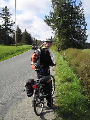
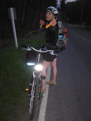
By this time Rhonda had come back around the corner, knowing it shouldn't take Robyn that long to ride down a hill, so fearing that she had crashed. Not literally, but her blood sugar had. Partway up the next long hill we took a banana break. As you can see from the picture, it was starting to get dark. We knew that, thanks to the power failure, when it got dark, it would be really dark. We had our headlights on and the formerly bored deer were starting to leap and skitter away as we passed them. We guess the deer on that island are descended from deer that could overcome the traditional reflex of standing on the road transfixed by oncoming headlights.
At long last we reached the one-lane bridge that signified the beginning of Moran State Park, and decided that we would camp in the first available campsite, and work out how and where to pay for it in the morning. "We didn't think you'd be able to process payment in a power failure," could supplement "It was dark. We were tired," as an excuse.
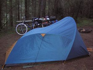
Leaving the road towards a group of campsites was an act of faith, because we were pretty much done with riding uphill, and while that road sloped down, if there had been nowhere to camp there, we'd have to ride up again. At fist we couldn't find a spot, but then some campers who had been there in daylight directed us to a gated trail where there were a few spots available to hikers and cyclists only. Number four was open and we soon had the tent pitched, the fog of our breath showing in the light from Rhonda's LED headlamps. The sky was still clear and the temperature was dropping fast.
To spare ourselves the task of lugging firewood, we visited our fellow campers, the ones with the biggest fire. We were treated to a few haltingly memorized lines of verse about Greek culture and architecture, recited by an almost-ten-year-old who'd learned them for a school assembly. They went something like "Spartan boys were trained to fight/They did not read or write./They were often hungry, often cold/Spartans believed it made them bold." We were hungry and cold, which made us bold enough to cuddle up to someone else's campfire until we were warm. Back at our own tent, we took care of the hunger by eating sardines, something Spartans might have eaten from time to time, although fresh or dried, not tinned.
And then we slept, just 4.34 km from the geohash.
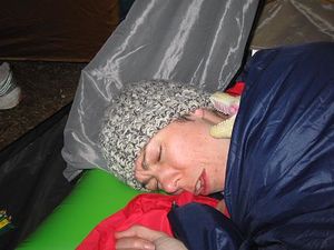
Robyn complained the next morning about the overnight cold, and that dinosaurs aren't very cuddly for sleeping with. Rhonda explained about dinosaurs, especially rubber ones, having no body heat of their own, so not making very useful sleeping companions. Robyn was still disappointed, but morning had arrived. We had a quick breakfast (almonds and apples) and started back towards the ferry.
Back to the ferry
Is a road filled with hills easier or harder to take when you are riding back along it and know the nature of the hill that lies around the next corner? It's hard to say. We had twenty-two kilometres to ride and two hours to do it in. It shouldn't be too hard to average 11 km/h on a bicycle, but we knew it meant we couldn't risk stopping for a proper hot breakfast in East Sound.
Nothing on the return trip was as soul-sapping as the long hill up to the Highlands on the outbound trip, and now the things we had missed while whipping down hills were available for our scenic pleasure as we grunted up hills. The descent of what had been the first hill after the ferry reassured us that it really had been a terrifyingly steep climb, and the last little uphill was a breeze, as we both knew that as soon as we rounded the corner, we would see the ferry terminal, and be done with riding uphill.
There was also a cafe where Rhonda bought and inhaled a full breakfast consisting of two eggs, two sausages, toast, and maybe some other things that disappeared into Rhonda too quickly to document. There was no concern about missing the ferry.
Heading home
When the ferry arrived, they loaded vehicles first, which confused us a little, because we knew that the bikes were usually loaded at the front. Thepiguy has pointed out that you never have to remember where you parked your bike on the ferry. It's always at the front corner of the bottom car deck. And our loaded bikes wouldn't fit down between the lines of cars. When we were marshalled on board, the ferry worker indicated that we were to go up onto the second deck. Up? This was so exiting and unusual for a cyclist that for a moment we forgot the implication of the word "up." The ferry worker said we could walk or ride our bikes on the ferry. We wordlessly both elected to walk. We were quite done with riding uphill.
On board the ferry we sat in seats next to a group of sixty-something year old women who thought we were very adventurous and interesting. We had an enjoyable chat which was mostly about American Idol, iPhones, and kids these days, but somehow was more substantial than that summary suggests.
From the ferry to the overnight parking lot was downhill and from then on the only pedal that needed to be pushed to get uphill was the accelerator. The border wait was minimal and Robyn dropped Rhonda off at the SkyTrain, making sure that she wouldn't have to ride uphill anymore today.
We were so thoroughly satisfied with our adventure that I don't think we were ever actually disappointed to have to class this adventure Coordinates not reached. I'm going to say it's Mother Nature, because we probably could have reached it through the park over Mount Constitution, had we had stronger constitutions and more daylight.
Epilogue
We had been unable to check the Friday coordinates because we had had no Internet for twenty-four hours. We had earlier discussed getting to an Internet cafe to find out if there was anything in Bellingham or Vancouver that we should try for on the way home, and joked that if the Bellingham point happened to fall on the I-5 our adventure report should be proof enough that we traversed it today.
But then we got home and saw where Friday's Bellingham coordinates had really been. In a parking lot. At the beach. Maybe ten kilometres from the Anacortes ferry terminal where we were. If only we had told the ladies on the ferry more about our sport and got them to look up today's coordinates on their iPhones. If only. Oh well. On to the next geohash.
