2024-02-12 32 35
| Mon 12 Feb 2024 in 32,35: 32.5944042, 35.2787732 geohashing.info google osm bing/os kml crox |
Location
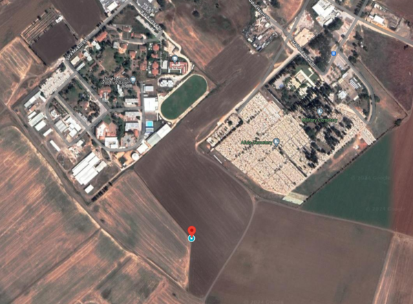
In a field southwest of Afula.
Participants
Plans
The previous day, MetricSystemDude and Yerushalmi planned to meet up at this geohash in the morning, despite both of them being unsure if this geohash is accessible. Google Maps' satellite view showed this geohash was on a path in the middle of a field, but as Yerushalmi noted: "One should never assume that dirt paths in satellite photos still exist".
MetricSystemDude, being fired from his job on that day, saw it as an opportunity to go on more expeditions. Moreover, he had the brilliant idea of calling the youth village to the north of the field in which this geohash is located, in order to find out about more information about this geohash's accessibility. He tried calling, but no one picked up the phone. He made note to try again in the morning of the expedition.
Expedition
MetricSystemDude
TBA
Yerushalmi
TBA
Photos
TBA
Achievements
MetricSystemDude and Yerushalmi earned the Land geohash achievement
|
MetricSystemDude earned the Public transport geohash achievement
|
MetricSystemDude earned the Two to the N achievement
|
MetricSystemDude earned the Meet-up achievement
|
